
Neuse River facts for kids
Quick facts for kids Neuse River |
|
|---|---|

|
|
| Country | United States |
| State | North Carolina |
| Region | South |
| Cities | Raleigh, North Carolina, Smithfield, North Carolina, Goldsboro, North Carolina, Kinston, North Carolina, New Bern, North Carolina |
| Physical characteristics | |
| Main source | Confluence of the Eno and Flat rivers Durham, North Carolina, United States 246 ft (75 m) 36°05′42″N 78°48′49″W / 36.09500°N 78.81361°W |
| River mouth | Pamlico Sound Hobucken, North Carolina, United States −11 ft (−3.4 m) 35°07′53″N 76°30′14″W / 35.13139°N 76.50389°W |
| Length | 443 km (275 mi) |
| Basin features | |
| Basin size | 14,600 km2 (5,600 sq mi) |
The Neuse River is a major river in North Carolina, United States. It starts in the Piedmont region and flows into Pamlico Sound near New Bern. The river is about 443 kilometers (275 miles) long. This makes it the longest river that stays completely within North Carolina.
The Trent River joins the Neuse River in New Bern. The area of land that drains into the Neuse River is about 14,600 square kilometers (5,630 square miles). This entire area is also within North Carolina. The Neuse River forms where the Flat River and Eno River meet. This happens before the river flows into the Falls Lake reservoir in northern Wake County.
Contents
Where the Neuse River Flows

The Neuse River begins when the Flat and Eno rivers come together. This is near Durham. The river then flows all the way to Pamlico Sound, which is a large body of water connected to the Atlantic Ocean. It enters the sound east of Maw Point Shoal, near Hobucken.
Like many rivers in North Carolina's Coastal Plain, the Neuse River often flows through swampy areas. These areas are sometimes flooded and sometimes dry. However, there's a special spot called the "Cliffs of the Neuse" near Goldsboro. Here, the river has carved a narrow gorge about 30 meters (90 feet) deep through limestone and sandstone cliffs.
The Neuse River's water level can change a lot. During rainy times, it can overflow its banks. But during long dry spells, the water can become so low that you can even walk across it!
The Neuse River flows through parts of seven counties in North Carolina. Some of the main cities and towns near the river include Durham, Raleigh (the state capital), Smithfield, Goldsboro, Kinston, and New Bern.
History of the Neuse River
For thousands of years, different groups of indigenous peoples lived along the Neuse River. They were here long before Europeans arrived. Many old tools and items found along the river banks show that Native American settlements existed there a very long time ago.

The Neuse River has one of the oldest English names still used in the United States. Early explorers named the river after the Neusiok tribe. This was a Native American tribe that the first English explorers, sent by Sir Walter Raleigh, met in 1584. These explorers, Arthur Barlowe and Phillip Amadas, wrote about "the country Neusiok, situated upon a goodly river called Neuse." This is what the local people called it.
During the American Civil War in 1865, the Confederates burned a special warship called the Ram Neuse. It was an ironclad, meaning it was covered in metal armor. They burned it to stop Union soldiers from capturing it. The river's water level had dropped too low for the ship to move. Many years later, in 1963, the remains of the ship were found and brought up from the river. Today, you can see the Ram Neuse next to the river at the Governor Caswell Memorial in Kinston.
A famous American rhythm and blues singer named Billy Stewart died in a car accident in January 1970. His car went off the road and into the Neuse River near Smithfield, North Carolina.
In 1952, a dam called the Quaker Neck Dam was built on the Neuse River. It helped provide cooling water for a power plant. This dam was removed in May 1998. Removing the dam helped fish like anadromous fish (which swim from the ocean to fresh water to lay eggs) travel further up the river.
Water Quality of the Neuse River

In recent years, the Neuse River has faced problems with its water quality. This is due to pollution from city and farm waste water, and water that runs off the land during storms. The pollution was especially bad after hurricanes like Hurricane Fran and Hurricane Floyd in the late 1990s.
A tiny organism called Pfiesteria piscicida lives in the river. It can grow very quickly, forming a "bloom," when there are too many nutrients in the water from pollution. This organism has been linked to fish kills, where many fish die suddenly.
Rivers and Creeks that Join the Neuse
Many smaller rivers and creeks flow into the Neuse River. These are called its tributaries.
- Eno River
- Flat River
- Little River
- Stoney Creek
- Crabtree Creek
- Walnut Creek
- West Bear Creek
- Bear Creek
- Contentnea Creek
- Lefferts' Creek
- Trent River
Images for kids
-
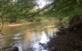
Neuse River in Raleigh

See also
 In Spanish: Río Neuse para niños
