Stoney Creek (North Carolina) facts for kids
Quick facts for kids Stoney Creek |
|
|---|---|
| Country | United States |
| State | North Carolina |
| County | Wayne County |
| Physical characteristics | |
| River mouth | Goldsboro, North Carolina 35°20′18″N 77°59′41″W / 35.338378°N 77.994702°W |
| Length | 11 miles (18 km) |
| Basin features | |
| River system | Neuse River |
| Basin size | 29.8 square miles (77 km2) |
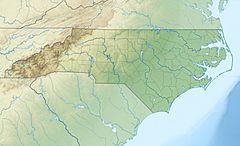
Stoney Creek, also called Stony Creek, is a small river in Wayne County, North Carolina, USA. It flows through the city of Goldsboro, North Carolina before joining a larger river called the Neuse River.
Contents
Where is Stoney Creek?
Stony Creek has been known by its name since at least 1756. On an old map from 1808, it was even called Rocky Creek.
This creek is a branch of the Neuse River. It is about 11 miles (18 km) long. The area that drains into Stoney Creek covers about 29.8 square miles (77.2 square kilometers) in the middle of Wayne County.
Starting Point of the Creek
The creek begins near the Wayne Executive Jetport. This starting point is about 138 feet (42 meters) above sea level. From there, the creek flows downhill. It drops about 4 to 6 feet for every mile it travels. The end of the creek, where it meets the Neuse River, is about 60 feet (18 meters) above sea level.
How Land is Used Around the Creek
The land around Stoney Creek is used for different things. The upper part of the creek's area, north of New Hope Road, was mostly farms or undeveloped land in 2004. This means it was open fields or forests.
City and Park Areas
Further downstream, about 40% of the creek's area is inside the city of Goldsboro. This part of the land is used for homes, shops, small factories, and even for military purposes at Seymour Johnson Air Force Base.
Stoney Creek Park is a fun place located in Goldsboro. It is on the west side of the creek, south of Ash Street. The park has a special garden for butterflies and a play area for kids. There is also an 18-hole disc golf course, which is like golf but with frisbees. You can also find a covered picnic area there.
Historically, buildings and businesses grew from the lower parts of the creek towards the upper parts. In the 2000s, more homes and shops started to appear in the upper part of the creek's area.
Water Flow and Environment
Stoney Creek is in the inner coastal plain of North Carolina. This area has slow-moving streams and many swampy places.
Creek Branches and Swamps
As you go from the start of the creek to its end, other smaller streams join it. These are called Stoney Run, Howell Creek, Reedy Branch, and Billy Branch. The upper part of the creek's area has slow-moving blackwater streams. These streams get their dark color from plants decaying in the water. There are also low-lying wooded swamps and marshy floodplains. Often, the streams flow right through these swampy areas.
Farmers and beavers have built many small dams in the upper part of the creek's area. These dams can slow down the water even more.
Flooding and Rainfall
About 42% of the land that floods around the creek has been developed with buildings. Another 28% is used for farming, and 23% is covered by forests. About 6.1% of the area is wetlands, which are like marshy lands. This area can often experience flooding, especially after heavy rains.
The area gets about 50 inches (127 cm) of rain each year. The most rain usually falls from June to September, often from thunderstorms. No wastewater is released into Stoney Creek, which helps keep its water clean.
 | Delilah Pierce |
 | Gordon Parks |
 | Augusta Savage |
 | Charles Ethan Porter |


