Prairie Hill, Missouri facts for kids
Quick facts for kids
Prairie Hill, Missouri
|
|
|---|---|

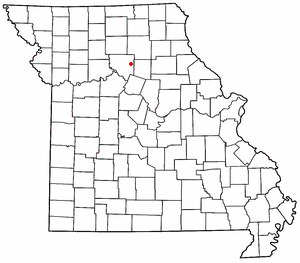
Location of Prairie Hill in Missouri
|
|
| Country | United States |
| State | Missouri |
| County | Chariton |
| Area | |
| • Total | 0.46 sq mi (1.19 km2) |
| • Land | 0.46 sq mi (1.19 km2) |
| • Water | 0.00 sq mi (0.00 km2) |
| Elevation | 725 ft (221 m) |
| Population
(2020)
|
|
| • Total | 50 |
| • Density | 109.17/sq mi (42.12/km2) |
| FIPS code | 29-59708 |
| GNIS feature ID | 2806390 |
Prairie Hill is a small, quiet place in the eastern part of Chariton County, Missouri, in the United States. It's called an unincorporated community, which means it doesn't have its own local government like a city or town does. Instead, it's part of the larger county.
Where is Prairie Hill Located?
Prairie Hill is found where two roads, Missouri Route W and Missouri Route HH, meet. This spot is about seven miles (or 11 kilometers) north-northeast of a town called Salisbury. Not too far away, about seven miles to the northeast, you'll find the dam for the Thomas Hill Reservoir. This reservoir is in the next county over, Randolph County.
What is the History of Prairie Hill?
Prairie Hill has been around for a long time.
- A post office, which is a place where you can send and receive mail, was opened here in 1869.
- This post office served the community for many years, finally closing its doors in 1966.
- The community got its name because it sits on a high piece of land that used to be a wide, open prairie.
How Many People Live in Prairie Hill?
| Historical population | |||
|---|---|---|---|
| Census | Pop. | %± | |
| 2020 | 50 | — | |
| U.S. Decennial Census | |||
Knowing the demographics of a place means understanding its population.
- According to the 2020 United States Census, which counts everyone living in the country, the population of Prairie Hill was 50 people.
- This number helps us understand how many residents call this small community home.
Black History Month on Kiddle
African-American Labor Activists
 | William Lucy |
 | Charles Hayes |
 | Cleveland Robinson |

All content from Kiddle encyclopedia articles (including the article images and facts) can be freely used under Attribution-ShareAlike license, unless stated otherwise. Cite this article:
Prairie Hill, Missouri Facts for Kids. Kiddle Encyclopedia.
