Presqu'île Lake (Nord-du-Québec) facts for kids
Quick facts for kids Presqu’île Lake |
|
|---|---|

Watershed of Nottaway River
|
|
| Location | Baie-James |
| Coordinates | 49°42′49″N 74°50′22″W / 49.71361°N 74.83944°W |
| Type | Natural |
| Primary inflows | Obatogamau River |
| Primary outflows | Obatogamau River |
| Basin countries | Canada |
| Max. length | 5.9 kilometres (3.7 mi) |
| Max. width | 5.6 kilometres (3.5 mi) |
| Surface area | 20 kilometres (12 mi) |
| Surface elevation | 354 metres (1,161 ft) |
| Islands | 28 |
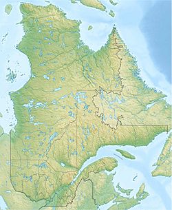
Presqu'île Lake (which means Peninsula Lake in French) is a beautiful lake in Quebec, Canada. It's located about 5.4 kilometres (3.4 mi) south of the village of Chapais. This lake is part of the Eeyou Istchee Baie-James area.
A forest road from Chapais helps people reach the northern part of the lake. This road is close to Highway 113. The lake usually freezes over from early November until mid-May. However, it's safest to walk or play on the ice from mid-November to mid-April.
Contents
About Presqu'île Lake
A Lake in a Crater
Presqu'île Lake sits inside a special bowl-shaped area. This area is called the Presqu'île crater. It was formed a very long time ago when a meteorite crashed into Earth. This happened during the Cambrian period.
Size and Shape
The lake has a unique horseshoe shape. It is about 5.9 kilometres (3.7 mi) long and 5.6 kilometres (3.5 mi) wide. The total area of the lake is around 20 square kilometres (7.7 sq mi).
A large piece of land, like a long finger, sticks out into the lake. This land is 3.6 kilometres (2.2 mi) long and 2.4 kilometres (1.5 mi) wide. It forms a big peninsula on the northeastern side. This peninsula is why the lake is called "Presqu'île Lake."
Water Flow
The Obatogamau River flows through the western part of Presqu'île Lake. The river goes around the southern side of the large peninsula. Other smaller streams also feed into the lake. One of these streams brings water from Lake Muguet.
The Lake's Amazing Geology
Traces of an Ancient Impact
About 5 kilometres (3.1 mi) east of the lake, along the Obatogamau River, scientists found special rocks. These rocks are called shatter cones. They are like cone-shaped marks left behind by the huge cosmic impact that created the crater. This impact happened about 759 million years ago!
These shatter cones are usually 10–20 centimetres (3.9–7.9 in) long. Some of them can even be as long as 60 centimetres (24 in).
How the Crater Changed Over Time
The original crater made by the meteorite was huge. Scientists believe it was at least 12 kilometres (7.5 mi) wide. Today, the crater looks like it's about 20 kilometres (12 mi) wide. Over millions of years, the land around the crater has changed a lot. During ice ages, thick layers of rock, about 3,000 metres (9,800 ft) deep, were worn away by glaciers. This made the land flatter.
The hills around the lake are made of strong, crystalline rocks. The area is part of the Canadian Shield. This part of the Canadian Shield has wide, flat areas, wet marshy plains, and old mountains. These mountains were once volcanoes, but their tops are now worn down.
Ancient Volcanoes
The Earth's crust in this region was formed by ancient volcanoes. These volcanoes were once under the ocean in tropical areas. Later, the ocean floor pushed up because of moving tectonic plates. This created the northern part of the Canadian Shield we see today.
North of Opemiska Lake, you can still see signs of old "lava cushioned" flows. These are special rock formations. They were made when hot lava quickly cooled down after touching cold seawater.
 | Delilah Pierce |
 | Gordon Parks |
 | Augusta Savage |
 | Charles Ethan Porter |


