Pretoria, Georgia facts for kids
Quick facts for kids
Pretoria, Georgia
|
|
|---|---|

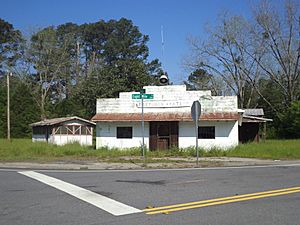
Pretoria Station
|
|
| Country | United States |
| State | Georgia |
| County | Dougherty |
| Elevation | 187 ft (57 m) |
| Time zone | UTC-5 (Eastern (EST)) |
| • Summer (DST) | UTC-4 (EDT) |
| ZIP code |
31721
|
| Area code(s) | 229 |
Pretoria is a small community in Dougherty County, Georgia, in the United States. It's called an unincorporated community because it doesn't have its own local government like a city or town.
Contents
A Glimpse into Pretoria's Past
Pretoria got its name from Pretoria, a city in South Africa. A post office opened here in 1900 and stayed open until 1917.
For a short time, Pretoria was officially a town. The Georgia General Assembly made it a town in 1907. However, its town status was removed in 1995.
Exploring Pretoria's Location
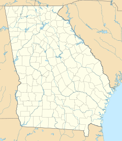
Pretoria is located at about 31.504 degrees north and 84.317 degrees west. It sits about 187 feet (57 meters) above sea level. You can find Pretoria on the Pretoria U.S. Geological Survey Map.
The community is at the crossroads of Tarva Road, Eight Mile Road, and Georgia Highway 62 (Leary Road). Other roads like Old Pretoria Road and Lonesome Road are also in the area.
Pretoria has a large body of water called Hunter Lake. The Cooleewahee Creek also flows through the community. You might see signs welcoming you to Pretoria as you arrive!
Schools in Pretoria
Pretoria is home to Sherwood Christian Academy. This is a private school that teaches students from kindergarten all the way through 12th grade.
Sherwood Christian Academy also has a big sports complex called Legacy Park. This park is well-known for its large cross. The school is connected with Sherwood Baptist Church in Albany, Georgia.
Neighborhoods in Pretoria
- Rolling Acres Subdivision
 | Toni Morrison |
 | Barack Obama |
 | Martin Luther King Jr. |
 | Ralph Bunche |


