Pumpelly Pillar facts for kids
Quick facts for kids Pumpelly Pillar |
|
|---|---|

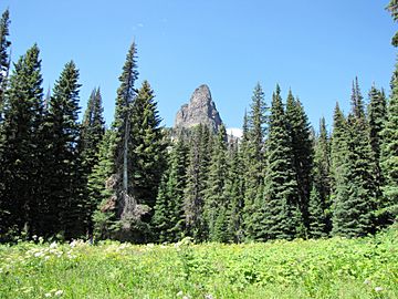
Pumpelly Pillar from the Twin Falls trail
|
|
| Highest point | |
| Elevation | 7,625 ft (2,324 m) |
| Prominence | 180 ft (55 m) |
| Geography | |
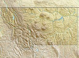
| Location | Glacier County, Montana, U.S. |
| Parent range | Lewis Range |
| Topo map | USGS Many Glacier MT |
| Climbing | |
| First ascent | Prehistoric |
| Easiest route | Scramble class 2-3 |
Pumpelly Pillar is a mountain peak in Glacier National Park, located in the state of Montana, U.S.. It stands at about 7,625 feet (2,324 m) high. This peak is part of the Lewis Range, a large group of mountains that runs through the park.
Contents
What is Pumpelly Pillar?
Pumpelly Pillar is a mountain peak that looks like a tall, strong column. It's known for its unique shape. The peak is a popular landmark for hikers and visitors to the Two Medicine area of Glacier National Park.
Where is This Mountain Located?
Pumpelly Pillar is found in the southeastern part of Glacier National Park. Specifically, it's in the Two Medicine region. This area is famous for its beautiful lakes, forests, and other mountain peaks. The park itself is in Glacier County, Montana.
How Did Pumpelly Pillar Get Its Name?
The mountain is likely named after a person named Raphael Pumpelly. He was an important leader of a group called the Northern Transcontinental Railway Survey. In 1883, his group traveled across a mountain pass called Pitamakan Pass. Naming mountains after explorers or important figures was a common practice back then.
Exploring Glacier National Park
Glacier National Park is a huge area of wilderness. It has many mountains, lakes, and glaciers. The park is a great place for outdoor activities. Visitors can enjoy hiking, camping, and spotting wildlife. It's home to many animals, including grizzly bears, moose, and mountain goats.
Hiking Near Pumpelly Pillar
The area around Pumpelly Pillar offers several hiking trails. These trails let people explore the beautiful scenery. Some trails lead to waterfalls or other viewpoints. The easiest way to reach the peak itself is by scrambling. This means climbing over rocks and uneven ground. It is a challenging route.
Wildlife in the Park
Glacier National Park is a protected home for many animals. You might see large mammals like elk and deer. Smaller animals like marmots and pikas also live here. The park works hard to keep these animals safe in their natural homes.
 | Laphonza Butler |
 | Daisy Bates |
 | Elizabeth Piper Ensley |


