Queen Anne Boulevard facts for kids
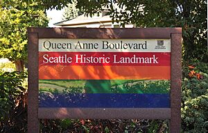
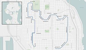
Queen Anne Boulevard is a special road that forms a big loop around the top of Seattle, Washington's Queen Anne Hill. It's about 6 kilometers (3.7 miles) long and is recognized as a City of Seattle landmark. This beautiful route was planned in 1907 and built between 1911 and 1916. It connects many different streets, creating a scenic drive.
Discovering Queen Anne Boulevard's Past
Back in 1906, it was easy to get to the lower parts of Queen Anne Hill from downtown Seattle using streetcars. But the higher areas were harder to reach. The local community wanted a beautiful road that would circle the hill. They asked the Parks Board for help.
At first, the Parks Board wasn't very excited. The proposed road wasn't part of their big "Olmsted Plan" for parkways. Also, the streets suggested were not wide enough for the park-like landscaping they usually wanted.
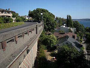
However, almost the entire route offered amazing views of the city and water. So, a deal was made! The community agreed to pay for any extra land needed to make the streets wider. The City Engineer, R. H. Thomson, would manage the building work. Eventually, the road would become part of the Park Department's system, which would add trees and make it look beautiful.
In 1907, a city rule approved this plan. By 1908, it was even added to the official Olmsted Plan. But there were some delays because of legal issues over buying land.
The Park Department finally took over in 1911, and construction began. The boulevard was finished in 1916. Many kinds of trees were planted, like Maples, sycamores, oaks, and elms.
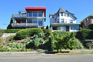
This new road was meant to be both a park and a way to get around. But it had some problems. New buildings started to block some of the great views. The tree roots grew too big and caused issues with sewer lines and sidewalks. Sometimes, the trees shaded houses more than people liked. The Parks Department did allow some trees to be removed, but the homeowner had to pay for it.
In 1942, the roads themselves (but not the landscaping) were given to the City Engineer's office. Later, in 1952, there was a suggestion to change the boulevard back to a regular street. But the City Council said no.
Enjoying Queen Anne Boulevard Today
Today, both the Parks Department and the City Engineer's office share responsibility for the boulevard. Sometimes they disagree, but everyone agrees the boulevard is a very important part of the Queen Anne neighborhood. People call it "The Crown of Queen Anne."
It's a popular place for walking, running, and driving. Many people in Queen Anne and visitors enjoy it all year round. It offers shade in the summer, beautiful colors in the fall, and a bright path in the winter.
Since 1986, a local group called the Queen Anne Helpline has hosted a fun run on the boulevard every July. It's called the "Crown of Queen Anne fun run." The race goes clockwise, starting near the Mt Pleasant Cemetery and ending at Coe Elementary School.
In recent years, there have been efforts to make the boulevard even better. These plans include improving sidewalks so there's a path on at least one side of the road. New signs help people find the boulevard route. There are also plans for safer crossings where the boulevard meets other main roads. Better care for the trees and plants is also a goal. New lighting is being added to make it safer at night, while still keeping its historic look.
Exploring the Boulevard's Route
Queen Anne Boulevard is a scenic loop that connects many streets around Queen Anne Hill. It starts near Prospect Street and winds its way through different avenues and streets. The boulevard goes north, then west, then south, and then east, making a full circle. It connects important places like Bigelow Avenue, Wheeler Street, McGraw Street, and West Highland Drive. This design allows people to enjoy the views and the unique character of the neighborhood as they travel around the hill.
 | William Lucy |
 | Charles Hayes |
 | Cleveland Robinson |


