Quenemo, Kansas facts for kids
Quick facts for kids
Quenemo, Kansas
|
|
|---|---|

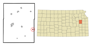
Location within Osage County and Kansas
|
|

|
|
| Country | United States |
| State | Kansas |
| County | Osage |
| Founded | 1870 |
| Platted | 1870 |
| Incorporated | 1885 |
| Area | |
| • Total | 0.44 sq mi (1.15 km2) |
| • Land | 0.44 sq mi (1.15 km2) |
| • Water | 0.00 sq mi (0.00 km2) |
| Elevation | 942 ft (287 m) |
| Population
(2020)
|
|
| • Total | 288 |
| • Density | 655/sq mi (250.4/km2) |
| Time zone | UTC-6 (CST) |
| • Summer (DST) | UTC-5 (CDT) |
| ZIP code |
66528
|
| Area code | 785 |
| FIPS code | 20-58100 |
| GNIS ID | 479622 |
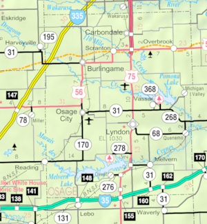
Quenemo is a small city in Osage County, Kansas, in the United States. It is located right by the Marais des Cygnes River. In 2020, about 288 people lived in Quenemo.
Contents
History of Quenemo
Quenemo was first planned out around 1870. The city was named after a chief from the Sac and Fox Native American tribe.
In 1878, a big fire destroyed a lot of the town. However, Quenemo grew quickly in 1884. This happened after the AT&SF railroad was built through the area.
Geography and Climate
Where is Quenemo Located?
Quenemo is found at specific coordinates: 38.580413 degrees North and -95.527895 degrees West. This helps pinpoint its exact spot on a map.
Land Area of the City
According to the United States Census Bureau, Quenemo covers a total area of about 0.44 square miles (1.15 square kilometers). All of this area is land, with no water.
Understanding Quenemo's Climate
The weather in Quenemo has hot and humid summers. The winters are usually mild to cool. This type of weather is called a humid subtropical climate. On climate maps, you might see it marked as "Cfa."
Population and People
| Historical population | |||
|---|---|---|---|
| Census | Pop. | %± | |
| 1880 | 122 | — | |
| 1890 | 643 | 427.0% | |
| 1900 | 682 | 6.1% | |
| 1910 | 556 | −18.5% | |
| 1920 | 733 | 31.8% | |
| 1930 | 564 | −23.1% | |
| 1940 | 557 | −1.2% | |
| 1950 | 391 | −29.8% | |
| 1960 | 434 | 11.0% | |
| 1970 | 429 | −1.2% | |
| 1980 | 413 | −3.7% | |
| 1990 | 369 | −10.7% | |
| 2000 | 468 | 26.8% | |
| 2010 | 388 | −17.1% | |
| 2020 | 288 | −25.8% | |
| U.S. Decennial Census | |||
Quenemo is part of the larger Topeka Metropolitan Statistical Area. This means it's connected to the economic and social life of the Topeka region.
Quenemo's Population in 2020
The 2020 United States census counted 288 people living in Quenemo. There were 125 households and 81 families. The population density was about 648 people per square mile.
Most of the people in Quenemo, about 93%, were white. A small number of people identified as Native American or from two or more races. Less than 1% of the population was Hispanic or Latino.
About 25% of households had children under 18 living there. The average household had about 2.8 people. The average family size was 2.9 people. The median age in the city was 46.6 years.
Quenemo's Population in 2010
In the census of 2010, Quenemo had 388 people. There were 139 households and 90 families. The population density was about 881 people per square mile.
Most residents, about 93%, were white. There were also small numbers of African American and Native American residents. About 1.8% of the population was Hispanic or Latino.
About 40% of households had children under 18. The average household size was 2.79 people. The average family size was 3.44 people. The median age in the city was 32.3 years.
Education in Quenemo
The local public schools are part of the Marais des Cygnes Valley USD 456 school district. Students attend Marais des Cygnes Valley High School. The school's mascot is the Trojans.
Before schools joined together, Quenemo High School had a successful basketball team. Their team, the Buffaloes, won the Kansas State High School boys class BB basketball championship in 1960.
Parks and Recreation
- Pomona State Park
See also
 In Spanish: Quenemo para niños

