Quinlan Mountains facts for kids
Quick facts for kids Quinlan Mountains |
|
|---|---|
| Highest point | |
| Peak | Kitt Peak |
| Elevation | 6,883 ft (2,098 m) |
| Dimensions | |
| Length | 25 mi (40 km) (NNW x SSE)-curves to southeast |
| Geography | |
| Country | United States |
| State | Arizona |
| County | Pima |
| Range coordinates | 31°57′44″N 111°36′53″W / 31.9623003°N 111.6148365°W |
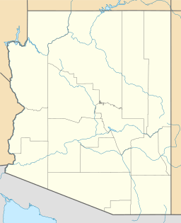
The Quinlan Mountains are a mountain range located in the U.S. state of Arizona. The highest point in this range is Kitt Peak, which stands at about 6,883 feet (2,098 meters) tall. Kitt Peak is also the second-highest peak on the Tohono O'odham Indian Reservation, after Baboquivari Peak. The Quinlan Mountains are found on the eastern side of the reservation, about 55 miles (88 km) southwest of the city of Tucson.
Where Are the Quinlan Mountains?
The Quinlan Mountains are located just north of the Baboquivari Mountains. These two ranges are separated by a pass at the top of the Pavo Kug Wash. The Quinlan range also sits southwest of the Coyote Mountains. They are separated from the Coyote Mountains by the Pan Tak Pass.
How the Quinlan Mountains Got Their Name
In 1893, a man named George J. Roskruge created the official map for Pima County. He decided to name the mountain range after James Quinlin. James Quinlin had opened a stagecoach station in 1884 in the nearby town of Quinlin. A stagecoach was like an old bus pulled by horses, used for carrying people and mail.
Over time, the mountains were also known as the Quinlin or Quinuin mountains. However, the name Quinlan became the official name. This happened because of a decision made by the Board on Geographic Names on April 16, 1941. This board is responsible for making sure places have clear and official names.
 | Sharif Bey |
 | Hale Woodruff |
 | Richmond Barthé |
 | Purvis Young |


