
Río Lajas, Toa Alta, Puerto Rico facts for kids
Quick facts for kids
Río Lajas
|
|
|---|---|
|
Barrio
|
|

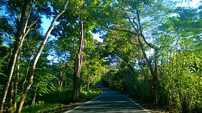
Puerto Rico Highway 142 in Río Lajas
|
|

Location of Río Lajas within the municipality of Toa Alta shown in red
|
|

Río Lajas, Toa Alta, Puerto Rico
Location in Caribbean
|
|
| Commonwealth | |
| Municipality | |
| Area | |
| • Total | 3.73 sq mi (9.7 km2) |
| • Land | 3.73 sq mi (9.7 km2) |
| • Water | 0 sq mi (0 km2) |
| Elevation | 394 ft (120 m) |
| Population
(2010)
|
|
| • Total | 2,566 |
| • Density | 687.9/sq mi (265.6/km2) |
| Source: 2010 Census | |
| Time zone | UTC−4 (AST) |
Río Lajas is a barrio (which is like a neighborhood or district) located in the municipality of Toa Alta, Puerto Rico. In 2010, about 2,566 people lived there. Río Lajas is known for its quiet, residential areas and natural beauty, offering a peaceful place to live in Puerto Rico.
| Historical population | |||
|---|---|---|---|
| Census | Pop. | %± | |
| 1900 | 973 | — | |
| 1910 | 1,256 | 29.1% | |
| 1920 | 1,519 | 20.9% | |
| 1930 | 1,393 | −8.3% | |
| 1940 | 1,420 | 1.9% | |
| 1950 | 1,340 | −5.6% | |
| 1980 | 976 | — | |
| 1990 | 1,481 | 51.7% | |
| 2000 | 2,082 | 40.6% | |
| 2010 | 2,566 | 23.2% | |
| U.S. Decennial Census 1899 (shown as 1900) 1910-1930 1930-1950 1980-2000 2010 |
|||
Contents
A Look at Río Lajas History
How Puerto Rico Became a U.S. Territory
After the Spanish–American War, Puerto Rico was given to the United States by Spain. This happened under the rules of the Treaty of Paris of 1898. Because of this treaty, Puerto Rico became a territory of the United States.
Early Population Counts in Río Lajas
In 1899, the United States Department of War conducted a special count of people living in Puerto Rico. This count, called a census, found that 973 people lived in the Río Lajas barrio at that time. This early census helps us understand how the area has grown over many years.
Exploring the Sectors of Río Lajas
What are Sectores?
Barrios like Río Lajas are often divided into even smaller areas. These smaller parts are called sectores (which means sectors in English). Think of them as smaller neighborhoods or local areas within the barrio. The names for these sectores can be different. Some are simply called "sector," while others might be named urbanización, reparto, barriada, or residencial.
Main Sectores in Río Lajas
Río Lajas barrio includes several of these smaller sectores. They help organize the different parts of the community. Some of the sectores you can find in Río Lajas are:
- Calles: Almendro, Cedro, Bambú, Deloniz, Guayacán, Higüero, Laurel, Jacaranda, Kamani, India Laurel, Maga, Níspero, Ébano, Potones, Ceiba, Ibisco
- Sector Jazmín
- Sector La Cuchilla
- Sector Marrero
- Sector Marzán
- Sector Nilo
- Sector Rivera
- Sector Ayala
- Sector Rufo Rodríguez
- Urbanización Haciendas de Dorado
- Urbanización Valle del Paraíso
- Urbanización Vista del Río I
- Urbanización Vista del Río III
Images for kids
-
Puerto Rico Highway 823 in Río Lajas
.jpg)
See also
 In Spanish: Río Lajas (Toa Alta) para niños
- List of communities in Puerto Rico
- List of barrios and sectors of Toa Alta, Puerto Rico
