Racine, Missouri facts for kids
Quick facts for kids
Racine
|
|
|---|---|
| Country | United States |
| State | Missouri |
| County | Newton |
| Elevation | 961 ft (293 m) |
| Population | |
| • Total | Estimated at 200 within ½ mile radius of the Racine Post Office; an exact population figure is impossible because there are no defined city limits. |
| • Demonym | Racinian |
| Time zone | UTC-6 (Central (CST)) |
| • Summer (DST) | UTC-5 (CDT) |
| ZIP code |
64858
|
| Area code(s) | 417 |
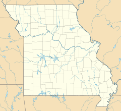
Racine is a small community in Newton County, Missouri, in the United States. It is called an unincorporated community because it doesn't have its own local government like a city or town. Instead, it's part of the larger Joplin Metropolitan Area.
Contents
Discovering Racine's Past
Racine has an interesting story behind its name. A post office first opened here in 1869.
Why the Name Changed
The community was originally named Dayton. It was named after Dayton, Ohio. However, there was already another place called Dayton, Missouri. This caused a lot of confusion for mail deliveries!
To fix this, the name was changed in 1871. The new name, Racine, came from Racine, Wisconsin. Even though the community's name changed, the surrounding area is still known as Dayton Township.
Where is Racine Located?
Racine is found in the beautiful Lost Creek Valley. It sits right along the old Frisco Railroad tracks. These tracks run between the towns of Neosho and Seneca.
Getting Around Racine
You can find Racine on Route 86. This is where Route K and Route CC meet. It's easy to get to Racine from nearby towns.
- It is about 6 miles west of Neosho.
- It is about 10 miles south of Joplin.
- It is about 5½ miles northeast of Seneca.
Learning in Racine
All students living in Racine attend public schools in the Seneca School District. This district provides education for all children in the community.
Community Buildings
Even though Racine is a small community, it has a few important buildings.
Places of Worship
There are two churches in Racine. One is an Apostolic Church. The other is a large Christian church. These churches serve as important gathering places for the community.
Local Fire Station
Racine also has a small fire station. This station is part of the Seneca Area Fire Protection District. It helps keep the community safe by responding to emergencies.
 | Kyle Baker |
 | Joseph Yoakum |
 | Laura Wheeler Waring |
 | Henry Ossawa Tanner |


