
Seneca, Missouri facts for kids
Quick facts for kids
Seneca, Missouri
|
|
|---|---|

Downtown Seneca
|
|

Location of Seneca, Missouri
|
|
| Country | United States |
| State | Missouri |
| County | Newton |
| Area | |
| • Total | 2.56 sq mi (6.63 km2) |
| • Land | 2.56 sq mi (6.63 km2) |
| • Water | 0.00 sq mi (0.00 km2) |
| Elevation | 948 ft (289 m) |
| Population
(2020)
|
|
| • Total | 2,230 |
| • Density | 871.43/sq mi (336.46/km2) |
| • Demonym | Senecan or Senecanian |
| Time zone | UTC-6 (Central (CST)) |
| • Summer (DST) | UTC-5 (CDT) |
| ZIP code |
64865
|
| Area code(s) | 417 |
| FIPS code | 29-66674 |
| GNIS feature ID | 2396574 |
Seneca is a city located in western Newton County, Missouri, in the United States. In 2010, about 2,336 people lived there. The city is on the southwestern border of Missouri. It is part of the Joplin Metropolitan Area.
History of Seneca
Seneca was planned and laid out by European Americans in 1869. This happened after the Civil War. The city got its name from the Seneca Nation. They are one of the Six Nations of the Iroquois League, also called Haudenosaunee. These Native American groups originally lived in New York and near the Great Lakes.
In the 1830s, many Seneca people were moved west of the Mississippi River. They went to an area called Indian Territory. This area included parts of what is now Missouri, Kansas, and Oklahoma. A post office called Seneca has been open since 1869.
The 2008 Tornado
On May 10, 2008, a strong tornado hit the northern Seneca area. Several houses were badly damaged or destroyed. This tornado was part of a series of storms that hit the region. It caused many problems and sadly, some people lost their lives. A national TV show, The Early Show, even broadcast their weather report from Seneca the next Monday.
One year after the tornado, a special memorial was created. Bill Lant, who owned a local store, donated the land for it. He also helped build the memorial next to his store. It was made to remember those who were affected by the disaster.
Geography of Seneca
Seneca is located by Lost Creek. It is about a quarter-mile from the Missouri-Oklahoma state line. Missouri Route 43 goes through the town. U.S. Route 60 passes just south of the city. The city of Neosho is about ten miles east, along Route 60.
According to the United States Census Bureau, Seneca covers about 2.56 square miles (6.63 square kilometers). All of this area is land.
Seneca is in the Lost Creek Valley. It is five miles upstream from the Grand Lake of the Cherokees. It is also five miles downstream from the old town of Racine. The Frisco Railroad (now Burlington-Northern) runs through this valley.
Before 1959, most highway traffic between Missouri and Oklahoma used US 60 through Seneca. US 60 connects with the famous U.S. Route 66 about 15 miles west of Seneca.
Population and People
| Historical population | |||
|---|---|---|---|
| Census | Pop. | %± | |
| 1870 | 285 | — | |
| 1880 | 380 | 33.3% | |
| 1890 | 1,101 | 189.7% | |
| 1900 | 1,043 | −5.3% | |
| 1910 | 981 | −5.9% | |
| 1920 | 1,104 | 12.5% | |
| 1930 | 1,063 | −3.7% | |
| 1940 | 1,091 | 2.6% | |
| 1950 | 1,195 | 9.5% | |
| 1960 | 1,478 | 23.7% | |
| 1970 | 1,577 | 6.7% | |
| 1980 | 1,853 | 17.5% | |
| 1990 | 1,885 | 1.7% | |
| 2000 | 2,135 | 13.3% | |
| 2010 | 2,336 | 9.4% | |
| 2020 | 2,230 | −4.5% | |
| U.S. Decennial Census | |||
2010 Census Information
In 2010, the city had 2,336 people living in 877 households. About 612 of these were families. The population density was about 912.5 people per square mile (352.3 people per square kilometer). There were 962 homes in the city.
Most people in Seneca were White (85.3%). About 8.0% were Native American. Other groups made up smaller percentages. About 2.2% of the population was Hispanic or Latino.
In 40.5% of households, there were children under 18. About 48.2% of households were married couples. The average household had 2.60 people. The average family had 3.13 people.
The average age in Seneca was 35.3 years old. About 28.9% of residents were under 18. About 17.3% were 65 years old or older. The population was 47.9% male and 52.1% female.
Education in Seneca
The public schools in Seneca are managed by the Seneca R-VII School District. Seneca also has a public library, which is called the Seneca Branch Library.
Famous People from Seneca
Several well-known people have connections to Seneca:
- Scott Elbert – A baseball pitcher who played for the Los Angeles Dodgers.
- Steve Gaines – A talented guitarist for the band Lynyrd Skynyrd.
- Cassie Gaines – A backup singer for Lynyrd Skynyrd, and Steve Gaines' sister.
- Little Britches – A female bandit who lived in Seneca during her childhood in the 1880s. She was known for being associated with another outlaw named Cattle Annie.
- Morris Watts – A former assistant football coach at Michigan State University.
Images for kids
-
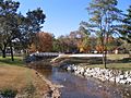
Bridge over Lost Creek, taken from Oneida Street.
-
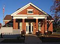
Seneca, Missouri City Hall. Note veterans monument in lower left-hand corner.
-
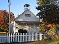
Old Schoolhouse behind City Hall.
-
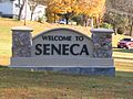
Sign welcoming people to Seneca, on MO 43.


See also
 In Spanish: Seneca (Misuri) para niños
