Rancho Corral de Tierra facts for kids
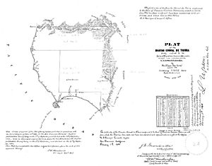
Rancho Corral de Tierra was a very large piece of land in what is now coastal western San Mateo County, California. It covered about 7,766 acres (about 31.4 square kilometers). This land was given out by the Mexican government as a "land grant" a long time ago.
The northern part of this rancho was given to Francisco Guerrero y Palomares in 1839. The name "Corral de Tierra" means "earthen corral" in Spanish. A smaller southern part was given to Tiburcio Vasquez.
Guerrero y Palomares's land stretched along the Pacific coast. It went from Martini Creek south past Montara to Arroyo de en Medio. It included places like Moss Beach and Princeton-by-the-Sea. Today, most of this land is part of the Golden Gate National Recreation Area.
Contents
A Look Back: Rancho Corral de Tierra's Story
The First Owners and Their Lives
Francisco Guerrero y Palomares was born in 1811 and passed away in 1851. He came to California in 1834 and settled in San Francisco. He married Josefa de Haro and they had five sons.
Francisco was an important leader in Yerba Buena (which is now San Francisco). He served as the "Alcalde" (like a mayor) in 1836 and 1839.
Changes Under United States Rule
After the Mexican–American War, California became part of the United States in 1848. The Treaty of Guadalupe Hidalgo said that the land grants given by Mexico would still be valid.
So, in 1852, a claim for Rancho Corral de Tierra was made. The land was officially given to Josefa de Haro de Guerrero, Francisco's widow, in 1866.
Josefa de Haro later married an American named James Denniston. Denniston Creek, which flows through the rancho, is named after him.
Farming and World War II
In the 1930s, some Japanese-American families began farming parts of the rancho. These lands are now within the Golden Gate National Recreation Area.
However, during World War II, many Japanese-American people were forced to leave their homes. In 1942, these families were removed from their farms and held in special camps.
Rancho Corral de Tierra: A National Park
Protecting the Land
A large part of the historic rancho is now part of the Golden Gate National Recreation Area (GGNRA). This area is often called "The RCDT."
The National Park Service bought about 3,858 acres (about 15.6 square kilometers) from the Peninsula Open Space Trust (POST). POST had bought the land earlier to stop houses and golf courses from being built there.
POST still owns some farming areas. These areas are used by private farms and stables, like Ocean View Farms and Ember Ridge Stables. The National Park Service now protects and manages the rest of the land for everyone to enjoy.
Nature and Trails
This park is home to special plants and animals. It has important places for rare and endangered species. These include the San Francisco garter snake and the Montara manzanita, which is a type of shrub.
There are trails for hiking, biking, and horseback riding in the park. Some trails are still being worked on, so they might not always be in the best condition.
Important Places: Landmarks of the Rancho
Ember Ridge Barn
The Ember Ridge Barn was built around 1883 or 1884. It is a large wooden barn that was used by Henry Cowell for a dairy farm. Today, it is part of the Ember Ridge Equestrian Center.
Montara Lighthouse Station
A fog whistle was first set up on Point Montara in 1873. This whistle helped ships find their way in foggy weather. In 1880, a system with two horns powered by coal was added.
Later, in 1900, a kerosene lantern was placed near the fog whistle. The lighthouse you see today, the Point Montara lighthouse, was built in 1928.
Marine Protected Areas
The Montara State Marine Reserve & Pillar Point State Marine Conservation Area is also nearby. These are special ocean areas that protect marine life and habitats.
 | Roy Wilkins |
 | John Lewis |
 | Linda Carol Brown |


