Rankin, Texas facts for kids
Quick facts for kids
Rankin, Texas
|
|
|---|---|

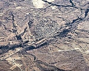
Aerial photo of the city
|
|

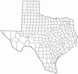
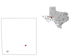
Location of Rankin, Texas
|
|
 |
|
| Country | United States |
| State | Texas |
| County | Upton |
| Area | |
| • Total | 1.05 sq mi (2.73 km2) |
| • Land | 1.05 sq mi (2.73 km2) |
| • Water | 0.00 sq mi (0.00 km2) |
| Elevation | 2,516 ft (767 m) |
| Population
(2020)
|
|
| • Total | 780 |
| • Density | 743/sq mi (285.7/km2) |
| Time zone | UTC-6 (Central (CST)) |
| • Summer (DST) | UTC-5 (CDT) |
| ZIP code |
79778
|
| Area code(s) | 432 |
| FIPS code | 48-60668 |
| GNIS feature ID | 1366016 |
Rankin is a small city in Upton County, Texas, United States. It is also the main town, or county seat, of Upton County. In 2020, about 780 people lived there.
The city is named after F.E. Rankin, who was a local rancher. In 2020, Upton County had only 3,308 residents in total. The city of McCamey was the only larger town in the county. Rankin grew a lot in the early 1900s. This happened because oil was found nearby in the Yates Oil Field. However, after another oil boom in the 1980s, the city's economy and population started to shrink.
Contents
Where is Rankin Located?
Rankin is located in Texas at coordinates 31°13′28″N 101°56′27″W / 31.22444°N 101.94083°W. It is easy to get to Rankin using major roads. These include U.S. Route 67, Texas State Highway 329, and Texas State Highway 349.
The United States Census Bureau says that Rankin covers about 1.1 square miles (2.7 square kilometers). All of this area is land.
A Look at Rankin's History
How Rankin Began
The town of Rankin was started in 1911. A year later, a post office was built there. In 1921, Rankin was still a very small community. It was mostly focused on ranching. Even so, it was chosen to be the county seat for Upton County. This meant it became the main town for the county's government. Rankin also had a train line, the Kansas City, Mexico and Orient Railway, which helped connect it to other places.
The Oil Boom Years
In 1926, oil was found in the Yates Oil Field. This oil field was in Pecos County, which is next to Upton County. Because Rankin was the closest town with a train line, it quickly became a "boom town." This means it grew very fast as people moved there for work. Rankin became a center for businesses that helped the oil fields.
During the Great Depression, the price of oil dropped. Many workers moved away to find jobs in new oil fields. This caused Rankin's population to go down. But in the 1940s, another oil field called Benedum Oil Field was discovered nearby. This led to a second boom for Rankin. During this time, the city built a hospital, three new schools, and a library.
Recent Times
Rankin's population reached its highest point in 1980, with 1,278 people. Since then, the number of people living in Rankin has slowly gone down. In 1990, a famous advertisement was filmed near Rankin. It was for the "Don't Mess with Texas" campaign. The ad featured a B-17G airplane called "Sentimental Journey."
People of Rankin
The population of Rankin has changed over the years. Here's a quick look at how many people have lived there:
| Historical population | |||
|---|---|---|---|
| Census | Pop. | %± | |
| 1930 | 935 | — | |
| 1940 | 672 | −28.1% | |
| 1950 | 1,139 | 69.5% | |
| 1960 | 1,214 | 6.6% | |
| 1970 | 1,105 | −9.0% | |
| 1980 | 1,216 | 10.0% | |
| 1990 | 1,011 | −16.9% | |
| 2000 | 800 | −20.9% | |
| 2010 | 778 | −2.7% | |
| 2020 | 780 | 0.3% | |
| U.S. Decennial Census | |||
Rankin's Population in 2020
In 2020, the 2020 United States census counted 780 people living in Rankin. There were 352 households, which are groups of people living together in one home. There were also 245 families.
The people living in Rankin come from different backgrounds. Here's a breakdown of the main groups:
| Group | Number | Percentage |
|---|---|---|
| White (NH) | 474 | 60.77% |
| Black or African American (NH) | 11 | 1.41% |
| Native American (NH) | 3 | 0.38% |
| Asian (NH) | 2 | 0.26% |
| Other Race (NH) | 1 | 0.13% |
| Mixed/multiracial (NH) | 32 | 4.1% |
| Hispanic or Latino | 257 | 32.95% |
| Total | 780 |
Schools in Rankin
The city of Rankin has its own school system, called the Rankin Independent School District. This district has two schools for students:
- Rankin High School (whose sports teams are called the Red Devils)
- James D. Gossett Elementary
Rankin's Climate
Rankin has a semiarid climate. This means it gets hot summers and cool winters. It does not get a lot of rain.
| Climate data for Rankin, Texas. | |||||||||||||
|---|---|---|---|---|---|---|---|---|---|---|---|---|---|
| Month | Jan | Feb | Mar | Apr | May | Jun | Jul | Aug | Sep | Oct | Nov | Dec | Year |
| Record high °F (°C) | 85 (29) |
87 (31) |
96 (36) |
99 (37) |
103 (39) |
109 (43) |
108 (42) |
105 (41) |
106 (41) |
101 (38) |
90 (32) |
82 (28) |
109 (43) |
| Mean daily maximum °F (°C) | 59.2 (15.1) |
64.0 (17.8) |
73.0 (22.8) |
81.3 (27.4) |
87.4 (30.8) |
93.4 (34.1) |
95.4 (35.2) |
93.5 (34.2) |
87.4 (30.8) |
79.1 (26.2) |
68.5 (20.3) |
61.0 (16.1) |
78.6 (25.9) |
| Mean daily minimum °F (°C) | 31.5 (−0.3) |
35.0 (1.7) |
43.6 (6.4) |
52.8 (11.6) |
59.9 (15.5) |
66.9 (19.4) |
69.8 (21.0) |
68.4 (20.2) |
62.8 (17.1) |
53.0 (11.7) |
41.8 (5.4) |
33.6 (0.9) |
51.6 (10.9) |
| Record low °F (°C) | 3 (−16) |
8 (−13) |
10 (−12) |
24 (−4) |
36 (2) |
45 (7) |
58 (14) |
57 (14) |
42 (6) |
27 (−3) |
12 (−11) |
6 (−14) |
3 (−16) |
| Average precipitation inches (mm) | 0.45 (11) |
0.67 (17) |
0.44 (11) |
0.96 (24) |
2.18 (55) |
1.36 (35) |
0.96 (24) |
2.27 (58) |
3.29 (84) |
1.84 (47) |
0.74 (19) |
0.50 (13) |
15.66 (398) |
| Source: The Western Regional Climate Center | |||||||||||||
Learn More
- In Spanish: Rankin (Texas) para niños
 | Georgia Louise Harris Brown |
 | Julian Abele |
 | Norma Merrick Sklarek |
 | William Sidney Pittman |


