
Rapid City, Michigan facts for kids
Quick facts for kids
Rapid City, Michigan
|
|
|---|---|
.jpg)
Post office in Rapid City
|
|
,_MI_location.png)
Location within Kalkaska County
|
|

Rapid City, Michigan
Location in Michigan

Rapid City, Michigan
Location in the United States
|
|
| Country | United States |
| State | Michigan |
| County | Kalkaska |
| Township | Clearwater |
| Area | |
| • Total | 5.53 sq mi (14.31 km2) |
| • Land | 5.41 sq mi (14.01 km2) |
| • Water | 0.12 sq mi (0.30 km2) |
| Elevation | 630 ft (190 m) |
| Population
(2020)
|
|
| • Total | 1,357 |
| • Density | 250.92/sq mi (96.87/km2) |
| Time zone | UTC-5 (Eastern (EST)) |
| • Summer (DST) | UTC-4 (EDT) |
| ZIP code(s) |
49676
|
| Area code(s) | 231 |
| GNIS feature ID | 635648 |
Rapid City is a small place in Kalkaska County, Michigan, USA. It is an unincorporated community and a census-designated place (CDP). This means it's a recognized area with its own population numbers, but it doesn't have its own city government.
In 2020, about 1,357 people lived in Rapid City. It is part of Clearwater Township. Rapid City is located about 8 miles (13 km) northwest of the town of Kalkaska.
Contents
History of Rapid City
Rapid City has an interesting history with its name. A post office first opened here on November 22, 1892. It was originally called Van Buren.
How Rapid City Got Its Name
The name of the post office changed a couple of times. On January 18, 1895, it was renamed Vanburen. Finally, on April 30, 1898, it became Rapid City. The town gets its name from the Rapid River, which flows right through the area.
Becoming a Census-Designated Place
For the first time, in the 2010 census, Rapid City was officially listed as a census-designated place (CDP). This means it now has clear boundaries and official population statistics. Even though it's a CDP, it doesn't have its own local government like an official city or town. It's mainly for collecting statistics.
Geography and Location
Rapid City is located in a scenic part of Michigan. The United States Census Bureau says the community covers an area of about 5.50 square miles (14.24 square kilometers). Most of this area, about 5.41 square miles (14.01 square kilometers), is land. The rest, about 0.09 square miles (0.23 square kilometers), is water.
Rivers and Lakes Nearby
The community is situated right on the Rapid River. It is also very close to Torch Lake, which is a large and beautiful lake. The Rapid River also flows near the border of Antrim County.
Population and People
The number of people living in Rapid City has stayed quite steady over the years.
- In 2010, the population was 1,352 people.
- By 2020, the population had slightly increased to 1,357 people.
| Historical population | |||
|---|---|---|---|
| Census | Pop. | %± | |
| 2010 | 1,352 | — | |
| 2020 | 1,357 | 0.4% | |
| U.S. Decennial Census | |||
Images for kids
-
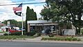
The post office in Rapid City.
-
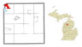
Map showing Rapid City's location within Kalkaska County.
See also
 In Spanish: Rapid City para niños
