Red Deer Lake (Manitoba) facts for kids
Quick facts for kids Red Deer Lake |
|
|---|---|

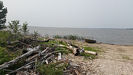
Photo taken on the south shore of the lake at Red Deer Lake, Manitoba
|
|
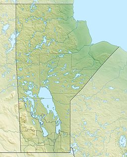
| Location | Western Manitoba |
| Coordinates | 52°57′N 101°22′W / 52.950°N 101.367°W |
| Primary inflows | Red Deer River |
| Primary outflows | Red Deer River |
| Basin countries | Canada |
| Surface elevation | 860 ft (260 m) |
Red Deer Lake is a beautiful lake located in western Manitoba, Canada. It's about 5 miles (8.0 km) north of a town called Barrows. The lake is also about 10 miles (16 km) west of Dawson Bay, which is part of a bigger lake called Lake Winnipegosis. If you travel about 8 miles (13 km) east from the lake, you'll reach the border of Saskatchewan.
This area is covered in thick forests. Even after the big sawmill closed, other logging companies and smaller sawmills have continued to work here. People also enjoy fishing in the lake. The fish caught here are processed in nearby places like Dawson Bay. There's even some coal exploration happening in the area, looking for coal in the ground.
Contents
History of Red Deer Lake
Early Industry and Settlements
In 1901, a company called the Red Deer Lumber Company started a big sawmill right on the south shore of Red Deer Lake. To help move the wood, they built a special railway track that connected the sawmill to the main Canadian Northern Railway line further south.
The company also created two small towns for the workers. The community of Red Deer Lake was built close to the sawmill, right by the lake. The other community, Barrows, was built where the new railway track met the main line. The sawmill operated for many years but eventually closed down in 1926.
Red Deer River
| Red Deer River | |
|---|---|

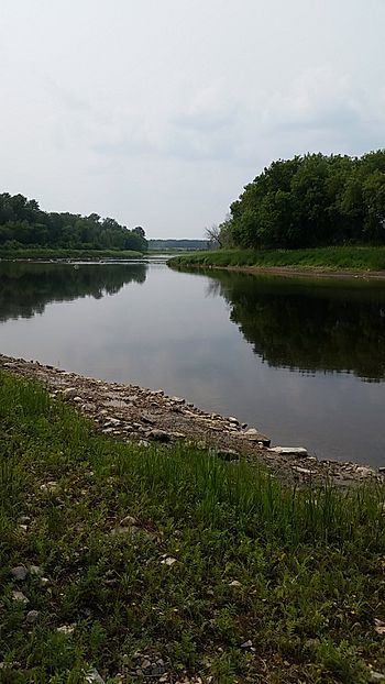
A photo of the Red Deer River near Erwood, Saskatchewan
|
|
| Physical characteristics | |
| River mouth | Dawson Bay on Lake Winnipegosis |
| Basin features | |
| Basin size | 11,000 km2 (4,200 sq mi) |
The Red Deer River is an important river that starts in eastern Saskatchewan. It flows east, passing through Red Deer Lake, and then empties into Dawson Bay, which is part of Lake Winnipegosis.
River Neighbors and Basins
The land area that collects water for the Red Deer River is called its basin. To the north of this basin is the basin of the Saskatchewan River. To the southwest, you'll find the basin of the upper Assiniboine River. And to the southeast, there's the basin of the Swan River.
Fort Red Deer River
Fort Red Deer River, also known as Fort Rivière la Biche, was an old North West Company trading post. It was located on the Red Deer River, close to the town of Hudson Bay, Saskatchewan.
History of the Trading Post
This trading post was started in 1794 by a person named Hugh McGillis. We don't know exactly when it closed down. Today, you can find a provincial marker at the site, which is believed to be at the mouth of the Etomami River in the Hudson Bay Regional Park (52°49′08″N 102°22′44″W / 52.81889°N 102.37889°W).
In 1774, a man named Matthew Cocking wrote about two trading posts on the Red Deer River. He called them the "Lower Settlement" and the "Upper Settlement." The Lower Settlement was just a bit upriver from the lake. The Upper Settlement was about 60 miles further upriver from the lake. It's thought that this Upper Settlement later became Fort Red Deer River. In 1889, J.B. Tyrrell found old ruins from both of these settlements.
Importance of Fort Red Deer River
Alexander Mackenzie, a famous explorer, thought this fort was one of the three most important trading posts in the Lake Manitoba area. The trading post was located where the Assiniboine tribes, who lived to the south, and the Swampy Cree tribes, who lived to the north, would often meet to trade.
 | Lonnie Johnson |
 | Granville Woods |
 | Lewis Howard Latimer |
 | James West |


