Red Hills (Charlottesville, Virginia) facts for kids
|
Red Hills
|
|

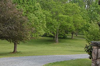
Entrance to the estate
|
|
| Location | 2051 Polo Grounds Rd., near Charlottesville, Virginia |
|---|---|
| Area | 26.5 acres (10.7 ha) |
| Built | c. 1797 |
| Built by | Milton L. Grigg, William Hale |
| Architectural style | Georgian, Colonial Revival |
| NRHP reference No. | 98000047 |
Quick facts for kids Significant dates |
|
| Added to NRHP | February 13, 1998 |
Red Hills is a historic house and farm located near Charlottesville in Albemarle County, Virginia. The main part of the house was built around 1797. It has two stories and is made of brick. The design is in the Georgian style, which was popular at that time.
The house also has two brick wings at the back. A newer, one-story section was added later. Around 1939, a front porch was built. This porch has a gabled roof and shows the Colonial Revival style.
The property also includes other old buildings. There is a barn, a corncrib, and a shed from the early 1900s. Another shed is from the late 1800s. A well from the 1800s is also on the land. There is also a cemetery from the 1800s where enslaved people were buried. Red Hills was added to the National Register of Historic Places in 1998.
Contents
Life at Red Hills Plantation
Red Hills was once a large farm, known as a plantation. Many people were forced to work there. These enslaved people helped run the farm. Records show that about 24 enslaved people lived and worked at Red Hills.
A large number of these individuals were children. Others were adults of different ages. Many of these enslaved people are buried in a special cemetery. This cemetery was once part of the Red Hills property.
The Slave Cemetery
About half a mile south of the main house is a small cemetery. This cemetery holds the remains of at least 21 enslaved people. They lived and worked on the Red Hills Plantation. Their graves are marked with upright fieldstones. Many of these stones have carvings that are hard to read today. Some graves also have matching footstones.
Other unmarked spots in the ground might also be graves. People believe an old road once led from the main house to this cemetery. The cemetery is no longer part of the Red Hills property. This is because parts of the land were sold over time.
Daily Life and Challenges
Enslaved families at Red Hills often lived close to each other. Their homes were usually near the main house. Getting drinking water was a big challenge for them. On average, they had to walk 100 to 200 yards to reach water. Some families had to walk even farther, over half a mile.
Access to doctors was also very difficult. There were no doctors for enslaved people in the Red Hills area. If someone needed a doctor, one had to be called from Charlottesville. This was a long and expensive trip. Doctors were only called in very serious situations.
Community and Education
Before the Civil War, there were no churches specifically for enslaved people in the Red Hills area. After the war, several churches were built. These included churches in South Garden, Chestnut Grove, and Cross Roads. All of these were Baptist churches.
Many enslaved families lived close to schools for children of color. About one-third of these families lived within a mile of such schools. However, walking to school could be dangerous. This was especially true because of cars on the roads. It was common for students to stop attending school after their third year.


