Remutaka Range facts for kids
Quick facts for kids Remutaka Range |
|
|---|---|

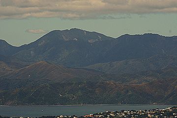
Mount Matthews, 940 metres, seen from Kelburn, Wellington
|
|
| Highest point | |
| Elevation | 940 m (3,080 ft) |
| Geography | |
| Location | Wairarapa/Wellington, New Zealand |
The Remutaka Range is a mountain chain in the lower North Island of New Zealand. Before 2017, it was known as the Rimutaka Range. This mountain chain stretches north into the Tararua and Ruahine Ranges. It runs along the east coast between Wellington and East Cape.
The highest point where the road crosses the range is called Remutaka Pass. This pass is 555 meters (about 1,820 feet) high. Its name was officially confirmed in 2015. The range's name officially changed to Remutaka Range in 2017. This happened after a special law called the Rangitāne Tū Mai Rā (Wairarapa Tamaki nui-ā-Rua) Claims Settlement Act was passed.
Contents
Geography of the Remutaka Range
The Remutaka Range stretches for 55 kilometers (about 34 miles). It runs from the upper Hutt Valley to Turakirae Head. This is at the western end of Palliser Bay. The range's northern end meets the southern part of the Tararua mountains.
The highest point in the range is Mount Matthews. It stands 940 meters (about 3,084 feet) tall. Mount Matthews is located near the southern end of the range.
Roads and Railways Across the Range
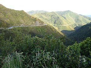
State Highway 2 crosses the Remutaka Range. This road is narrow and winding. It connects the Hutt Valley to Featherston. At the top of the road, there used to be a lookout point. This spot once had tea rooms and later a cafe. However, the building was badly damaged by fire in 2009 and was later taken down.
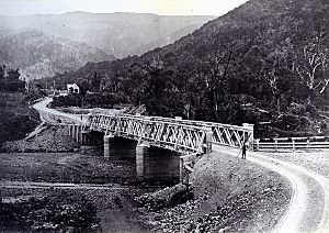
A different path was used by the Wairarapa Line railway. This railway used to climb over the Remutakas. It included the famous Rimutaka Incline. This was a special type of railway designed for steep hills. It opened in 1878 and closed in 1955. The railway was replaced by the Remutaka Tunnel. Today, the old railway path is a popular walking and cycling route. It is known as the Remutaka Rail Trail and is part of the Remutaka Cycle Trail.
There are plans to rebuild part of the old railway. The Rimutaka Incline Railway Heritage Trust hopes to bring it back as a tourist attraction.
History of the Remutaka Range
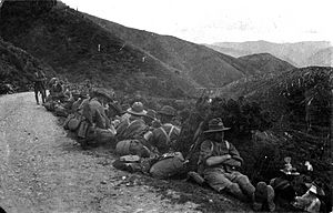
During World War I, more than 30,000 New Zealand soldiers marched over the Remutaka Hill Road. This was part of their training. The march was 43.5 kilometers (about 27 miles) long and took three days. Soldiers walked from military camps in Trentham and Upper Hutt to Featherston. Then, after their training, they marched back over the hill to Wellington. From there, they would board ships to join the war in France.
There were 23 such marches between September 1915 and April 1918. Each march involved 500 to 1,800 soldiers. In 2015, a group re-enacted this historic march.
See also
 In Spanish: Montes Rimutaka para niños
 | Leon Lynch |
 | Milton P. Webster |
 | Ferdinand Smith |


