Ruahine Range facts for kids
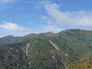
The Ruahine Range is a large mountain range in the North Island of New Zealand. It is one of several mountain chains that run along the island's east coast, stretching from East Cape to Wellington. These ranges, including the Ruahine, Tararua, and Remutaka Ranges, form a clear ridge in the central North Island.
The Ruahine mountains extend for 110 kilometers (about 68 miles). They run from inland Hawke's Bay down towards Woodville. To the south, the Manawatu Gorge separates the Ruahine Range from the Tararua Range.
The tallest point in the Ruahine Range is Mangaweka Peak. It stands 1733 meters (5686 feet) high. Mangaweka is the second highest non-volcanic mountain in the North Island. Only Mount Hikurangi in the Raukumara Range is taller, at 1754 meters (5755 feet).
Another important peak is Wharite, which is 920 meters (3017 feet) tall. Wharite marks the southern end of the Ruahine Range. It is a well-known landmark in the Manawatu and Tararua District. Wharite is famous for its tall television transmission tower. The first TV transmitter there started working in 1963. It relayed Wellington's WNTV1 channel, which is now part of TVNZ 1. The main transmitter used today was set up in 1966.
What's in a Name?
The name Ruahine comes from the Māori people. It is thought to mean "wise woman." This name refers to the granddaughter of a leader who traveled on the Aotea canoe.
See also
 In Spanish: Montes Ruahine para niños
 | Frances Mary Albrier |
 | Whitney Young |
 | Muhammad Ali |


