Reusens Dam facts for kids
Quick facts for kids Reusens Dam |
|
|---|---|
|
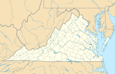
Location of Reusens Dam in Virginia
|
|
| Location | Amherst County, Virginia, U.S. |
| Coordinates | 37°27′47.68″N 79°11′10.44″W / 37.4632444°N 79.1862333°W |
| Purpose | Power |
| Status | In use |
| Opening date | 1903 |
| Owner(s) | Eagle Creek Renewable Energy |
| Operator(s) | Eagle Creek Renewable Energy |
| Dam and spillways | |
| Type of dam | Concrete gravity and concrete arch |
| Impounds | James River |
| Height | 24 feet |
| Length | 416 feet |
| Power station | |
| Operator(s) | Eagle Creek Renewable Energy |
| Turbines | 5 |
| Installed capacity | 12.5 MW |
The Reusens Dam is a special structure on the James River in Virginia. It helps make electricity using the power of water. This is called hydroelectric power. The dam is near the city of Lynchburg, Virginia.
The Reusens Dam is made of two main parts. One part is a concrete gravity dam. This means it's super heavy and uses its weight to hold back the water. It has eight large gates that can open and close to control water flow. The other part is a concrete arch dam. This part is curved like an arch, which helps it stand strong against the water pressure. It also has special boards called flashboards to manage water levels.
This dam has two separate buildings called power houses. Inside these buildings are machines called turbines. These turbines spin when water flows through them, creating electricity. One power house has three turbines and can make 7.5 megawatts of power. The other has two turbines and can make 5.0 megawatts. Together, they can produce 12.5 megawatts of electricity. The dam is used for "peaking capacity," which means it generates power when people need it most, like during hot afternoons when air conditioners are running.
Where is the Reusens Dam?
The Reusens Dam is part of a series of dams on the James River. It is located downstream from a smaller dam called the Holcomb Rock Dam. It is also upstream from the Scotts Mill Dam. Further down the river, closer to Richmond, is the Bosher Dam.
How Dams Make Electricity
Dams like Reusens use a clever way to make electricity.
- Water Power: Water from the river is held back by the dam, creating a reservoir (a large lake). This water has a lot of energy because of its height.
- Spinning Turbines: When electricity is needed, gates in the dam open. Water rushes down through large pipes called penstocks. This fast-moving water hits the blades of giant turbines, making them spin very fast.
- Generators: The spinning turbines are connected to machines called generators. Generators are like big dynamos that turn the motion of the spinning turbines into electrical energy.
- Powering Homes: This electricity then travels through power lines to homes, schools, and businesses. It's a clean way to make power because it doesn't burn fossil fuels.
History of the Reusens Dam
The Reusens Dam was finished and started working in 1903. That means it's been making electricity for over 120 years! It was built specifically to generate power for the area. Today, the dam is owned and operated by a company called Eagle Creek Renewable Energy. They manage the dam to keep producing clean energy for people to use.


