Rew Down facts for kids
| Site of Special Scientific Interest | |

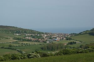
Looking towards Ventnor from Rew Down
|
|
| Area of Search | Isle of Wight |
|---|---|
| Grid reference | SZ550775 |
| Interest | Biological |
| Area | 23.5 hectare |
| Notification | 1977 |
| Location map | Natural England |
Rew Down is a special natural area on the Isle of Wight. It covers about 23.5 hectares, which is like 23 large football fields! This land is protected as a Site of Special Scientific Interest (SSSI) and a Local Nature Reserve. It sits on the hills west of Ventnor, on the island's south-east side.
Contents
What Makes Rew Down Special?
Rew Down is mostly a chalk grassland. This means the soil is made of chalk, which helps unique plants and flowers grow. The land gently slopes towards the south. From here, you can see amazing, wide views of the English Channel. It's a great spot to enjoy the scenery.
Nature and Views
The Stenbury Trail, a walking path, runs along the west side of Rew Down. To the north, you'll find the Ventnor golf club. This area is important for its wildlife and plants. It's a peaceful place where you can connect with nature.
Who Looks After Rew Down?
The Isle of Wight Council helps manage Rew Down. They work to keep it a healthy place for nature. Since 2003, you might see Highland cattle grazing here. These sturdy cows help keep the grass short. This grazing is good for the chalk grassland. It allows many different types of plants to grow.
A Glimpse into History
Rew Down also holds a piece of history from World War II. You can find the remains of a tower base there. This tower was part of a Royal Navy direction finding (D/F) station. These stations were also known as Y-stations. They were used to listen in on enemy radio messages. This helped the Allies during the war. The Ventnor station is thought to be one of the most complete ones still left. It's a reminder of the important role the Isle of Wight played in history.
 | Misty Copeland |
 | Raven Wilkinson |
 | Debra Austin |
 | Aesha Ash |

