Ventnor facts for kids
Quick facts for kids Ventnor |
|
|---|---|
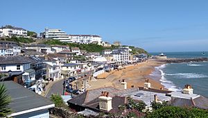 Ventnor seafront, June 2018 |
|
| Area | 0.980 sq mi (2.54 km2) |
| Population | 5,567 (2021 Census) |
| • Density | 5,681/sq mi (2,193/km2) |
| OS grid reference | SZ562775 |
| Unitary authority | |
| Ceremonial county | |
| Region | |
| Country | England |
| Sovereign state | United Kingdom |
| Post town | VENTNOR |
| Postcode district | PO38 |
| Dialling code | 01983 |
| Police | Hampshire |
| Fire | Isle of Wight |
| Ambulance | Isle of Wight |
| EU Parliament | South East England |
| UK Parliament |
|
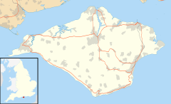
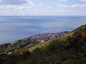
Ventnor is a fun seaside town on the southeast coast of the Isle of Wight, England. It's about 11 miles from Newport. The town is built on steep hills that lead down to the sea.
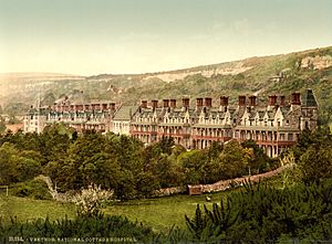
Ventnor became very popular in the Victorian era (late 1800s) as a place for holidays and for people to get well. It was even called the 'English Mediterranean' because of its warm weather! Later, as medicine got better and travel changed, fewer people came for health reasons.
The town is tucked away under a big chalk hill called St Boniface Down. It faces south towards the English Channel. This gives Ventnor a special microclimate (a small area with different weather). It gets more sunny days and fewer frosts than other parts of the island. This special weather lets many amazing subtropical plants grow here, especially at the famous Ventnor Botanic Garden.
Contents
- Ventnor's Story: A Look Back in Time
- How Ventnor is Governed
- Ventnor's Location and Landscape
- Ventnor's Geology: The Ground Beneath Our Feet
- Ventnor's Climate: Why it's So Sunny!
- Amazing Wildlife in Ventnor
- Ventnor's People
- Ventnor's Economy: How People Make a Living
- Arts and Culture in Ventnor
- Ventnor's Famous Places
- Getting Around Ventnor
- Schools and Learning in Ventnor
- Places of Worship
- Sports and Fun in Ventnor
- Famous People from Ventnor
- Other Places Named Ventnor
- See also
Ventnor's Story: A Look Back in Time
While nearby places like Bonchurch and St Lawrence have very old churches from the Norman times, Ventnor itself was just a small area until the 1800s. Long ago, in Anglo-Saxon times, it was called Holeweia. By the 1600s, it was known as Ventnor, possibly named after a family called le Vyntener.
There's proof that people lived here even in the Bronze Age, with old burial mounds on the hills. Digs have also found small settlements from the Iron Age and early Roman times.
In the early 1800s, Ventnor was just a few fishing huts, a couple of inns, and a farm. But things changed quickly! In 1830, a doctor named James Clark wrote a book. He said Ventnor's special climate was perfect for people with chest problems, like TB.
After that, Ventnor grew super fast into a town. Many hotels and guesthouses opened for sick visitors, especially in winter. It had more shops than you'd expect for its size. In 1844, a law was passed to help improve the town, like paving streets and setting up a market.
In 1853, the first newspaper on the island, the Ventnor Mercury, started here. In 1869, a big hospital for chest diseases, the Royal National Hospital for Diseases of the Chest, opened nearby. Many buildings you see today were built in the 1860s. Ventnor became a very popular place for wealthy holidaymakers from Britain and Europe.
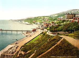
The first pier was built in 1860, but storms washed it away. New sea walls were built, and by 1864, you could take a boat to Littlehampton and then a train to London. In 1866, the Isle of Wight Railway reached Ventnor. In 1870, a new iron pier was built. Trains even ran a special 'Invalid Express' directly to Ventnor for patients. The town became known as 'Mayfair by the sea' because so many rich Londoners visited. By 1887, it was called "one of the most popular English health resorts."
By the early 1900s, Ventnor was a busy resort. It had newspapers, a science institute, a big library, and many clubs. Its population grew to over 6,000.
The First World War stopped the holiday trade, but the town itself wasn't damaged. Ventnor helped wounded soldiers. After the war, summer holidays returned in the 1920s, but the winter health visits didn't. The town was at its busiest in the 1930s. The cool Art Deco Winter Gardens opened in 1936/37. The small sandy beach was great for swimming.
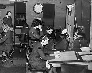
During World War II, the Isle of Wight was a protected area. The radar station at RAF Ventnor was attacked, and the town was bombed. By the end of the war, 120 buildings were destroyed, and 1,500 were damaged. The holiday business slowed down.
In the 1960s, British seaside holidays faced competition from cheap trips abroad. The railway lines to Ventnor closed in 1952 and 1966. The pier was damaged and taken down in the 1990s. For a while, Ventnor seemed to struggle. But recently, it's been getting popular again! Its old Victorian architecture is back in style, and there are new shops, restaurants, and a lively arts scene.
How Ventnor is Governed
Ventnor is part of the Isle of Wight area for national government. Local services are run by the Isle of Wight Council.
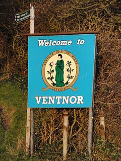
Ventnor also has its own town council. This council looks after things like the town park, car parks, public toilets, and community gardens. They also help make local rules and give advice on things like planning and transport. The town's coat of arms shows Hygeia, the Greek goddess of health. This shows how important health resorts were to Ventnor in the past.
Ventnor's Location and Landscape
Ventnor is on the southeast coast of the Isle of Wight, an island in the English Channel. It's about 2 miles off the coast of Hampshire. Ventnor is about 11 miles south of Newport, the island's main town.
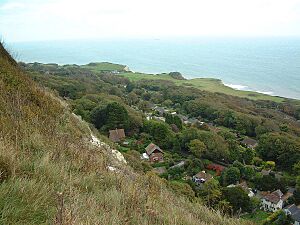
The coastline here has amazing cliffs. The town climbs up the steep slopes between Ventnor Bay and St Boniface Down. This down is the highest point on the island, at 241 meters (791 feet) tall. Ventnor's town center is about 45 meters (148 feet) above sea level.
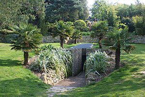
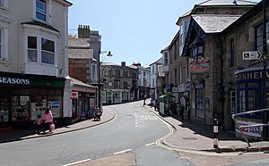
There are special natural areas nearby called Sites of Special Scientific Interest (SSSIs). These include Ventnor Downs and the Bonchurch Landslips. Ventnor beach is one of the island's main beaches, even if it's small. The Isle of Wight Coastal Path runs right through Ventnor. The town doesn't have a big river, but there are small streams that flow down to the sea, like the one in Cascade Gardens.
The tides along the coast are strong. There are 71 recorded shipwrecks off the coast! The famous Clarendon wreck happened nearby in 1836, which led to the building of St Catherine's lighthouse.
The coastline needs protection from erosion. Large rocks and concrete blocks have been put in place to help protect the cliffs. This area is also special for marine life, with underwater reefs that are home to many sea creatures.
Ventnor is the seventh largest town on the Isle of Wight, with almost 6,000 people. The closest town is Shanklin, about four miles northeast.
Ventnor's Geology: The Ground Beneath Our Feet
Ventnor is built on a unique geological feature called the Undercliff. This is the largest urban landslide area in North West Europe! The Isle of Wight has layers of different rocks, like sandstone, chalk, and clay.
A lot of the town is built on a type of clay called 'blue slipper'. When this clay gets wet, it becomes slippery, and the rocks above it can slide. This means the ground can be unstable. Over the years, this movement has damaged buildings and roads. In 2014, after heavy rain, a landslide caused the road between Ventnor and Niton to collapse.
The area is also important for fossils. You can find many interesting invertebrate fossils along the coast.
Ventnor's Climate: Why it's So Sunny!
Ventnor and the Isle of Wight have a mild climate, with cool summers and gentle winters. The Met Office has a weather station in Ventnor Park. Ventnor holds the British record for the warmest night in June, reaching 22.7°C (72.9°F) in 1976!
The Isle of Wight is one of the sunniest places in the UK. Ventnor gets around 1888 hours of sunshine each year, averaging five hours a day. It's protected from cold north winds by St Boniface Down, which creates its special microclimate. This is why the Botanic Garden can grow plants that wouldn't survive elsewhere in the UK.
| Climate data for Ventnor Park 60m asl, 1971-2000 | |||||||||||||
|---|---|---|---|---|---|---|---|---|---|---|---|---|---|
| Month | Jan | Feb | Mar | Apr | May | Jun | Jul | Aug | Sep | Oct | Nov | Dec | Year |
| Mean daily maximum °C (°F) | 7.9 (46.2) |
7.8 (46.0) |
9.8 (49.6) |
12.0 (53.6) |
15.2 (59.4) |
17.5 (63.5) |
19.7 (67.5) |
20.1 (68.2) |
18.1 (64.6) |
14.9 (58.8) |
11.2 (52.2) |
9.0 (48.2) |
13.6 (56.5) |
| Mean daily minimum °C (°F) | 3.6 (38.5) |
3.2 (37.8) |
4.4 (39.9) |
5.6 (42.1) |
8.7 (47.7) |
11.3 (52.3) |
13.6 (56.5) |
14.1 (57.4) |
12.4 (54.3) |
9.9 (49.8) |
6.5 (43.7) |
4.7 (40.5) |
8.2 (46.7) |
| Source: YR.NO | |||||||||||||
| Climate data for St Catherine's Point 16m asl, 1981-2010 | |||||||||||||
|---|---|---|---|---|---|---|---|---|---|---|---|---|---|
| Month | Jan | Feb | Mar | Apr | May | Jun | Jul | Aug | Sep | Oct | Nov | Dec | Year |
| Mean daily maximum °C (°F) | 8.2 (46.8) |
7.8 (46.0) |
9.4 (48.9) |
11.6 (52.9) |
14.6 (58.3) |
17.1 (62.8) |
19.2 (66.6) |
19.8 (67.6) |
18.2 (64.8) |
15.1 (59.2) |
11.7 (53.1) |
9.1 (48.4) |
13.5 (56.3) |
| Mean daily minimum °C (°F) | 4.2 (39.6) |
3.6 (38.5) |
4.9 (40.8) |
6.3 (43.3) |
9.3 (48.7) |
11.9 (53.4) |
14.2 (57.6) |
14.7 (58.5) |
13.2 (55.8) |
10.7 (51.3) |
7.5 (45.5) |
4.9 (40.8) |
8.8 (47.8) |
| Average rainfall mm (inches) | 72.0 (2.83) |
53.4 (2.10) |
54.4 (2.14) |
46.2 (1.82) |
46.2 (1.82) |
39.0 (1.54) |
37.5 (1.48) |
42.9 (1.69) |
57.6 (2.27) |
90.6 (3.57) |
78.7 (3.10) |
81.6 (3.21) |
700.2 (27.57) |
| Average rainy days (≥ 1.0 mm) | 12.3 | 9.2 | 10.0 | 8.5 | 7.9 | 6.6 | 6.6 | 6.8 | 8.2 | 12.0 | 12.3 | 12.5 | 112.8 |
| Source: UK Met Office | |||||||||||||
Amazing Wildlife in Ventnor
Ventnor's climate and habitats are home to rare species in the UK, especially those that like warmer places.
- The town has the biggest and oldest group of common wall lizards in Britain. Some people think they've always been here, while others believe they were released in the 1920s.
- The Isle of Wight is one of the main places in Britain where you can still see red squirrels. They are shy, so look for them in wooded areas.
- Ventnor downs have a small herd of feral goats. They were brought here in 1993 to help control the growth of holm oak trees. These trees were planted a lot by Victorians and Ventnor has the largest holm oak wood in Northern Europe!
- The only significant group of Glanville fritillary butterflies, one of Britain's rarest, lives along the southern coast of the Isle of Wight, including Ventnor.
- The coastal downs west of Ventnor are one of the few places in the UK where you can find Field Cow-wheat.
- Early gentian, a rare flower, can be found on Rew Down, just northwest of town.
- Ventnor's underwater reefs are important homes for sea creatures. You might even spot bottlenose dolphins and basking sharks offshore!
Ventnor Botanic Garden
Ventnor Botanic Garden is a special place that opened in 1970. It's built on the site of an old hospital. The warm and sunny microclimate lets plants grow here that usually can't survive outdoors in mainland Britain. The garden has trees and shrubs from all over the world, especially Australia, New Zealand, Japan, and the Mediterranean.
The garden has a temperate house and a visitor center. It claims to be Britain's hottest garden! It also has a collection of puya plants from the Andes, which are almost unique for being grown outdoors in Britain.
Ventnor's People
Ventnor's population grew to over 7,300 in the early 1950s. In 2021, the population was 5,567. The town has an older population compared to the rest of England. Most people in Ventnor were born in the UK.
Ventnor's Economy: How People Make a Living
Ventnor's economy relies a lot on tourism, with many hotels and cafes that are open during the holiday season. The main shopping areas are the High Street and Pier Street, and the Esplanade. There's also a small fishing industry near the Haven.
Many jobs in Ventnor are in health and social care, retail, and food services. The town council is working to improve the economy and community life in Ventnor.
Arts and Culture in Ventnor
Ventnor has a lively arts scene for its size, with several annual events and places for theatre and independent films.
- Ventnor Fringe Festival has been held every year since 2010. It's an open arts festival that takes place all over town, like a smaller version of the Edinburgh Festival Fringe.
- Ventnor Carnival is a traditional town parade held in mid-August. It started in 1889 and is one of the oldest carnivals in the UK!
- Since 2016, there's been an annual Ventnor Day to celebrate the town, with music, entertainment, and stalls.
Ventnor doesn't have a big cinema, but there's a local film club that shows international movies. The Ventnor Arts Club, in an old bank building, shows live opera, ballet, and theatre.
Ventnor's Famous Places
Ventnor has many interesting landmarks, from its natural beauty to its Victorian history.
- St Boniface Down is a tall chalk hill just north of town.
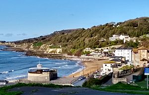
- Ventnor Beach is small with reddish sand and pebbles. It has Ventnor Haven (a small harbor) and the Spyglass Inn at one end.
- The Esplanade was built in 1848 and is now lined with pubs, cafes, and shops. You can see a sundial (gnomon) there from 1851.
- The Ventnor sign on the cliffs at La Falaise has the town's name in 13-foot-tall white concrete blocks. It was put up between the World Wars so ships could see it.
- Steephill Cove is a small hamlet and beach nearby that you can't reach by car. It has cafes and cottages.
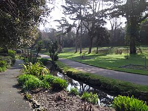
- Ventnor Park, on the west side of town, won 'Park of the Year' in 2016! It has a bandstand, a small aviary, and a stream.
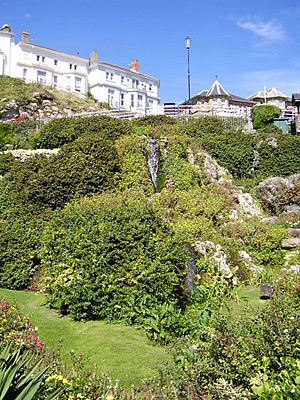
- Cascade Gardens have a stream and a small waterfall. Below them is a paddling pool on the esplanade with a model of the Isle of Wight for kids to play on.
- RAF Ventnor is a former radar station on top of St Boniface Down. It's now used for communication antennae.
- Ventnor Exchange is an arts center that opened in 2014 in an old Post Office building. It runs the Ventnor Fringe Festival and helps young artists.
- The Winter Gardens is an Art Deco building from 1936. It's now a cafe/restaurant and entertainment venue.
- Nearby is Blackgang Chine, the UK's oldest theme park, which opened in 1843.
- The powerful St Catherine's Lighthouse is five miles away, at the very tip of the island.
Getting Around Ventnor
Ventnor is surrounded by hills and doesn't have a train station anymore. It's a bit isolated from the rest of the island.
Road Access
In the past, it was hard to reach Ventnor by road because the tracks were narrow and steep. Modern roads were built in the late 1800s.
History of the Railway
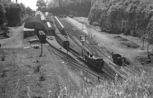
Railways reached Ventnor in 1866 and 1900, bringing many visitors. But both stations were a bit far from the town center. Ventnor West station closed in 1952, and Ventnor Station closed in 1966. This closure made it harder for tourists to get to Ventnor, which hurt the town's economy.
Bus Services
Southern Vectis runs bus routes from Ventnor to places like Newport, Ryde, and Shanklin. There's also a local minibus service that connects Ventnor to Bonchurch Village, the Botanic Garden, and the esplanade.
Schools and Learning in Ventnor
Ventnor has one secondary school, one primary school, and one special school:
- The Island Free School (secondary)
- St Francis Catholic and CofE Primary School Academy
- St Catherine's School, a special school for students with speech and language difficulties.
Ventnor's library started in 1848. It's a popular place for residents and offers books, music, computers, and events. The town also has a small heritage center and museum that shows how Ventnor grew in Victorian times.
Places of Worship
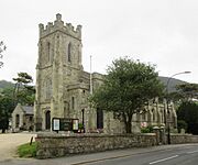
Ventnor has several churches. St Catherine's Church and Holy Trinity Church are both Church of England churches. There's also a third Church of England church, St Alban's.
Our Lady and St Wilfrid's Catholic Church was rebuilt in 2015 after a fire. There's also a Baptist Church in the town center.
Sports and Fun in Ventnor
Ventnor has many sports clubs:
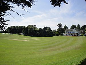
- Ventnor Cricket Club has several teams and plays on a unique ground that isn't flat!
- Ventnor Rugby Club has two men's teams.
- Ventnor Football Club is next to the rugby club.
- There's a riding school and equestrian center north of Ventnor.
- Rew Valley Sports Centre is available for the community to use outside of school hours.
- Ventnor has a bowling club and a Golf Club with the oldest course on the island.
- Ventnor Tennis Club has four hard courts.
- The town also has an angling club.
- Ventnor skatepark, at the east end of the esplanade, is currently closed but hopes to reopen soon.
- Ventnor Beach is popular for swimming and relaxing. Next to it is Ventnor Haven, where you can buy fresh fish.
- The Isle of Wight is known as a great place for cycling, and Ventnor is on the route of the annual randonnée cycling event.
Famous People from Ventnor
People who live in Ventnor are called Ventnorians.
- Queen Victoria visited Ventnor because her doctor recommended it. The Royal Hotel was named after her visit in 1855.
- Many famous writers stayed in Ventnor during the Victorian era. Charles Dickens wrote part of David Copperfield nearby.
- The poet and critic Algernon Charles Swinburne spent his childhood in Bonchurch.
- The famous thinker Karl Marx rented a house in Ventnor for two winters, calling the island "a little paradise."
- The composer Edward Elgar and his wife spent their honeymoon here in 1889.
- In the 20th century, poet Alfred Noyes lived in Ventnor.
- The band the Bees are from Ventnor.
- The actor Brian Murphy was born in Ventnor.
Other Places Named Ventnor
Did you know there are other places around the world named Ventnor?
- Ventnor is a seaside area in Australia.
- Ventnor City is a coastal city in New Jersey, USA.
- Ventnor, Eastern Cape is a farm in South Africa.
- Ventnor, Ontario is a small village in Canada.
- Ventnor, Queensland is a place in Australia.
See also
 In Spanish: Ventnor para niños
 | Percy Lavon Julian |
 | Katherine Johnson |
 | George Washington Carver |
 | Annie Easley |


