Reydon, Oklahoma facts for kids
Quick facts for kids
Reydon, Oklahoma
|
|
|---|---|

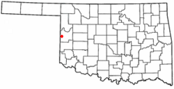
Location of Reydon, Oklahoma
|
|
| Country | United States |
| State | Oklahoma |
| County | Roger Mills |
| Area | |
| • Total | 0.49 sq mi (1.28 km2) |
| • Land | 0.49 sq mi (1.28 km2) |
| • Water | 0.00 sq mi (0.00 km2) |
| Elevation | 2,261 ft (689 m) |
| Population
(2020)
|
|
| • Total | 137 |
| • Density | 277.89/sq mi (107.19/km2) |
| Time zone | UTC-6 (Central (CST)) |
| • Summer (DST) | UTC-5 (CDT) |
| ZIP code |
73660
|
| Area code(s) | 580 |
| FIPS code | 40-63100 |
| GNIS feature ID | 2412546 |
Reydon is a small town located in Roger Mills County, Oklahoma, in the United States. It is a quiet place with a rich history connected to the railways.
Contents
How Reydon Began
Reydon was officially started in 1928. This happened after the Atchison, Topeka and Santa Fe Railway built train tracks through the area. The railway bought land from local farmers to create a new town site.
The new town was about two miles north of an older settlement called Rankin. Many businesses and people from Rankin moved to the new site. They wanted to be closer to the train tracks.
However, the name "Rankin" caused some confusion. There was already another town called Rankin, Texas along the same railway line. So, the new town was given the name Reydon instead. It might have been named after a railway boss in Chicago, or perhaps after a village called Reydon in Suffolk County, England.
Population Changes
The town of Reydon grew quite a bit after it was founded. Its population reached its highest point in 1950, with 331 people living there.
In 2003, a big newspaper, The New York Times, wrote an article about Reydon. The article talked about how some small towns in the Great Plains area were getting smaller.
By the time of the 2020 census, Reydon had a population of 137 people.
| Historical population | |||
|---|---|---|---|
| Census | Pop. | %± | |
| 1930 | 216 | — | |
| 1940 | 311 | 44.0% | |
| 1950 | 331 | 6.4% | |
| 1960 | 183 | −44.7% | |
| 1970 | 215 | 17.5% | |
| 1980 | 252 | 17.2% | |
| 1990 | 200 | −20.6% | |
| 2000 | 177 | −11.5% | |
| 2010 | 210 | 18.6% | |
| 2020 | 137 | −34.8% | |
| U.S. Decennial Census | |||
Life in Reydon
In 2000, there were 177 people living in Reydon. There were 77 households, which are groups of people living together. About 46 families lived in the town.
Most of the people in Reydon were White. A small number were African American or Native American. Some people were of Hispanic or Latino background.
About 27.7% of the people were under 18 years old. The average age in the town was 39 years old.
Geography and Location
Reydon covers an area of about 0.4 square miles (1.28 square kilometers). All of this area is land.
The town is located where two main roads meet: State Highway 30 and State Highway 47.
Reydon is surrounded by the Black Kettle National Grassland. This is a large area of protected land with prairies and forests. To the southeast of the town, you can find Skipout Lake.
Education
Students in Reydon attend schools that are part of the Reydon Public Schools district.
See also
 In Spanish: Reydon (Oklahoma) para niños
 | James B. Knighten |
 | Azellia White |
 | Willa Brown |

