Rib Lake (Ontario) facts for kids
Quick facts for kids Rib Lake |
|
|---|---|

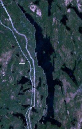
Satellite image of Rib Lake (middle) and smaller adjacent lakes
|
|
| Location | Latchford and Temagami, Ontario |
| Coordinates | 47°12′53″N 79°42′58″W / 47.21472°N 79.71611°W |
| Part of | Ottawa River drainage basin |
| Primary inflows | Ten unnamed creeks |
| Primary outflows | Net Creek |
| Basin countries | Canada |
| Max. length | 10 km (6.2 mi) |
| Max. width | 1.2 km (0.75 mi) |
| Surface elevation | 313 m (1,027 ft) |
| Islands | Babcock Island, Sans Souci Island |
| Settlements | Freeman, Rib Lake |
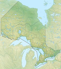
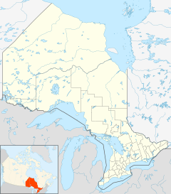
Rib Lake is a long, narrow lake in Ontario, Canada. It is located in the towns of Latchford and Temagami. The lake is about 9 kilometres (6 mi) southeast of Latchford and 9 kilometres (6 mi) northeast of Temagami North.
This lake is part of the larger Ottawa River drainage basin. It is a main starting point for canoeists heading towards Rib Mountain. The Indigenous people, the Teme-Augama Anishnabai, called it Gitchiway-Pigigonaysing. This name means Big Rib Lake.
Exploring Rib Lake in Ontario
Rib Lake is about 10 kilometres (6 mi) long from north to south. It is about 1.2 kilometres (0.7 mi) wide from east to west. Most of the lake is in Gillies Limit Township, which is part of Latchford. The very southern tip of the lake is in Best Township, part of Temagami.
How Water Flows Through Rib Lake
Rib Lake gets water from ten different creeks. One creek flows in from Johnson Lake at the north end. Four creeks enter on the east side from places like Roosevelt Lake and Cliff Lake. Another creek comes from unnamed lakes at Murphy's Bay in the southeast.
On the west side, four more creeks flow into Rib Lake. The main outflow from the lake is Net Creek. This creek flows from the southwest corner of Rib Lake. The water then travels through several other lakes, including Net Lake and Cassels Lake. Finally, it reaches the Ottawa River and then the Saint Lawrence River.
Getting Around Rib Lake
The Ontario Northland Railway runs along the entire west side of Rib Lake. There are stops or small settlements called Freeman and Rib Lake on the west shore.
Ontario Highway 11 also runs just west of the lake. This highway is part of the Frontier Route. The TransCanada pipeline also follows a path just west of the lake.
 | Jackie Robinson |
 | Jack Johnson |
 | Althea Gibson |
 | Arthur Ashe |
 | Muhammad Ali |


