Rijnwaarden facts for kids
Quick facts for kids
Rijnwaarden
|
|||
|---|---|---|---|
|
Former municipality
|
|||

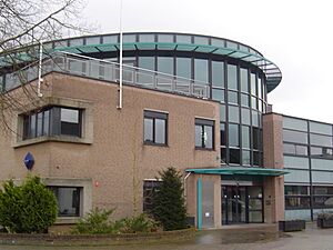
Rijnwaarden town hall
|
|||
|
|||

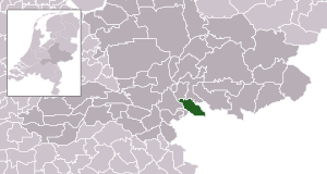
Location in Gelderland
|
|||
| Country | Netherlands | ||
| Province | Gelderland | ||
| Municipality | Zevenaar | ||
| Established | 1985 | ||
| Area | |||
| • Total | 48.08 km2 (18.56 sq mi) | ||
| • Land | 39.84 km2 (15.38 sq mi) | ||
| • Water | 8.24 km2 (3.18 sq mi) | ||
| Elevation | 15 m (49 ft) | ||
| Population | |||
| • Total | Included with Zevenaar | ||
| • Density | 275/km2 (710/sq mi) | ||
| Time zone | UTC+1 (CET) | ||
| • Summer (DST) | UTC+2 (CEST) | ||
| Postcode |
6910–6917
|
||
| Area code | 0316 | ||
Rijnwaarden was a special area, like a small town or district, in the eastern part of the Netherlands. It was located in the province of Gelderland. A very important river, the Rhine, flows into the Netherlands right at Rijnwaarden. On January 1, 2018, Rijnwaarden joined with another area called Zevenaar to become one bigger municipality.
Towns and Villages
Rijnwaarden was made up of several smaller towns and villages. These included:
- Aerdt
- Herwen
- Lobith
- Pannerden
- Spijk
- Tolkamer
Where Rijnwaarden Was Located
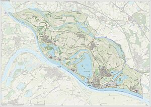
This map shows where the former municipality of Rijnwaarden was located. You can see how the different towns and villages fit together.
Black History Month on Kiddle
Famous African-American Architects:
 | Calvin Brent |
 | Walter T. Bailey |
 | Martha Cassell Thompson |
 | Alberta Jeannette Cassell |

All content from Kiddle encyclopedia articles (including the article images and facts) can be freely used under Attribution-ShareAlike license, unless stated otherwise. Cite this article:
Rijnwaarden Facts for Kids. Kiddle Encyclopedia.


