Rinard, Iowa facts for kids
Rinard is a small city located in Calhoun County, Iowa, in the United States. In 2020, about 38 people lived there.
Quick facts for kids
Rinard, Iowa
|
|
|---|---|

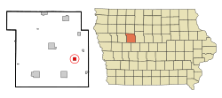
Location of Rinard, Iowa
|
|
| Country | |
| State | |
| County | Calhoun |
| Area | |
| • Total | 1.00 sq mi (2.59 km2) |
| • Land | 1.00 sq mi (2.59 km2) |
| • Water | 0.00 sq mi (0.00 km2) |
| Elevation | 1,168 ft (356 m) |
| Population
(2020)
|
|
| • Total | 38 |
| • Density | 37.96/sq mi (14.65/km2) |
| Time zone | UTC-6 (Central (CST)) |
| • Summer (DST) | UTC-5 (CDT) |
| ZIP code |
50538
|
| Area code(s) | 515 |
| FIPS code | 19-67125 |
| GNIS feature ID | 0460638 |
Contents
A Look Back in Time
Rinard was officially planned out in 1904. It quickly became an important place for sending and receiving goods. This was because it was located where two major train lines met. These lines were the Chicago Great Western and the Fort Dodge, Des Moines & Southern railways.
Where is Rinard?
According to the United States Census Bureau, Rinard covers a total area of about 1.00 square mile (2.59 square kilometers). All of this area is land.
How Many People Live Here?
| Historical populations | ||
|---|---|---|
| Year | Pop. | ±% |
| 1920 | 160 | — |
| 1930 | 140 | −12.5% |
| 1940 | 143 | +2.1% |
| 1950 | 115 | −19.6% |
| 1960 | 99 | −13.9% |
| 1970 | 88 | −11.1% |
| 1980 | 97 | +10.2% |
| 1990 | 71 | −26.8% |
| 2000 | 72 | +1.4% |
| 2010 | 52 | −27.8% |
| 2020 | 38 | −26.9% |
| Source: and Iowa Data Center Source: |
||
Census Facts from 2020
In 2020, the census counted 38 people living in Rinard. These people lived in 18 households, and 9 of these were families. The city had about 37.9 people per square mile (14.7 per square kilometer). Most of the people living in Rinard (92.1%) were White.
About 16.7% of households had children under 18 living with them. About 38.9% of households were married couples living together. Half of all households (50%) were not families. Also, half of all households (50%) had only one person living there. About 33.3% of households had someone aged 65 or older living alone.
The average age of people in Rinard was 57.5 years. About 13.2% of residents were under 20 years old. About 34.2% were 65 years or older. The city had slightly more males (57.9%) than females (42.1%).
Census Facts from 2010
In 2010, the census showed 52 people living in Rinard. There were 24 households and 15 families. The population density was about 52 people per square mile. All of the residents were White.
About 33.3% of households had children under 18. Most households (58.3%) were married couples living together. About 37.5% of households had only one person. Of those, 20.8% were people aged 65 or older living alone.
The average age was 46 years. About 23.1% of residents were under 18. Also, 17.3% were 65 or older. The number of males and females in the city was about equal (50% male, 50% female).
Schools in Rinard
Rinard is part of the Southeast Valley Community School District. Students in high school attend Southeast Valley High School in Gowrie.
Before 2023, Rinard was served by the Prairie Valley Community School District. This district was formed in 1993 when two other school districts, Cedar Valley and Prairie, joined together. In 2023, the Prairie Valley district merged into the Southeast Valley district.
See also
 In Spanish: Rinard (Iowa) para niños
 | Victor J. Glover |
 | Yvonne Cagle |
 | Jeanette Epps |
 | Bernard A. Harris Jr. |

