River Alwin facts for kids
Quick facts for kids River Alwin |
|
|---|---|

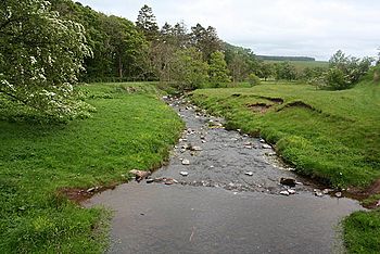
River Alwin near Clennell
|
|
|
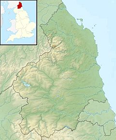
Location within Northumberland
|
|
| Country | United Kingdom |
| County | Northumberland |
| Physical characteristics | |
| River mouth | 55°20′42″N 2°07′33″W / 55.3451°N 2.1257°W |
| Basin features | |
| Basin size | 33.5 km2 (12.9 sq mi) |
The River Alwin is a small river in Northumberland National Park, England. It flows down from the Cheviot Hills and through Kidland Forest. The River Alwin is about 4.3 kilometers (2.7 miles) long. It eventually joins a bigger river called the River Coquet.
Contents
The River Alwin's Journey
Where the River Starts
The River Alwin begins high up in the hills. It starts as a small stream called the Outer Sike. This is near the edge of Kidland Forest, between two peaks named Yarnspath Law and Bloodybush Edge.
Flowing Through the Forest
As it flows south through the forest, other small streams and channels join it. It then becomes known as the White Burn. Later, another stream called the Yoke Burn joins it. From this point, the river is officially called the River Alwin. This happens just north of a place called Kidlandlee.
Onward to the Coquet
The River Alwin continues to flow south. It picks up the Allerhope Burn as it leaves the forest. The river then travels through a valley with steep sides. It passes by Clennell Hall and flows south of Alwinton. Finally, the River Alwin reaches a small village called Low Alwinton, where it joins the River Coquet.
How Much Water Does It Carry?
From 1969 to 1983, scientists measured the flow of the River Alwin. They did this at a special measuring spot near Clennell. The area that drains into the river at this point is about 28 square kilometers (10.8 square miles). On average, the river carried about 0.57 cubic meters (20 cubic feet) of water every second.
The area where the river collects its water gets a lot of rain, about 1003 millimeters (39.5 inches) each year. The highest point in this area is Cushat Law, which is 615 meters (2,018 feet) high. Most of the land around the river is forest. More than half of the area is covered in trees, while the rest is grassland and moorland.
A Healthy River
The River Alwin is considered to have a "good" ecological quality. This means it's a healthy river for plants and animals. This rating comes from the Water Framework Directive, which is a way to check the health of rivers. Rivers can be rated from high, good, moderate, poor, to bad. The River Alwin's "good" rating is one of the best!
 | William L. Dawson |
 | W. E. B. Du Bois |
 | Harry Belafonte |


