River Banwell facts for kids
Quick facts for kids River Banwell |
|
|---|---|
 |
|
| Country | England |
| County | Somerset |
| Cities | Banwell, Weston-super-Mare |
| Physical characteristics | |
| Main source | Banwell, Somerset, England 51°19′37″N 2°51′50″W / 51.32694°N 2.86389°W |
| River mouth | St Thomas's Head Bristol Channel, Somerset, England 51°23′26″N 2°55′58″W / 51.39056°N 2.93278°W |
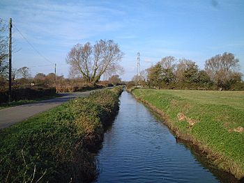
The River Banwell is a small river in Somerset, England. It flows through a beautiful part of the country.
Contents
Journey of the River Banwell
The River Banwell starts its journey as several springs. These springs are found near the Church of St Andrew in the village of Banwell. Long ago, these springs filled a big pool right below the church.
Where the River Flows
From Banwell, the river flows towards the northeast of Weston-super-Mare. It continues its path until it reaches Woodspring Bay. This is where the river meets the sea, flowing into the Bristol Channel. The exact spot where it enters the channel is called St Thomas's Head. This headland also marks the eastern edge of Sand Point and Middle Hope, which is close to Woodspring Priory.
Changes to the River's Source
Over a hundred years ago, in 1915, something big happened to the Banwell springs. A special law was passed by the government, even though many local people didn't agree. This law allowed the springs to be "capped." This means their water was collected and redirected.
The Village Pool Dries Up
After the springs were capped, the large pool in Banwell village slowly dried up. The water from the springs was then used by the Weston Water Company. This company supplied drinking water to homes in the area. Eventually, the old pool was filled in. Today, that spot is a bowling green where people play games.
Dealing with Flooding
Even though parts of the River Banwell have been straightened and deepened (a process called canalisation), flooding can still happen. This is especially true on Banwell Moor.
Managing Flood Risk
Experts have studied the area to find ways to manage the river better. Their goal is to reduce the risk of floods. This is important for protecting homes and land, especially in the Weston-super-Mare area. These studies look at how to control the water flow and prevent future flooding.
 | Janet Taylor Pickett |
 | Synthia Saint James |
 | Howardena Pindell |
 | Faith Ringgold |

