River Blyth, Northumberland facts for kids
Quick facts for kids River Blyth |
|
|---|---|

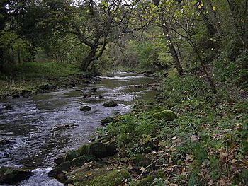
River Blyth near Bedlington
|
|
|
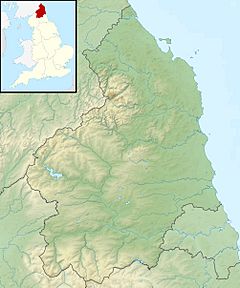
Location within Northumberland
|
|
| Country | United Kingdom |
| County | Northumberland |
| Physical characteristics | |
| Main source | Kirkheaton, Northumberland, England 215 m (705 ft) |
| River mouth | Blyth 55°06′59″N 1°29′21″W / 55.1165°N 1.4891°W |
| Length | 44 km (27 mi) |
The River Blyth is a river in Northumberland, England. It flows towards the east, through the southern part of Northumberland. The river eventually empties into the North Sea at the town of Blyth.
The River Blyth is about 27 miles (44 km) (27 miles) long. It flows through a lovely place called Plessey Woods Country Park. A smaller river, the River Pont, joins the River Blyth. The River Pont is about 17 miles (28 km) (17 miles) long.
The River's Journey to the Sea
The River Blyth starts its journey high up in Northumberland. As it gets closer to the sea, the river changes. The point where the river starts to be affected by the ocean's tides is at a place called Bebside.
The Estuary
From Bebside, the river gets wider and wider. This wide part is called an estuary. An estuary is where the river meets the sea. Here, the fresh river water mixes with salty ocean water. A small stream, called Sleek Burn, also flows into the estuary from the north side. The whole estuary area covers about 415 acres (168 hectares) (415 acres).
Helping Fish Travel
There's a dam on the River Blyth at Humford Country Park in Bedlington. Dams can sometimes block fish from swimming upstream to lay their eggs. Experts who study nature, called ecologists, have suggested removing this dam. This would help fish move freely along the river.
However, the people who live nearby really like the dam. They see it as a beautiful spot in their local area. Instead of removing the dam, they have suggested building a special path for fish. This path is called a fish passage or fish ladder. It would allow fish to swim around the dam safely. This way, both the fish and the local beauty spot can be protected.
 | Lonnie Johnson |
 | Granville Woods |
 | Lewis Howard Latimer |
 | James West |


