River Blyth, Suffolk facts for kids
Quick facts for kids Blyth |
|
|---|---|

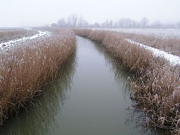
The River Blyth near Wenhaston.
|
|
|
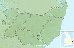
Location of the river mouth within Suffolk
|
|
| Country | England |
| Region | Suffolk |
| Physical characteristics | |
| Main source | Laxfield 58 m (190 ft) 52°17′58″N 1°20′23″E / 52.2995°N 1.3398°E |
| River mouth | North Sea near Walberswick 0 m (0 ft) 52°18′48″N 1°40′30″E / 52.3133°N 1.675°E |
| Length | 30.5 km (19.0 mi) |
The River Blyth is a river found in the eastern part of Suffolk, England. It starts near a place called Laxfield. The river then flows into a wide, tidal area called an estuary between the towns of Southwold and Walberswick, where it meets the North Sea.
Where the River Flows
The River Blyth travels through farmland between Laxfield and Halesworth. It passes by the grand estate of Heveningham Hall and the village of Walpole. Roads like the A144 road and the East Suffolk Line railway cross the river south of Halesworth.
East of Halesworth, parts of the river have been made straighter, like a canal. Here, the land around it is a clear flood plain, often used for grazing animals. When it reaches Blythburgh, the A12 main road crosses it. After this, the river becomes its wider, estuarine section.
The mouth of the estuary is the main harbour for Southwold. It is still a busy place for fishing boats. People can cross the river using a public footbridge called the Bailey Bridge. This bridge is about a mile upstream from the sea. Another way to cross is by taking the Walberswick rowing boat ferry.
In 1761, a special canal called the Blyth Navigation was opened. It ran for about 7 miles (11 km) from Halesworth to the Blyth estuary. This project involved making parts of the river east of Halesworth more like a canal.
However, by 1884, the canal was not making enough money. One reason was that attempts to reclaim salty marshland at Blythburgh caused the estuary to fill with silt. Also, the Southwold Railway opened in 1879, offering another way to transport goods. The canal was used only sometimes until 1911. It was officially closed in 1934.
River's Name and History
The River Blyth gives its name to local places like Blyford and Blythburgh. Blyford's name suggests there was once an important ford (a shallow place to cross a river) there. The river's name itself comes from an old English word, blithe. This word means "gentle" or "pleasant," which describes the river well.
 | Audre Lorde |
 | John Berry Meachum |
 | Ferdinand Lee Barnett |


