River Burn, Norfolk facts for kids
Quick facts for kids River Burn |
|
|---|---|

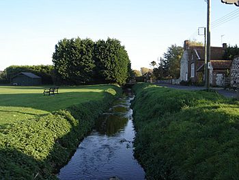
The Burn at Burnham Thorpe
|
|
|
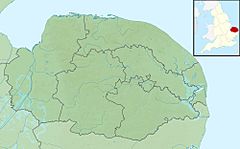
Location of the river mouth within Norfolk
|
|
| Country | England |
| County | Norfolk |
| Physical characteristics | |
| Main source | South Creake 52°52′21″N 0°45′50″E / 52.8726°N 0.764°E |
| River mouth | Overy Creek, Burnham Overy Staithe 52°57′40″N 0°43′48″E / 52.9610°N 0.7301°E |
| Length | 12.3 km (7.6 mi) |
| Basin features | |
| Basin size | 101 km2 (39 sq mi) |
The River Burn, also called "Nelson's River," flows through the northwest part of Norfolk, England. It starts in the East of England and travels about 12.3 kilometers (7.6 miles) to the North Norfolk coast. Along its journey, the river drops 36 meters (118 feet) from its source to the sea.
Contents
River Burn's Journey
The River Burn begins its journey about one mile south of South Creake village. It starts in a small group of trees west of a bend in London Lane. From there, it flows northeast towards South Creake.
When it reaches Fakenham Road, the river turns northwest and goes right through the village. Slowly, the river turns north and runs along the west side of Burnham Road. It continues this path towards North Creake.
Through North Creake and Beyond
The river flows through North Creake village. It then goes under Burnham Road and heads north across the open countryside. Its next stop is near the old ruins of Creake Abbey.
This abbey is on the southern edge of the area known as "the Burnhams," not far from Burnham Thorpe. It was built in the late 1300s for a group of Augustinian monks. They had lived on this spot since the 1220s.
Creake Abbey is special because it survived for a long time. It was not affected by big changes like the Reformation or the closing of monasteries. However, in 1508, a serious illness, the Bubonic plague, caused almost everyone living there to die. Because of this, the abbey was left empty.
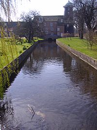
The river flows through a small pool that used to be part of the abbey's grounds. This pool is on the west side of the old abbey. After that, the river goes under a lane and continues north through the countryside towards Burnham Thorpe.
Nelson's River and the Coast
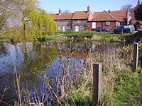
At Burnham Thorpe, the river flows through another pool. This pool is very close to where Admiral Horatio Nelson was born. Nelson was a famous British naval hero.
Burnham Thorpe was one of seven villages that all started with "Burnham." They got their name from the river. The village is about three miles from the North Norfolk coast. This coastline is flat and has soft colors, with lots of sand and salt marshes. From the high ground above the village, you can see the sea. People say you can even hear the sound of waves crashing on the sandy shore from there.
The river then curves northwest through Burnham Thorpe village towards Thorpe Common. The Manor House on Thorpe Common has a moat all around it. This moat gets its water from the River Burn.
Further on, the river passes under the old path of the West Norfolk Junction Railway. This is to the east of Burnham Market. From here, the river gets a bit wider and flows into the mill pond at Burnham Overy.
Unique Mills of Burnham Overy
Burnham Overy Union Mill is very special. It is one of only two mills in Norfolk that used both water and wind power at the same place. The watermill part had three sets of grinding stones. The windmill had two more sets of stones.
Both mills were built in 1737 from brick. The watermill had two floors with a Norfolk pan tiled roof, and a third floor was added later. The windmill started with five floors, and a sixth was added later. In 1825, the windmill's sails even had copper parts!
Just a very short distance away, the river reaches a second watermill. This is the Lower Mill at Burnham Overy. This mill is a long building with four parts, three stories high. It is built from local red brick with pantile roofs.
It was originally three stories tall. But after a fire in the 1940s, it was rebuilt with only two stories, as it stands today. The mill dates back to 1795. The bridge where the water flows into the mill is between the second and third parts of the building. The A149 coast road goes over the river right at the mill site.
Into the Sea
From the mills, the River Burn enters Overy Marshes and Overy Creek. The river spreads out into many tidal creeks that flow through the salt marshes along the coast.
Finally, the river leaves the land and flows into the sea. This happens between the eastern point of Scolt Head Island and Overy Marshes. This opening is known locally as Burnham Harbour. Small boats can reach Burnham Overy Staithe by going through this opening and creek.
 | Frances Mary Albrier |
 | Whitney Young |
 | Muhammad Ali |


