River Cam (Somerset) facts for kids
Quick facts for kids River Cam |
|
|---|---|

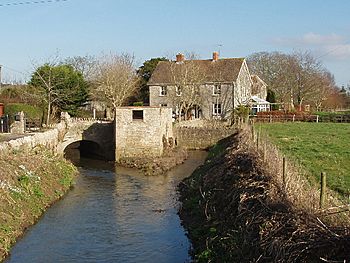
File:The Old Mill on the River Cam, West Camel
|
|
|
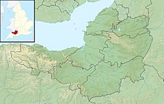
Location of the mouth in Somerset
|
|
| Country | England |
| State | Somerset |
| District | South Somerset |
| City | North Cadbury, Sparkford, Queen Camel, West Camel |
| Physical characteristics | |
| Main source | Yarlington 144 m (472 ft) 51°03′38″N 2°27′55″W / 51.06056°N 2.46528°W |
| River mouth | River Yeo Yeovilton 51°00′06″N 2°38′10″W / 51.00167°N 2.63611°W |
| Length | 17 km (11 mi) |
The River Cam is a river in the south of Somerset, England. It is a smaller river that flows into a larger one called the River Yeo.
Contents
The River Cam's Journey
The River Cam is about 17 kilometers (11 miles) long. It starts its journey in the hills of Somerset and flows through several villages before joining another river.
Where Does It Begin?
The River Cam begins its flow east of a village called Yarlington. It starts high up, about 144 meters (472 feet) above sea level. From there, it travels southwest.
The river passes by several villages. These include North Cadbury, Sparkford, Queen Camel, and West Camel.
Other Streams Join In
Other smaller streams also flow into the River Cam. One important stream comes from the areas of Blackford and Compton Pauncefoot. This stream gets its water from hills and several natural springs in those areas.
The main water for this stream comes from three places: Maperton, Quarry Hill, and Sigwells Hill. These waters combine in Blackford. More springs add water as the stream flows through the villages. This stream then goes under the A303 road. After that, it joins the main River Cam, which started near Yarlington.
In the 1980s, people worked on the riverbanks in Blackford. This helped the water flow better and made flooding less common there.
Flowing to the Sea
The River Cam eventually flows onto the land of the Royal Naval Air Station at Yeovilton. Here, it joins the River Yeo.
The River Yeo then flows west, passing south of Yeovilton and through the town of Ilchester. Further west, when the river reaches Langport, it changes its name. At this point, it becomes known as the River Parrett. The River Parrett then continues its journey towards the sea.
When the River Floods
Sometimes, heavy rain can cause rivers to overflow their banks. In 2009, the River Cam experienced a flash flood. This caused the river to burst its banks near West Camel.
 | Selma Burke |
 | Pauline Powell Burns |
 | Frederick J. Brown |
 | Robert Blackburn |


