River Cam facts for kids
Quick facts for kids Cam |
|
|---|---|
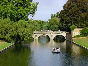
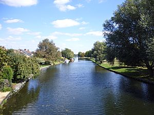
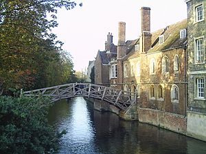
View north towards Clare College bridge
|
|
|
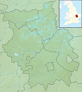
Location of the river mouth within Cambridgeshire
|
|
| Country | England |
| County | Cambridgeshire |
| Physical characteristics | |
| Main source | south of Debden 112 m (367 ft) 51°57′37″N 0°16′18″E / 51.9602°N 0.2718°E |
| River mouth | River Great Ouse east of Stretham 2 m (6 ft 7 in) 52°20′54″N 0°15′09″E / 52.3483°N 0.2525°E |
| Length | 69.4 km (43.1 mi) |
| Basin features | |
| River system | River Great Ouse |
| Tributaries |
|
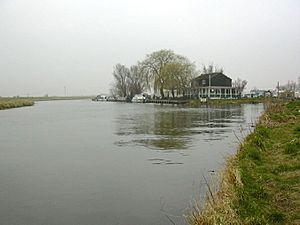
The River Cam is a famous river that flows through the city of Cambridge in eastern England. After leaving Cambridge, it travels north and east. It then joins the larger River Great Ouse near Ely.
The total journey from Cambridge to the sea is about 40 miles (64 km). You can explore this part of the river using small boats like punts and rowing boats. The River Cam is also connected to England's canal system through the River Great Ouse. In total, the Cam is about 69 kilometers (43 miles) long, starting from its source near Debden in Essex.
Contents
Understanding the River's Name
The River Cam actually had a different name originally: the Granta. It's quite interesting because the river's current name, Cam, comes from the city of Cambridge, not the other way around! The city's name used to be Grantebrycge in Middle English. As the city's name changed to Cambridge, people started calling the river the Cam to match.
However, not everyone changed the name. The upper part of the river is still sometimes called the Granta. Some people say the river is the "Granta" above the Silver Street Bridge in Cambridge and the "Cam" below it. One of its main branches, the Rhee, is also officially known as the Cam. Even the Granta has a smaller stream also called the Granta! On maps, you'll often see these alternative names, like "River Cam or Granta" and "River Cam or Rhee."
It's important to know that this River Cam has no connection to a much smaller river also called the River Cam in Gloucestershire.
The Lower River: From Jesus Lock to the Great Ouse
An organization called the Conservators of the River Cam was created in 1702. Their job was to make sure the river stayed easy to travel on. They are in charge of two locks near Cambridge: Jesus Lock and Baits Bite Lock. The part of the river north (downstream) of Jesus Lock is often called the lower river.
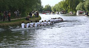
The section between Jesus Lock and Baits Bite Lock is very popular for rowing. Many people also live on boats along this part of the river. They form a community called the Camboaters.
The Environment Agency is responsible for managing boats on the lowest part of the Cam, including Bottisham Lock.
Exploring the Middle and Upper River
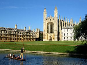
The part of the river above Jesus Lock is sometimes called the middle river. The section even further upstream, above the Mill Pond, is known as the upper river. Between Jesus Lock and the Mill Pond, the river flows through a beautiful area called the Backs. Here, it passes by the back gardens of many of Cambridge University's colleges.
This is the most popular part of the river for tourists. It offers stunning views of old bridges, green lawns, and graceful willow trees. This section also has a unique feature: the remains of a submerged towpath. In the past, horses used to walk in the river to pull barges up to the mill because the colleges didn't allow them on the land along the riverbanks.
From April 1st to September 30th, boats with engines are not allowed upstream of 'La Mimosa' Pub (near Jesus Green). During these months, only boats moved by hand, like the flat-bottomed punts, can use the middle and upper river.
From October 1st to March 31st, powered boats can go as far as the Mill Pool. However, few people do this because there aren't many public places to tie up boats along the Backs. Also, the river is quite narrow, and the bridges are low, making it hard for many boats to pass or turn.
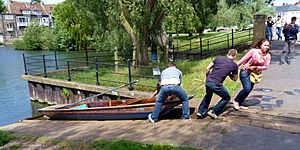
Punts and canoes can be moved around the weir above the Mill Pool using rollers. This is like a slipway that connects the lower and upper parts of the river. From the Mill Pool, you can follow the river upstream through Grantchester meadows to the village of Grantchester. You'll also find Byron's Pool, where many small streams join the river.
River Branches and Streams
The River Cam has two main branches, or tributaries: the Granta and the Rhee. Both of these are also sometimes called the Cam.
The Rhee Branch
The Rhee starts near Ashwell in Hertfordshire. As it flows north, it forms the border between Bedfordshire and Hertfordshire for about two kilometers. Then, it forms the border between Bedfordshire and Cambridgeshire for another kilometer. At this point, it turns east. From here until it meets the Granta, it forms the boundary for several villages.
The Rhee flows under the old Roman Ermine Street and crosses the grand avenue of Wimpole Hall. A few kilometers later, it is joined by the smaller River Mel, which flows through Meldreth. The Rhee then runs along the southern edge of Barrington, where it still powers an old water mill called Bulbeck Mill. At Harston, it passes Harston Mill, a site that had a water mill for hundreds of years. It then touches the eastern edge of Haslingfield before joining the Granta at Hauxton Junction. The Rhee is about 33.2 kilometers (20.6 miles) long from its start to where it meets the Granta.
The Granta Branch
The Granta is the longer of the two main branches. It begins in Essex, near the village of Widdington. It first flows southwest from the hills of Uttlesford before turning north just west of Henham. From there, it mostly follows the West Anglia Main Line railway.
As it travels north, it passes through Newport, where it is joined by streams called Wicken Water and Debden Water. A couple of miles later, it flows past the beautiful Audley End House, adding to the lovely views. It also picks up a stream called Fulfen Slade. The Granta then moves into Cambridgeshire, flowing past villages like Littlebury, Little Chesterford, Great Chesterford, Ickleton, Hinxton, Duxford, and Whittlesford. It used to power many water mills along its way. The Granta forms the border between Great Shelford and Little Shelford before turning west to flow past Hauxton. It finally joins the Rhee about a mile south of Grantchester at Hauxton Junction. The Granta is about 41.7 kilometers (25.9 miles) long from its source to where it meets the Rhee.
Other Streams Joining the Cam
Another stream, also called the Granta, flows for about 10 miles (16 km) from south of Haverhill to join the larger Granta south of Great Shelford. Another smaller stream is Bourn Brook. It starts near the village of Eltisley, about 10 miles (16 km) west of Cambridge. It flows east through Caxton, Bourn, and Toft before joining the Cam at Byron's Pool.
The Cam in Literature
The River Cam has appeared in many famous stories and poems.
"The Reeve's Tale" from Geoffrey Chaucer's Canterbury Tales starts with these lines:
At Trumpyngtoun, nat fer fro Cantebrigge,
Ther gooth a brook, and over that a brigge,
Upon the whiche brook ther stant a melle;
And this is verray sooth that I yow telle:
A millere was ther dwellynge many a day.
The mill mentioned in the poem used to stand by Brasley Bridge on Grantchester Road. You can still see the mill pond today, and the mill's foundations can be seen when the water level is low.
Byron's Pool is named after the famous poet, Lord Byron, who is said to have swum there. It was also a favorite swimming spot for Rupert Brooke and his friends, who were part of a group called the Cambridge neo-Pagans. Brooke often canoed from Cambridge to his home in Grantchester, which included the Old Vicarage. His poem from 1912 describes the river beautifully:
- Oh! there the chestnuts, summer through,
- Beside the river make for you
- A tunnel of green gloom, and sleep
- Deeply above; and green and deep
- The stream mysterious glides beneath,
- Green as a dream and deep as death.
- ...
- To smell the thrilling-sweet and rotten
- Unforgettable, unforgotten
- River-smell, and hear the breeze
- Sobbing in the little trees.
- Say, do the elm-clumps greatly stand
- Still guardians of that holy land?
- The chestnuts shade, in reverend dream,
- The yet unacademic stream?
—"The Old Vicarage, Grantchester", Collected Poems (1916)
Gwen Darwin, who later became Gwen Raverat, grew up in the old mill by the Mill Pond. Her book, Period Piece, shares memories of her childhood spent playing on the river. The mill house is now part of Darwin College.
Children's author Philippa Pearce, who lived in Great Shelford, often featured the Cam in her books. Her most famous book, Minnow on the Say, renames the river the River Say.
The River Cam is also mentioned in John Milton's poem Lycidas, where it is called "Camus, reverend Sire."
Fun Activities on the River Cam
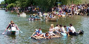
Like many rivers, the Cam is a great place for many fun activities. These include fishing, swimming, and different kinds of boating.
Fishing on the Cam
The water in the River Cam is clear and clean enough to support many fish. Fishing rights on the west bank are given each year to the Cambridge Fish Preservation and Angling Society.
Some people believe that the Cam, below Bottisham Sluice, might still have a type of fish called burbot. These fish were thought to have disappeared from English waters in the 1970s.
Above Hinxton and Great Chesterford, the river has wild brown trout. It is also stocked with fish by fishing clubs like the Audley Fly Fishers.
Boating Adventures
All boats on the Cam need a special navigation license from either the Conservators of the River Cam or the Environment Agency.
There are public places to tie up boats (moorings) just below Jesus Lock and near Clayhithe. These usually have a time limit of 48 hours. There are also some unofficial moorings in Cambridge.
There's a public slipway (a ramp for launching boats) next to the Green Dragon pub in Chesterton.
Punting Fun
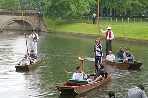
Punting is the most popular way to explore the river between Jesus Lock and Grantchester. Many of the colleges own punts. You can also rent them from different companies, either to steer yourself or with someone to guide you.
Canoeing and Kayaking
Canoeing and kayaking are popular all year round, especially on the section above the Mill Pond towards Grantchester. The Cambridge Canoe Club and Cambridge University Canoe Club are both located here.
Powered Boats
Boats with engines can travel as far upstream as La Mimosa restaurant (near Jesus Green) all year. They can go as far as the Mill Pool only between October 1st and March 31st.
Rowing Races
The lower river, between Jesus Lock and Baits Bite Lock, is where the university and college rowing teams practice and race. The Cambridge Lent, May, and Town Bumps rowing races happen here. In these races, boats start at regular times, and the goal is to catch and touch the boat in front of you!
Sailing on the Cam
The Cam Sailing Club started in 1899. It's based at Clayhithe near Waterbeach and holds sailing races most weekends from March to November.
Swimming in the River
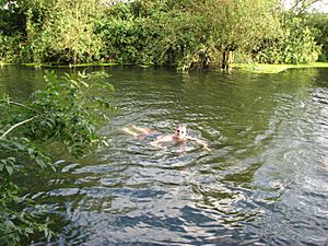
Swimming in the upper river is very popular in the summer. People also swim at Grantchester Meadows all year round. Some brave swimmers even take part in a New Year's Day swim!
How the River Cam is Managed
Cambridge used to be an important inland port because of its location on the River Cam. As the university colleges grew, the river's path through the town, known as the Backs, was moved to make space for new buildings.
In 1702, the Conservators of the River Cam were created by an Act of Parliament. This group was given the power to charge tolls (fees) for using the river. They used this money to improve the river, building sluices (water gates) at Jesus Green, Chesterton, Baits Bite, and Clayhithe.
The river was quite profitable for a while, with tolls bringing in more money over the years. The Conservators even helped pay for rebuilding the Great Bridge (now Magdalene Bridge) and the Small Bridge (now Silver Street Bridge). They also built a house at Clayhithe for meetings.
However, when the Eastern Counties Railway reached Cambridge in 1845, river travel quickly became less popular. Most commercial boats stopped using the river by World War I. Today, the river is mainly used by private boats and university rowing clubs.
The Conservators of the River Cam now have an office at Baits Bite. They are still in charge of the river above Bottisham Lock. The lower part of the river has been managed by the Environment Agency since 1995.
The three locks on the Cam are all different. Bottisham and Baits Bite locks are automatic. Jesus Lock is operated by hand. Boats are limited in size by the locks: Bottisham lock is about 96.8 feet (29.5 m) long, Baits Bite lock is about 14 feet (4.3 m) wide, and Jesus lock is only about 9.7 feet (3.0 m) wide.
Flooding on the Cam
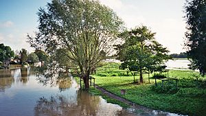
The River Cam is usually calm, but sometimes it does flood. Some of the more serious floods happened in 2001 and again in 2009.
The Environment Agency is responsible for managing water levels and telling people when there's a risk of flooding along the entire river.
See also
 In Spanish: Río Cam para niños
- List of bridges in Cambridge
- Jesus Green Swimming Pool
- List of rivers of the United Kingdom
 | Ernest Everett Just |
 | Mary Jackson |
 | Emmett Chappelle |
 | Marie Maynard Daly |


