
Chesterton, Cambridge facts for kids
Quick facts for kids Chesterton |
|
|---|---|
 St Andrew's Church, Chesterton |
|
| District | |
| Shire county | |
| Region | |
| Country | England |
| Sovereign state | United Kingdom |
| Post town | CAMBRIDGE |
| Postcode district | CB4 |
| Dialling code | 01223 |
| EU Parliament | East of England |
Chesterton is a busy area in the northeast part of Cambridge, England. It sits on the north bank of the River Cam. It's about 2 kilometers (1.2 miles) north of Cambridge's main train station.
Contents
Chesterton's Story: A Look Back
People have lived in the Chesterton area for a very long time. We know this from things found from the Bronze Age. In Anglo-Saxon times, Chesterton was part of a larger village. This village spread across the River Cam. The rest of that village later became the town of Cambridge. But Chesterton stayed separate for many years.
Chesterton was once its own parish. A parish is like a local area with its own church and local rules. It included the village and the countryside around it. It even included Cambridge Castle at one point. Until 1880, Chesterton was run by its local church group, called a vestry. It also had special manorial courts for local issues.
In 1880, Chesterton got a new way to govern itself. It became a "local government district." This meant it had an elected board to make decisions. Later, these districts became "urban districts." The city of Cambridge tried many times to make Chesterton part of Cambridge. But people in Chesterton voted against it three times between 1897 and 1909.
Chesterton Urban District stopped existing in 1912. The southern part, which was more like a town, joined Cambridge. The northern, more rural part, joined the nearby parish of Milton. The smaller Chesterton parish continued to exist. But it no longer had its own council. In 1923, all the parishes in Cambridge joined together. So, Chesterton parish officially ended. In 1921, about 11,611 people lived in Chesterton parish. The rural parts that joined Milton in 1912 later became part of Cambridge too. This happened in 1934. These areas then grew into new suburbs of Cambridge.
Today, a large housing estate is part of East Chesterton.
How Chesterton is Governed
Chesterton is divided into two voting areas. These are called West Chesterton and East Chesterton. They are part of the city of Cambridge. In 2021, about 18,620 people lived in these two areas. This was a small increase from ten years before. These areas are mostly what people call Chesterton. They are north of the River Cam and east of Castle Hill. They are south of the Arbury and King's Hedges areas.
Local politicians called city councillors represent Chesterton. For East Chesterton, the councillors are Gerri Bird, Alice Gilderdale, and Baiju Thittala. For West Chesterton, they are Sam Carling, Richard Swift, and Rachel Wade. These councillors help make decisions for the city.
Getting Around Chesterton
Chesterton has good transport links. Buses run often to Cambridge city centre. They also go to Milton and Addenbrooke's Hospital.
Milton Road is a main road that goes through Chesterton. It connects the centre of Cambridge to the A14 road. The A14 is a major highway.
Cambridge North railway station is on the edge of East Chesterton. It opened in May 2017. People in the area had wanted this train station for many years.
Famous People from Chesterton
Some notable people have lived in Chesterton:
- Horace Gray (1874–1938) was a cricketer.
- Leo Reid (1888–1938) was also a cricketer.
- Veronica Volkersz (1917–2000) was a brave aviator. She flew planes in the Air Transport Auxiliary during World War II. She was the first woman to fly a special jet fighter plane.
Gallery
-
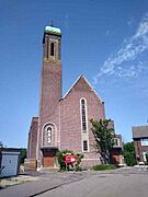
Church of St George
-
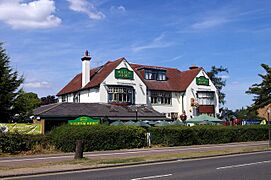
The Milton Arms pub
-
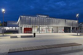
Cambridge North railway station at night
-
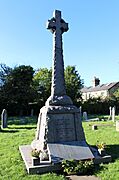
Chesterton War Memorial
-
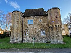
Chesterton Tower


