Bourn Brook, Cambridgeshire facts for kids
Quick facts for kids Bourn Brook |
|
|---|---|

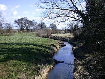
Bourn Brook from Barton Bridge
|
|
|
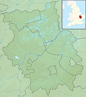
Location of the mouth within Cambridgeshire
|
|
| Country | United Kingdom |
| County | Cambridgeshire |
| Physical characteristics | |
| Main source | Eltisley 62 m (203 ft) 52°13′03″N 0°07′56″W / 52.2176°N 0.1321°W |
| River mouth | River Cam at Byron's Pool 52°10′17″N 0°05′53″E / 52.1714°N 0.098°E |
| Length | 25.8 km (16.0 mi) |
| Basin features | |
| Basin size | 85 km2 (33 sq mi) |
The Bourn Brook is a small river, also called a 'brook', that flows into the River Cam in Cambridgeshire, England. It's an important part of the local countryside.
Contents
Where the Bourn Brook Flows
The Bourn Brook starts near the village of Eltisley. This is about 10 miles west of Cambridge. The land here is about 60 meters (200 feet) above sea level.
Journey Through Villages
Smaller streams like the Eastern Brook and Hay Dean join it. They all come together west of Caxton. The brook then flows through Caxton village. It even crosses an old Roman road called Ermine Street.
A walking path follows the brook towards Bourn. Here, a road crosses the brook, and the brook flows right through the middle of Bourn village. The village actually got its name from the brook, as "bourn" is an old word for a small stream.
Flowing Eastward
After Bourn, the brook flows southeast through the Bourn Golf Course. Here, another stream called Dean Brook joins it. When it reaches the B1046 road, it turns east. It then runs next to an old railway line that closed in 1968.
From this point on, the Bourn Brook often forms the border between different local areas. It forms the northern border of Kingston and Great Eversden. It also forms the southern border of Caldecote and Toft. Sometimes, the brook moves a little from these borders. This shows that its path has changed over many years.
Reaching the River Cam
The brook goes around the southern edge of Toft village. It then crosses the Prime Meridian, which is an imaginary line that divides the Earth into eastern and western halves. It still follows the old railway line, which is now part of the Mullard Radio Astronomy Observatory.
Here, the brook forms the southern border of Comberton and Barton. It also forms the northern border of Little Eversden, Harlton, and Haslingfield. Even though it marks these borders, the brook flows some distance away from the actual villages.
Finally, the Bourn Brook goes under the M11 motorway. It then forms the border between Grantchester and Haslingfield. It flows into the River Cam at a place called Byron's Pool. This spot is a few hundred meters south of Grantchester village. It's said that the famous poet Lord Byron used to swim there.
What the Brook is Used For
People sometimes go fishing in the Bourn Brook. However, there are not many fish in its waters. The types of fish you might see are small roach, dace, and perch.
When the Brook Floods
Sometimes, after a lot of rain, the Bourn Brook can flood. This means the water level gets very high and can overflow its banks. A big flood happened in 2001. The water reached a record height of 3.11 meters in Bourn. This caused a lot of damage to homes and other buildings in Bourn and nearby villages.
The Caxton End ford in Bourn often becomes too deep to cross when the water rises. You can find information about the current height of the brook on the Environment Agency website. They have gauges in Bourn and Comberton that measure the water level.
 | Valerie Thomas |
 | Frederick McKinley Jones |
 | George Edward Alcorn Jr. |
 | Thomas Mensah |


