River Dee, Cumbria facts for kids
Quick facts for kids River Dee |
|
|---|---|

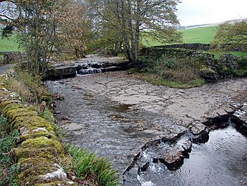
The River Dee at Stone House
|
|
|
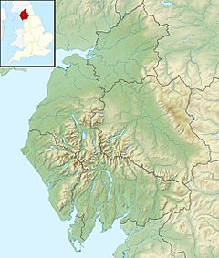
Location of the mouth in Cumbria
|
|
| Country | England |
| Subdivision | North West England |
| County | Cumbria |
| Physical characteristics | |
| Main source | Dent Head Farm 54°14.083′N 2°20.689′W / 54.234717°N 2.344817°W |
| River mouth | Confluence with River Rawthey 54°18.815′N 2°32.569′W / 54.313583°N 2.542817°W |
| Length | 21 km (13 mi) |
The River Dee is a river located in the southeast part of Cumbria, England. It flows through a beautiful area known as Dentdale. The name Dee might come from an old language called Brythonic. In this language, deva means goddess. Another idea is that the name comes from the village of Dent or the valley of Dentdale itself.
The River Dee is about 21 kilometers (13 miles) long. It is an important part of the local landscape and helps shape the valleys it flows through.
Contents
Where the River Dee Begins
The River Dee starts its journey high up near Dent Head Farm. It is formed from several smaller streams. These tiny streams flow out of a marshy area called Blea Moor Moss.
Journey Through Dentdale
As the River Dee begins, it flows north past a place called Stone House. Here, another stream, Arten Gill, joins it. The river then reaches Cowgill, where it makes a turn into the lovely valley of Dentdale.
In Dentdale, the River Dee gets bigger. It is joined by Deepdale Beck, a stream that flows north from the side of Whernside mountain. The river then continues its path, passing through the villages of Dent and Gawthrop.
Meeting Other Rivers
The River Dee keeps flowing, passing by small places like Lenacre and Rash. Its journey ends when it meets the River Rawthey. This meeting point is at Catholes, which is close to the town of Sedbergh.
The River Rawthey then continues on its own path. It eventually joins an even larger river, the River Lune. This shows how many rivers connect to each other, forming a big network of waterways.
The Jolly Miller of Dee
There is an old water mill at Rash Bridge. This mill is thought to have inspired a famous folk song. The song is called "The Jolly Miller of Dee." It tells a story about a happy miller who lived by the river. This connection makes the River Dee a part of local history and culture.
 | Kyle Baker |
 | Joseph Yoakum |
 | Laura Wheeler Waring |
 | Henry Ossawa Tanner |


