River Drone facts for kids
Quick facts for kids River Drone |
|
|---|---|

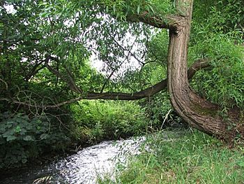
River Drone by Ramshaw Woods, Unstone
|
|
| Country | England |
| Physical characteristics | |
| Main source | Sheffield Border 140 m (460 ft) (Dronfield) |
| River mouth | River Rother |
| Length | 9.6 kilometres (6.0 mi) |
| Basin features | |
| Basin size | 57.8 km2 (22.3 sq mi) |
The River Drone is a small river in England. It starts near the border of Sheffield in South Yorkshire. From there, it flows south through towns like Dronfield, Unstone, and Unstone Green in Derbyshire.
The River Drone eventually joins another river called the Barlow Brook near Sheepbridge. After that, it continues flowing southeast until it meets the River Rother in Chesterfield. The River Drone is one of the main smaller rivers that flow into the River Rother. These smaller rivers are called tributaries.
Contents
Protecting the River Drone
Sometimes, rivers can overflow their banks, especially after heavy rain. This is called flooding. In the late 1990s, the River Drone flooded a shopping area in Dronfield.
To prevent this from happening again, a special area was built at Bowshaw. This area acts like a big storage tank for water. It helps to hold back extra rainwater that flows off nearby housing areas in Sheffield. This way, the river doesn't get too full too quickly.
Workers also built up the river banks in some places. They used special walls or raised earth barriers to help keep the water in the river channel.
The River's Past Uses
A long time ago, in the 1700s and 1800s, the River Drone was very important for local factories. Its flowing water was used to power water wheels. These wheels helped run machines in early factories in the Dronfield valley.
Today, you can still see parts of the old water channels, called a mill race, near Mill Lane in Dronfield. The factory buildings themselves were taken down in the 1970s.
Cleaning Up the River
In the past, the River Drone was not very clean. Water from old mine workings used to flow into the river, making it polluted. Also, like many rivers, it sometimes had sewage (waste water) flowing into it from storm overflows. This meant that very few fish could live in the river.
Luckily, things have changed! In recent years, a lot of work has been done to clean up the River Drone. Water companies now have to follow much stricter rules to protect the environment.
Because of these efforts, the river is much healthier now. You can even see brown trout swimming in the water, especially below Unstone. This shows that the river's environment is improving.
Measuring the River's Flow
Since 1976, people have been measuring how much water flows in the River Drone. They do this using a special structure called a weir. This weir is located near Sheepbridge, just after the Barlow Brook joins the Drone.
By measuring the flow over many years, scientists can understand the river better. They know that the area of land that drains into the river (called its drainage basin) is about 50 square kilometers. On average, about 0.8 cubic meters of water flow past the measuring point every second.
 | Percy Lavon Julian |
 | Katherine Johnson |
 | George Washington Carver |
 | Annie Easley |

