River Eachaig facts for kids
Quick facts for kids River Eachaig |
|
|---|---|

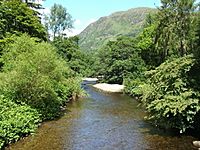
The River Eachaig at Benmore Botanic Garden
|
|
| Physical characteristics | |
| Main source | Loch Eck Cowal 56°02′20″N 4°59′05″W / 56.038795°N 4.9847063°W |
| River mouth | Holy Loch Cowal Sea level 55°59′54″N 4°57′06″W / 55.998381°N 4.9517269°W |
| Basin features | |
| Tributaries |
|
The River Eachaig is a lovely river in western Scotland. It flows through the beautiful Cowal peninsula in Argyll and Bute. This river starts at Loch Eck and makes its way to the Holy Loch. Along its journey, it passes by places like Benmore Botanic Garden, Rashfield, and Cot House. Other smaller streams, like the Inverchapel Burn and the River Massan, join the Eachaig. Just before reaching the Holy Loch, the Little Eachaig also adds its water to the river.
Contents
A Journey Through Time
The River Eachaig has been an important pathway for a very long time.
Old Travel Routes
Imagine travelling in Scotland hundreds of years ago. One old way to get from Inveraray to the Firth of Clyde was by boat down Loch Eck. Then, you had to cross the River Eachaig to reach Dunoon. Even famous people used this route! For example, Mary, Queen of Scots travelled this way in 1563.
The Cot House Ferry
To cross the river, people used a small boat called a "coite." This boat was like a ferry. The person who operated the ferry lived in a house with a thatched roof. This house became known as the Cot House. Over time, it even became an inn where travellers could stay.
Building New Bridges
Around 1835, a smart engineer named David Napier helped build a new road. This road went from Kilmun pier to Loch Eck. It was part of a "new route to Inveraray." Because of this new road, the old ferry was no longer needed. A wooden bridge was built instead to cross the river.
The 1885 Iron Bridge
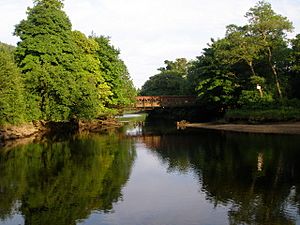
The wooden bridge eventually needed to be replaced. So, around 1884, new plans were made. Engineers and builders worked together to create a strong new bridge. This bridge was made of "malleable iron girder." It was about 70 feet (21 meters) long. The new bridge was finished in May 1885. It is a special type of bridge called a "lattice truss bridge." It has a criss-cross pattern made of wrought iron.
The River Today
Even in 1960, maps still showed this old route. But in later years, the main road (called the A815) was changed. A new bridge was built further north for the main road. The old 1885 bridge is still there today! It is now considered a "listed building." This means it's an important historical structure. It is a rare example of an old wrought iron bridge that hasn't been changed much.
 | Chris Smalls |
 | Fred Hampton |
 | Ralph Abernathy |


