Cowal facts for kids
Quick facts for kids Cowal
|
|
|---|---|
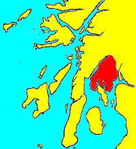 Cowal shown within Argyll |
|
| Population | 15,560 (2013 est.) |
| OS grid reference | NS 09111 85254 |
| Council area | |
| Lieutenancy area |
|
| Country | Scotland |
| Sovereign state | United Kingdom |
| EU Parliament | Scotland |
| UK Parliament |
|
| Scottish Parliament | |
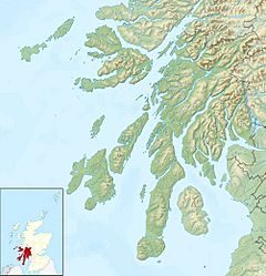
Cowal (Scottish Gaelic: Còmhghall) is a beautiful peninsula in the west of Scotland. It's part of Argyll and Bute and stretches out into the Firth of Clyde.
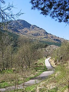
The northern part of Cowal is covered by the Argyll Forest Park. This park is managed by Forestry and Land Scotland. High mountains like the Arrochar Alps are found here. Deep sea lochs, which are like long, narrow arms of the sea, cut into the land. These features make Cowal one of the most remote places in mainland Scotland.
Part of the Loch Lomond and The Trossachs National Park also reaches into Cowal. The peninsula is separated from Knapdale by Loch Fyne. To the east, the Firth of Clyde separates it from Inverclyde and North Ayrshire. Loch Long and Loch Goil are to the north-east.
The southern part of Cowal splits into three sections. This is because of two sea lochs: Loch Striven and Loch Riddon. The Isle of Bute is just south of Cowal. It's separated by the narrow Kyles of Bute.
Cowal's only large town is Dunoon. It's located in the south-east. From Dunoon, you can take ferries to Gourock in Inverclyde. Other ferries connect Portavadie in the west to Tarbert in Kintyre. You can also take a ferry from Colintraive to Rhubodach on the Isle of Bute.
Long ago, much of Cowal was owned by the Lamonts. Later, the Campbells became very powerful in the area.
Contents
Exploring Cowal's Landscape
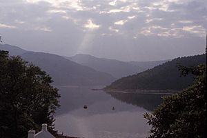
The Cowal peninsula has Loch Fyne on its west side. On the east, it has Loch Long and the Firth of Clyde. The narrow Kyles of Bute separate it from the Isle of Bute. The coastline has many deep sea lochs. These include Loch Riddon and Loch Striven.
These lochs divide the southern part of Cowal into three smaller peninsulas. On the west is the Kilfinan peninsula. On the east is the Toward peninsula. A smaller central peninsula sits between them.
Cowal's land is mostly made of strong, old rocks. These are called metamorphic rocks. However, the southern part of the Toward peninsula has sedimentary rocks. The area is very mountainous. High ground is covered by moorland (open, wild land) and peat mosses. Forests often grow right down to the water's edge along the sea lochs.
There isn't much farmland in Cowal. Most of the land belongs to large estates or Forestry and Land Scotland. The coast is mostly rocky. The few beaches are usually made of small stones and gravel. The longest sandy beach is at Ardentinny on Loch Long.
Most people live in the lowland areas near the coast. Dunoon is the biggest town. Other towns include Innellan, Sandbank, Kilmun, Strone, Lochgoilhead, Tighnabruaich, Kames, and Strachur.
Getting Around Cowal
The main road, the A83, crosses the northern end of Cowal. It passes near Arrochar and Cairndow. This road partly follows an old military road. This old road was built by William Caulfield. It's famous for a spot called Rest and Be Thankful. This name comes from a stone seat at the top of Glen Croe. Sometimes, if the A83 is closed due to landslides, the old military road is used instead.
Other important roads include the A815. This road connects the A83 to Dunoon. The A886 goes south from Strachur to Colintraive. From Colintraive, a ferry takes you to the Isle of Bute. The A8003 links Tighnabruaich to the A886. Many other roads are smaller or just tracks.
The Caledonian MacBrayne ferry at Colintraive is very quick. It takes only five minutes to cross to Rhubodach on Bute. Another ferry goes from Portavadie to Tarbert on Kintyre. This trip across Loch Fyne takes about 25 minutes. There's also a ferry from Dunoon to Gourock in Inverclyde. From Gourock, you can easily catch a train to Glasgow Central railway station.
Cowal's Past: A Look Back in Time
Evidence shows people lived in Cowal a very long time ago. There are ancient burial mounds called cairns. One is a Bronze Age cairn, built around 2000 BC to 800 BC. It's a mound of stones about 20 meters wide and 2 meters high. It overlooks Loch Fyne.
Another cairn at Dunchraigaig is 100 feet wide. When it was dug up in 1864, it contained burnt bones. These bones were from 8 to 10 bodies. Smaller stone boxes, called cists, held bowls, burnt bones, and flint chips. Tools like a whetstone, a flint knife, and a greenstone axe were also found.
Early Kingdoms and Scotland
Long ago, people from Ireland came to this region. It became part of their kingdom called Dál Riata. A group within Dál Riata, the Cenél Comgaill, controlled the Cowal peninsula. That's how Cowal got its name, from Comgaill. Before this, not much is known, but the area might have been part of the Pictish kingdom of Fortriu.
Later, Norsemen (Vikings) invaded. The islands of Dál Riata became the Kingdom of the Isles. This kingdom was part of Norway. The rest of Dál Riata became known as Argyle. Eventually, a new kingdom called Alba formed elsewhere in Scotland. It grew and included Argyll.
In the 11th century, the Norse took control of many areas, including Lorn, Islay, Kintyre, Knapdale, Bute, and Arran. This left Alba with only Cowal and the land between Loch Awe and Loch Fyne. Alba later united with another kingdom to become Scotland. In 1326, a sheriff was appointed for the Scottish parts of Argyll.
The Lordship of the Isles, which followed the Norse kingdom, eventually joined Scotland in 1475. The sheriffdom of Argyll then grew to include these new areas. Later, in the 1800s, Cowal became part of the county of Argyll.
Clans and Castles of Cowal
The history of Cowal is closely linked to the powerful families, or clans, who lived there. Around the 11th century, a woman from the Cenel Comgaill family married a man named Anrothan. He was the grandson of a king from Ulster, Ireland.
Clan stories say Anrothan's lands were passed down to his descendant, Aodha Alainn O'Neil. Aodha Alainn O'Neil had several sons who started important clans:
- Neil started the MacNeil of Argyll clan. They were in charge of Castle Sween in Knapdale.
- Gillachrist's son, Lachlan Mor, started Clan MacLachlan. They lived at Castle Lachlan on Loch Fyne.
- Dunslebhe's sons also founded clans:
- Ewen started Clan Ewen of Otter. They lived at Castle MacEwen in the Kilfinan peninsula.
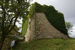
- Fearchar started Clan MacKerracher. This clan was renamed Clan Lamont around 1235. They lived at Toward Castle in the Toward peninsula.
Archaeologists have found that Castle MacEwen had several stages of building. First, it was a fenced area. Then, it became a fort with wooden walls.
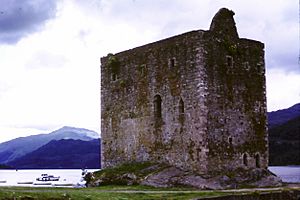
The remote northern parts of Cowal were used by Scottish kings for hunting. Wild boar used to live here. When King John Balliol was in conflict with Robert de Bruys, the King of England helped Balliol. He placed a knight named Henry Percy at Carrick Castle. Dunoon Castle was also used.
Robert de Bruys, with help from the Campbells, drove the English out of Cowal. He eventually defeated Balliol. Later, Robert de Bruys's son gave Carrick Castle to the Campbells. Dunoon Castle also came under Campbell control.
During a civil war in Scotland in the 1600s, the Campbells supported the Puritans. After the Puritans lost a battle, the Clan Lamont attacked the Campbells. In 1646, the Campbells took revenge. They attacked Toward Castle. Even after the Lamont chief surrendered, the Campbells harmed many members of Clan Lamont. This event is known as the Dunoon massacre.
Later, the Campbells continued to hold their lands. They supported the new king, and their power in Cowal remained strong.
Military Roads and Tourism
After a rebellion in 1745, the British army needed better roads in the Highlands. General Wade was put in charge of building military roads. These roads helped the army move quickly to stop unrest. William Caulfeild continued this work. He built the road through Cowal, which is now known as the "Rest and Be Thankful."
In Victorian times, tourism became popular on the Clyde coast. Paddle steamers began carrying thousands of people from Glasgow. They would travel "doon the watter" (down the water) to holiday spots like Dunoon in Cowal.
Sports and Culture in Cowal
The Loch Lomond and Cowal Way is a long walking path. It stretches over 57 miles through Cowal. It goes from Portavadie on Loch Fyne to Inveruglas on Loch Lomond. This area is part of the Loch Lomond and The Trossachs National Park.
The Cowal Highland Gathering is a famous annual event. It's a highland games competition held every August in Dunoon.
Castles You Can Find in Cowal
Here are some of the castles in Cowal:
- Auchenbreck Castle, Kilmodan, Glendaruel (no longer standing).
- Dunans Castle, Glendaruel (a ruin, damaged by fire).
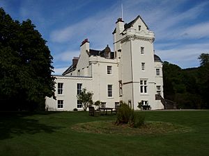
- New Castle Lachlan, Strathlachlan (a private home).
- Old Castle Lachlan, Strathlachlan (a ruin).
- Castle MacEwen, Kilfinan (no longer standing).
- Castle Toward, Toward (a private home).
- Dunoon Castle, Dunoon (no longer standing).
 | Jackie Robinson |
 | Jack Johnson |
 | Althea Gibson |
 | Arthur Ashe |
 | Muhammad Ali |


