River Foulness facts for kids
Quick facts for kids River Foulness |
|
|---|---|

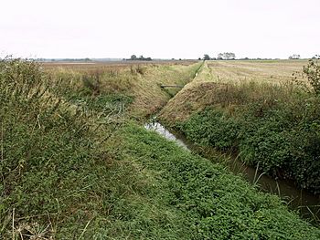
River Foulness near Seaton Ross
53°50′51″N 0°47′51″W / 53.84750°N 0.79750°W |
|
| Country | England |
| Physical characteristics | |
| Main source | Shiptonthorpe 20 metres (66 ft) 53°53′8″N 0°42′39″W / 53.88556°N 0.71083°W |
| River mouth | Market Weighton Canal 1 metre (3.3 ft) 53°46′56″N 0°42′57″W / 53.78222°N 0.71583°W |
| Length | 15.85 miles (25.51 km) |
The River Foulness is a river found in the East Riding of Yorkshire, England. Its name comes from an old English phrase, fūle[n] ēa, which means "dirty water". This river flows into the Humber Estuary through the Market Weighton Canal.
Special groups called drainage boards help manage the river. Since 2012, the Ouse and Humber Drainage Board has been in charge of keeping the river and its smaller streams flowing well. They work to control water levels, which is important for the surrounding land. The river is located in an area known as the Humberhead Levels.
Contents
Where Does the River Foulness Flow?
The River Foulness starts in the fields north-west of a village called Shiptonthorpe. This village is close to the town of Market Weighton. From its start, the river flows south through Shiptonthorpe.
After leaving the village, it turns and flows west-south-west towards Holme-on-Spalding-Moor. The river goes around this town. Then, it changes direction again, heading south-east. Finally, it joins the Market Weighton Canal just north of the M62 highway.
Wildlife and Nature Along the River
The land around the River Foulness is mostly farmland. You can see large, rectangular fields separated by hedges. These hedges are often made of plants like hawthorn, blackthorn, dog rose, elder, and hazel. There are not many forests or large groups of trees in this area.
Long ago, this whole area was a big marshland. A marsh is a type of wetland, like a swamp. It was full of water before people built drainage systems and the Market Weighton Canal. These systems helped to remove water from the land.
Today, many animals live near the river. Wildlife experts have found signs of European water voles and European otters. These are small mammals that live near water. You might also find freshwater mussels and many different kinds of amphibians, like frogs and newts.
The Ground Beneath the River
The River Foulness flows over different types of soil. These include loam, which is a mix of sand, silt, and clay, as well as pure sand and alluvium. Alluvium is soil left behind by flowing water.
The river itself does not have many natural smaller rivers flowing into it. However, there are more than 75 miles (121 km) of drainage ditches. These are human-made channels that collect water from the land and feed it into the river. They are very important for managing water in the area.
A Look Back in Time: River Foulness History
People have lived in the valley of the River Foulness for a very long time. Archeologists, who study ancient times, have found many old objects here. These objects date back to the Paleolithic period, which was the Old Stone Age.
Even more discoveries have been made from other ancient times. These include the Mesolithic (Middle Stone Age), Neolithic (New Stone Age), Bronze Age, Iron Age, and even Roman times. These finds show that the river valley has been an important place for humans for thousands of years.
What People Do for Fun Near the River
There are not many public paths or trails along the River Foulness. Not many roads cross it, and there are only a few small towns nearby. Because of this, most people who visit the river for fun enjoy fishing. This activity is often called angling.
Smaller Streams and Towns Along the River
Tributaries of the River Foulness
- East Beck, Shiptonthorpe
- Skelfrey Beck
- Black Dike
- Over 75 miles (121 km) of drainage channels and small watercourses
Towns and Villages Near the River
- Shiptonthorpe
- Harswell
- Holme-on-Spalding-Moor
- Welham Bridge
- Bursea
- Spaldington
Bridges Crossing the River
- Clayfield Lane, Shiptonthorpe
- A1079 Shipton Bridge, Shiptonthorpe
- Harswell Bridge (Bull Lane), Harswell
- Carr Bridge (footpath)
- Foxcarr Bridge (footpath)
- Minor road bridge, Seaton New Hall
- Foulness Bridge (footpath)
- Major Bridge, A163 Selby Road, near Holme-on-Spalding-Moor
- Welham Bridge (Minor Road) and A614 (Major Road)
 | Emma Amos |
 | Edward Mitchell Bannister |
 | Larry D. Alexander |
 | Ernie Barnes |

