River Horner facts for kids
Quick facts for kids River Horner / Horner Water |
|
|---|---|

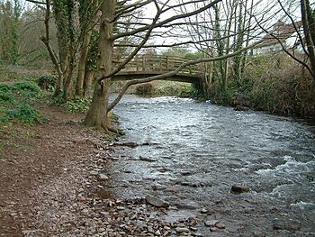
River Horner at Bossington
|
|
| Country | England |
| County | Somerset |
| Physical characteristics | |
| Main source | near Luccombe, Somerset, England 51°11′08″N 3°34′45″W / 51.18556°N 3.57917°W |
| River mouth | Porlock Bay, Bristol Channel near Hurlestone Point, Somerset, England 0 m (0 ft) 51°13′31″N 3°35′10″W / 51.22528°N 3.58611°W |
| Basin features | |
| Tributaries |
|
The River Horner, also known as Horner Water, is a river in Somerset, England. It starts its journey near a village called Luccombe on Exmoor. The river then flows past the town of Porlock.
Finally, the River Horner reaches the sea at Porlock Bay. This is near a place called Hurlstone Point on the Bristol Channel. The river flows into the sea through a natural barrier of stones and pebbles at Bossington beach. This area is part of a special protected site called the Porlock Ridge and Saltmarsh Site of Special Scientific Interest. When there is a lot of rain, the river can get very full. The water builds up behind the pebble ridge until it breaks through.
Contents
Discovering the River Horner
Where the River Begins
The River Horner starts high up on Exmoor, a beautiful area of hills and open land in Somerset. Its source is close to the small village of Luccombe. From there, it begins its journey downhill, collecting water from smaller streams.
Its Path to the Sea
As the River Horner flows, it passes by the historic town of Porlock. The river continues its winding path until it reaches the coast. It empties into Porlock Bay, which is part of the larger Bristol Channel. This is where the river's fresh water mixes with the salty sea.
The Shingle Ridge at Bossington
A unique feature of the River Horner is how it meets the sea. At Bossington beach, there is a long ridge made of shingle, which are small, smooth stones. The river flows through this ridge to reach the ocean. This area is important for nature. It is part of the Porlock Ridge and Saltmarsh Site of Special Scientific Interest. This means it's a special place protected for its wildlife and natural features.
When the River Floods
Sometimes, especially after heavy rain, the river's water level gets very high. The shingle ridge at Bossington can act like a dam, holding back the water. When too much water builds up, it can cause the ridge to break open. This allows the floodwater to flow out into the bay.
A Look into the River's Past
Old Iron Workings
People have found clues that the River Horner was used for power a long time ago. Evidence shows that the river's path was changed. This was done to help power places where iron was made. These were called iron workings.
The Hammer Mill Discovery
In 1996, archaeologists dug near the river. They found the remains of an old iron hammer mill. A hammer mill used the power of flowing water to operate large hammers. These hammers would shape or crush iron. They also found a 55-meter-long embankment dam that had been broken. This dam would have held back water to power the mill. These discoveries tell us about the industrial history of the area.
 | Bayard Rustin |
 | Jeannette Carter |
 | Jeremiah A. Brown |

