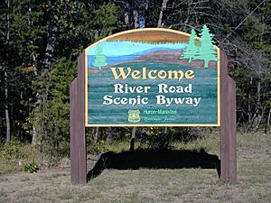
River Road National Scenic Byway facts for kids
Quick facts for kids
[[File:|x70px|alt= marker]] |
|
|---|---|
| River Road National Forest Scenic Byway | |
|
River Road NSB highlighted in red
|
|
| Route information | |
| Maintained by MDOT and ICRC | |
| Length | 23.458 mi (37.752 km) |
| Existed | September 22, 2005–present |
| Major junctions | |
| West end | |
| East end | |
| Location | |
| Counties: | Iosco |
| Highway system | |
| Michigan State Trunkline Highway System Interstate • US • State (CDH) Michigan State Trunkline Highway System Interstate • US • State (CDH) |
|
The River Road National Scenic Byway is a special road in Michigan, USA. It is also known as the River Road National Forest Scenic Byway. This road is about 23.5 miles (37.8 km) long.
It follows parts of M-65 and River Road. The byway goes east into the Huron National Forest. It ends in the town of Oscoda, close to Lake Huron. The road runs next to the historic Au Sable River. This river was once very important for moving giant white pine trees. Loggers floated the trees from the forest to sawmills by Lake Huron. Along the byway, you can find many places for fun activities. You can also enjoy the beautiful views.
Exploring the River Road Byway
The scenic byway begins near the town of Hale. It starts where M-65 meets Rollways Road. From there, it goes east along M-65. This part of the road is near Loud Dam Pond. The byway then travels through the Huron National Forest. It also passes along the Five Channels Dam Pond.
The byway then leaves M-65 and follows River Road. This part of the road goes east along the south side of the Au Sable River. You will pass important spots like the Canoer's Memorial. There is also the Kiwanis Monument and the Lumberman's Monument. These are all near Cooke Dam Pond.
River Road then moves away from the river for a bit. It cuts through forest land. Near Old Orchard Park, the byway follows the southern shore of Foote Dam Pond. From here, the road continues along the river's south bank. It passes the Oscoda-Wurtsmith Airport as it enters Oscoda. The byway ends in Oscoda where it meets US 23. This is just a few blocks from Lake Huron.
The Michigan Department of Transportation (MDOT) takes care of the M-65 part of the byway. The Iosco County Road Commission (ICRC) maintains River Road.
Fun Things to Do Along the Byway
The River Road Byway offers many activities all year long. You can find lots of trails for hiking. In winter, these trails are great for cross-country skiing. Camping, fishing, and watching wildlife are also popular.
Visitors can enjoy the forest and amazing views. There are special spots along the route to stop and look. Other cool places include the Lumberman's Monument. It has a visitors' center that tells the story of Michigan's logging history. This was a big industry in the 1800s.
You can also visit the Iargo Springs Interpretive Site. Here, you can learn about natural springs. There are boardwalks that let you walk along the river.
History of the Byway
The part of the byway that uses M-65 became a state highway in the mid-1930s. On December 20, 1988, the United States Forest Service gave the road a special title. It was named the River Road National Forest Scenic Byway.
Later, on September 22, 2005, it received another important title. The Federal Highway Administration named it the River Road National Scenic Byway. This shows how special and beautiful this road is.
 | Sharif Bey |
 | Hale Woodruff |
 | Richmond Barthé |
 | Purvis Young |


