River Slea facts for kids
Quick facts for kids River Slea |
|
|---|---|

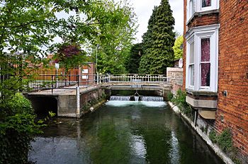
Slea in Sleaford
|
|
|
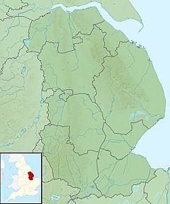
Location of the mouth within Lincolnshire
|
|
| Country | England |
| County | Lincolnshire |
| Physical characteristics | |
| Main source | West Willoughby |
| River mouth | River Witham at Chapel Hill 53°04′11″N 0°11′48″W / 53.069747°N 0.196723°W |
| Length | 36.4 km (22.6 mi) |
The River Slea is a river in Lincolnshire, England. It is about 36.4 kilometers (22.6 miles) long. The Slea is a tributary of the River Witham, which means it flows into the River Witham.
Years ago, in 1872, people said the River Slea was a great source of clean water. It was famous for its trout fish along the East coast of England. However, in the late 1960s, the river changed. A group called the Anglian Water Authority took control. After that, the river became less healthy. This was mostly because too much water was taken out for farming.
Contents
Where Does the River Slea Flow?
The River Slea starts near a place called West Willoughby. This is about two miles southwest of Ancaster. The river begins at a height of 70 meters (230 feet) above sea level.
The Slea's Journey Downhill
In its first 3 kilometers (1.9 miles), the river drops 30 meters (98 feet). It flows through Ancaster. Then, it passes by a special natural area next to Sleaford Golf Club. This area is called a Site of Special Scientific Interest, which means it has important plants, animals, or geology.
Flowing Through Sleaford
The River Slea then reaches Sleaford. In Sleaford, the river splits into two parts that flow above ground. It then curves around a building called The Hub. There's a new path along the river here, with sculptures to see.
Reaching the River Witham
After leaving Sleaford, the Slea flows past Haverholme. It continues through South Kyme. In this area, it is sometimes called the Kyme Eau. Finally, the River Slea joins the River Witham at a place called Chapel Hill.
For a time, parts of the River Slea were used like a highway for boats. This was called the Slea Navigation.
The Slea was made navigable, meaning boats could travel on it, from the River Witham up to Sleaford in 1794. This helped transport goods. However, these river routes were closed in 1878. They became too expensive to use because trains arrived in 1857. Trains could move goods faster and cheaper.
Today, there is a group called the Sleaford Navigation Trust. They are working hard to reopen the river for boats again, all the way to Sleaford. This would allow people to enjoy the river for recreation and bring new life to the area.
 | Janet Taylor Pickett |
 | Synthia Saint James |
 | Howardena Pindell |
 | Faith Ringgold |


