River Thet facts for kids
Quick facts for kids Thet |
|
|---|---|

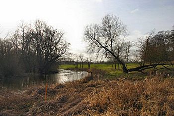
River Thet at Brettenham
|
|
|
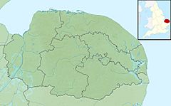
Location of the river mouth within Norfolk
|
|
| Country | England |
| Region | Norfolk |
| Physical characteristics | |
| Main source | Deopham Green 53 m (174 ft) 52°33′03″N 1°00′07″E / 52.5507°N 1.0019°E |
| River mouth | River Little Ouse Thetford 10 m (33 ft) 52°24′41″N 0°44′55″E / 52.4113°N 0.7485°E |
| Length | 34.3 km (21.3 mi) |
| Basin features | |
| River system | River Little Ouse |
| Basin size | ≈225km2 |
| Tributaries |
Stream from Middle Harling Fen Stream from Old Buckenham Fen
Stream from Hockham |
The River Thet is a river located in Norfolk, England. It is a tributary of the River Little Ouse, which means it flows into the Little Ouse. The River Thet starts in an area called Breckland, with its main beginnings near Deopham Green and Rockland All Saints. It then flows generally southwest before joining the Little Ouse in the town of Thetford.
The river gets its water from several smaller streams. These streams come from special wet areas known as fens, which are like marshy grasslands. Some of these fens include Swangey Fen and Old Buckenham Fen. Along the river's path, you can also find carr woodland. This is a type of forest that grows in wet, swampy areas, often where open wetlands used to be. The ground under the river is mostly made of clay and chalk in the east, and sand and gravel over chalk in most other parts.
The River Thet's Name and Journey
The name of the River Thet actually comes from the town of Thetford. Thetford was a very important place during the time of the Anglo-Saxons. The town's name, "Theodford," means "Peoples Ford" in Anglo-Saxon. A "ford" is a shallow place in a river where people or animals can cross.
Places Along the River
One of the most well-known places along the River Thet is East Harling. For hundreds of years, people have crossed the river here using a ford. Today, a modern brick and concrete bridge carries the B1111 road over the river. Underneath this bridge, there is a weir, which is like a small dam that controls the water flow. The river here is wider and has a gravel bottom, while most of the riverbed is muddy.
Further downstream, the river flows over another weir near Bridgham, where another bridge crosses it. It then passes through the Shadwell Estate. In this area, the river splits into two separate channels before joining back together. It also flows past a large lake that was made by people.
When the River Thet reaches the town of Thetford, it makes a curve, first heading south and then west. It finally meets the Little Ouse just west of Butten Island, right in the middle of Thetford town.
Lakes and Fishing
In the upper parts of the River Thet, there are several lakes. Many of these lakes were formed in old gravel pits that filled with water. You can find these lakes in a line along the river's floodplain near Snetterton and also close to Attleborough. All of these lakes are on private land and are mainly used for fishing.
 | Jackie Robinson |
 | Jack Johnson |
 | Althea Gibson |
 | Arthur Ashe |
 | Muhammad Ali |


