Rivière aux Rats facts for kids
Quick facts for kids Rivière aux Rats |
|
|---|---|

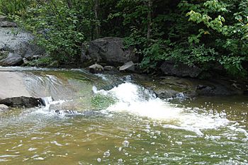
The "rivière aux Rats" view from Rosaire-Gauthier park.
|
|
| Country | Canada |
| Province | Quebec |
| Region | Saguenay-Lac-Saint-Jean |
| Regional County Municipality | Le Fjord-du-Saguenay Regional County Municipality |
| City | Saguenay |
| Physical characteristics | |
| Main source | Saguenay |
| River mouth | Saguenay River Saguenay 4 m (13 ft) 48°25′24″N 71°03′55″E / 48.42333°N 71.06528°E |
| Length | 3.72 km (2.31 mi) |
The Rivière aux Rats is a small watercourse in Quebec, Canada. It flows through the Chicoutimi area, which is part of the city of Saguenay. The river gets its name from the French word for "muskrat," a type of rodent. It is about 3.72 km (2.31 mi) long and flows into the larger Saguenay River.
The river's surface usually freezes from early December to late March. It is generally safe to walk on the ice from mid-December to mid-March.
About the River
The Rivière aux Rats flows roughly parallel to two other rivers. To its west is the Chicoutimi River. To its east is the Rivière du Moulin.
The river starts in the south, near Boulevard du Royaume (Route 170). It then passes by Rosaire-Gauthier Park and under Jean-Béliveau Park. Finally, it empties into the Saguenay River near Rue de l'Hotel-de-Ville.
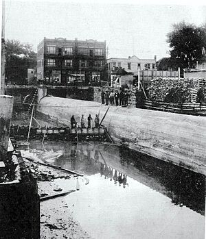
In 1929, part of this river was put into an underground channel. This happened under the Chicoutimi Downtown area.
In its southern part, a forest helps protect the river's natural state. There is a 2.4 km (1.5 mi) long trail along the Rivière aux Rats. It is called the Muscat Rats Trail and is open all year round.
River's Name
The name "Rivière aux Rats" was officially recognized on February 25, 1976. This was done by the Commission de toponymie du Québec, which is in charge of place names in Quebec.
More to Explore
Related Articles
- Chicoutimi
- Saguenay (city)
- Saguenay River
- List of rivers of Quebec
 | Tommie Smith |
 | Simone Manuel |
 | Shani Davis |
 | Simone Biles |
 | Alice Coachman |


