Chicoutimi River facts for kids
Quick facts for kids Chicoutimi River |
|
|---|---|
 |
|
| Country | Canada |
| Province | Quebec |
| Region | Saguenay-Lac-Saint-Jean |
| Regional County Municipality | Le Fjord-du-Saguenay Regional County Municipality |
| City | Saguenay |
| Physical characteristics | |
| Main source | Kenogami Lake via Barrage de Portage-des-Roches Saguenay 164 units? 48°18′35″N 71°12′42″W / 48.3097°N 71.2116°W |
| River mouth | Saguenay River Saguenay 87 m (285 ft) 48°25′48″N 71°04′30″W / 48.4301°N 71.0750°W |
| Length | 26.2 km (16.3 mi) |
| Basin features | |
| Tributaries |
|
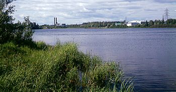
The Chicoutimi River is a important watercourse in eastern Quebec, Canada. It flows into the Saguenay River in the city of Saguenay. This river is the main way that water leaves Kenogami Lake. It's about 26.2-kilometre-long (16.3 mi). The river starts in a large area of land called a watershed, which covers 3,390 square kilometres (1,310 sq mi) in the Laurentides Wildlife Reserve. The Chicoutimi River is entirely within the Chicoutimi area of Saguenay. It's known for having many dams and being very urbanized.
Long ago, the Montagnais people used this river before Europeans arrived. It was the first place where people would carry their canoes and goods overland to reach Lac Saint-Jean. In the 1900s, many dams were built along the river to create hydropower (electricity from water). The river also provides drinking water for the Chicoutimi and Jonquière areas. It has six dams, including two power plants that are still working. In 1996, during the Saguenay flood, the river swelled and caused a lot of damage in Laterrière and Chicoutimi.
River Journey and Landscape
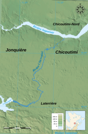
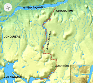
The Chicoutimi River starts at the Portage-des-Roches dam in the Laterrière part of Chicoutimi. It begins at about 150 m (490 ft) above sea level. From there, it flows northeast towards Laterrière-Bassin, where the Père-Honorat bridge crosses it.
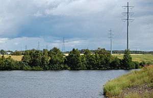
After leaving the rocky hills, the river enters a flatter area. For about ten kilometers, you'll see homes and farms along its banks. Then it reaches the Chute-Garneau dam. A little further, Route 170 crosses the river. Here, the river enters a more developed part of Chicoutimi.
The river then goes under Autoroute 70 and flows into an industrial park. It passes the Pont-Arnaud dam and starts to drop faster as the land gets steeper. After going under the Ulric Blackburn bridge, it flows into Lac Dubuc. This lake is actually a reservoir for the Chute-Blanchette dam. This dam sends the river's water underground to power the S.P.C. (Elkem Métal) factory.
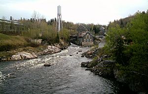
The river then reappears at the historic Pulperie de Chicoutimi site. It continues its journey downhill to the Chicoutimi dam basin. Finally, it flows into the Saguenay River.
The Chicoutimi River mainly flows through a large valley called the Saguenay graben. The soil in this valley is made of soft materials like silt and clay. These were left behind by an ancient sea thousands of years ago. In its last three kilometers before joining the Saguenay River, the river cuts deep into the clay. It forms steep channels, making it look like a fast-moving torrent.
River System
Where the Water Comes From
The area that collects water for the Chicoutimi River is called its watershed. It covers 3,390 km2 (1,310 sq mi). Most of this area is in the Laurentian Wildlife Reserve. This watershed is shared between two regions: Saguenay–Lac-Saint-Jean and Capitale-Nationale.
The Chicoutimi River flows from south to north. It starts from Kenogami Lake through the Portage-des-Roches dam. This is in the old town of Laterrière, which is now part of Chicoutimi borough in Saguenay. For over a century, the river's flow has been controlled by dams. It flows for 26.2 km (16.3 mi) and drops 150 m (490 ft) in elevation.
The first part of the river, between the Portage-des-Roches and Pont-Arnaud dams, is almost 20 km (12 mi) long. This section is in the flat area of Laterrière. It has a small drop of about 17.3 m (57 ft). Here, the river forms curves and a reservoir held back by the Pont-Arnaud and Chute-Garneau dams.
Downstream from Pont-Arnaud, the river drops much faster. It falls 132.7 m (435 ft) over about 5 km (3.1 mi). The Chute-Blanchette (Elkem Métal) and Chicoutimi (Abitibi-Consolidated) dams were built on large falls. These falls are 84.1 m (276 ft) and 21.3 m (70 ft) high, which explains the steep drop to the Saguenay River. Near the Saguenay River, the river has carved a small valley into the rock. The tide only affects the river downstream of the Chicoutimi dam.
Managing the River's Flow
Over the 1900s, the Chicoutimi River's water level changed a lot because many dams were built. This turned parts of the river into a series of basins between Kénogami Lake and the Saguenay River. Different groups manage the dams:
- The Quebec Department of Environment and Wildlife manages the Portage-des-Roches Dam.
- The City of Saguenay manages the Chute-Garneau and Pont-Arnaud dams.
- Elkem metal manages the Chute-Blanchette dam.
- Abitibi-Bowater manages the Chicoutimi dam.
Since the early 1900s, work on Kenogami Lake has helped control the flow of the Chicoutimi River. Water was sent to industries downstream based on their needs. This sometimes caused problems because the lake's water supply changed with the seasons. A court decision in 1911 decided that 2/3 of the water from Kenogami Lake should go to the Chicoutimi River and 1/3 to the Rivière-aux-Sables. This rule is still followed today.
In 1912, the Pont-Arnaud power station was finished. Later, between 1923 and 1924, the Portage-des-Roches dam was built to further control the water.
Dams on the River
| --- | Portage-des-Roches Dam | |||
|---|---|---|---|---|
| Tank volume | Height of the structure | Max. | 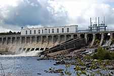 |
|
| 706.5 Mm3 | 15.2 m | 163.96 m (Summer) | ||
| Tank area
Length of the structure |
Height Min. | |||
| 5,180 ha | 449.6 m | 163.76 m (Summer) | ||
| Dependent facilities: All facilities on the Chicoutimi River |
||||
| Dam Chute-Garneau | |||||||
|---|---|---|---|---|---|---|---|
| Tank volume | Height of the structure | Max. | 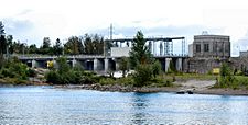 |
||||
| 0.9 Mm3 | 13.8 m | 136.5 m (Summer) | |||||
| Tank area
Length of the structure |
Height Min. | ||||||
| Water flow | 257.5 m | 136.2 m (Summer) | |||||
| Dependent installations: Borough water intake Jonquière, Pont-Arnaud, Chute-Blanchette, Chicoutimi |
|||||||
| Dam Pont-Arnaud | |||||||
|---|---|---|---|---|---|---|---|
| Tank volume | Height of the structure | Max. | |||||
| 1.125 Mm3 | 16.5 m | 124.5 m (Summer) | |||||
| Tank area
Length of the structure |
Height Min. | ||||||
| 7.5 ha | 121 m | 124.3 m (Summer) | |||||
| Dependent installations: Borough water intake Chicoutimi, water intake of the company Alcan, Chute-Blanchette, Chicoutimi |
|||||||
| Chute-Blanchette Dam | |||||||
|---|---|---|---|---|---|---|---|
| Tank volume | Height of the structure | Max. | 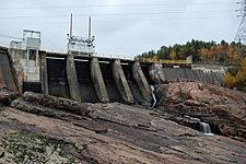 |
||||
| 0.88 Mm3 | 12.5 m | ? m (Summer) | |||||
| Tank area
Length of the structure |
Height Min. | ||||||
| 11 ha | 137 m | ? m (Summer) | |||||
| Dependent installations: Water intake of the Elkem Metal power plant, Elkem Metal power plant, Chicoutimi pulp mill, Chicoutimi Dam |
|||||||
| Chicoutimi Dam | |||||||
|---|---|---|---|---|---|---|---|
| Tank volume | Height of the structure | Max. | 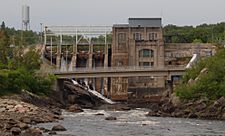 |
||||
| 1.054 Mm3 | 30 m | ? m (Summer) | |||||
| Tank area
Length of the structure |
Height Min. | ||||||
| 3.7 ha | 221 m | ? m (Summer) | |||||
| Dependent installations: Centrale Abitibi-Price Chicoutimi |
|||||||
Major Floods
The table below shows some of the biggest floods on the Chicoutimi River between 1971 and 1996. The "Flow" column shows how much water was moving per second.
| Flow (m3/s) | Year | Season |
| 1100 | 1996 | Summer |
| 340 | 1986 | Spring |
| 317 | 1974 | Spring |
| 313 | 1979 | Spring |
| 310 | 1983 | Spring |
| 310 | 1994 | Summer |
| 297 | 1985 | Spring |
| 288 | 1982 | Spring |
| 286 | 1971 | Summer |
| 280 | 1975 | Spring |
| 267 | 1976 | Spring |
| 265 | 1981 | Spring |
| 255 | 1986 | Summer |
| 255 | 1995 | Spring |
| 245 | 1985 | Summer |
| Source: BAPE |
History of the River
Early Settlements
The first lasting European settlements in the Saguenay area were built where the Chicoutimi and Saguenay rivers meet. In 1676, a trading post was built on an old Amerindian camp site. This Chicoutimi trading post, which had a warehouse and a chapel, was very busy in the late 1600s. It closed in 1856.
The Pulp Industry
Mills and Factories
In 1847, Peter McLoed (son), who founded the town of Chicoutimi, built his second mill near the Chicoutimi River. After he died, William Price took over the mills. His sons later started the Price Brothers and Company, which became Abitibi-Price (now AbitibiBowater).
A surveyor named L.M. Deschênes wrote in 1888 about the river. He said that the river had many rapids and was great for building mills. He also mentioned a huge waterfall in Chicoutimi that could power large factories.
On November 24, 1896, Joseph-Dominique Guay, the mayor of Chicoutimi, and his friends started "La Compagnie de Pulpe de Chicoutimi." This was the first company run by French Canadians in the pulp and paper business. They built a mill on the Chicoutimi River. Because there were so many trees upstream, the company grew quickly. It became famous around the world for exporting pulp.
Under the leadership of Julien-Édouard-Alfred Dubuc, the Pulperie de Chicoutimi expanded, and three mills were built in total. The river was used to float wood and provide power. Chicoutimi became a major center for pulp, supplying England during the First World War. The company faced problems after the war and closed in 1930. Today, the Pulperie de Chicoutimi is a regional museum.
Hydroelectric Power
Because of its steep drops and strong current, the Chicoutimi River was a perfect place for building power plants. Over time, many dams were built to control the river's flow. Today, the river is largely controlled by these man-made structures.
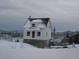
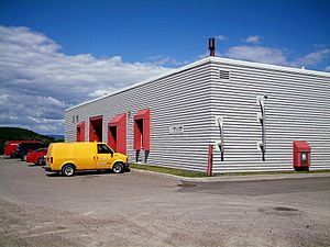
There are four hydroelectric power plants on the Chicoutimi River. The ones at Pont-Arnaud (built 1912) and Chute-Garneau (built 1925) are no longer active. However, the Chicoutimi power station (built 1923) and the Elkem Métal plant (built 1957) are still in use.
Power Plants on the River
The Saguenay Flood of 1996
Between July 19 and 20, 1996, the area around Kenogami Lake received a huge amount of rain. It was like one and a half times the lake's full capacity! The water level behind the Portage-des-Roches dam became dangerously high. To prevent the dam from breaking, Hydro-Québec had to open its gates all the way. This meant the Chicoutimi River's flow suddenly jumped from 100 m (328.084 ft)/s to 1,200 m (3,937.008 ft)/s.
This massive rush of water changed the riverbed. Many homes, especially in Rang Saint-Pierre, were completely surrounded by water. Some houses were even swept away from their foundations. Debris from these houses hit the Portage-Des-Roches road bridge in Laterrière, threatening to break it.
Further downstream, the huge amount of water overwhelmed the Chute-Garneau dam. It dug a new trench 18 m (59 ft) deep around the dam. The same thing happened at Pont-Arnaud, where a 12 m (39 ft) deep trench was dug. The city of Chicoutimi's drinking water intake was ripped out, and they had to set up a temporary pump.
The Chute-Blanchette dam managed to hold up by opening its valves fully. Water rushed through a spillway near the Pulperie de Chicoutimi. The floodwaters then flowed through two of the old mills at the Pulperie, destroying parts of them.
When the flood reached the city center, it violently bypassed the last dam, the Chicoutimi dam. The Bassin district was completely flooded, and homes near the dam suffered heavy damage.
Even though there was a lot of damage, no one died in this part of the flood. However, about 6,000 people had to leave their homes. The Chicoutimi River was the second most affected river during the deluge, after the rivière à Mars.
Damage and Repairs
The flood caused a lot of damage and changed the river:
- The river's path was changed in some places.
- 10 houses were destroyed in Laterrière.
- 14 houses were destroyed in Chicoutimi.
- 263 homes were damaged, costing about $5,420,000.
- The Chute-Garneau dam was badly damaged.
- Repairing the Pont-Arnaud dam cost $20 million.
- Repairs to the Alcan water intake cost $6 million, and their railway lines cost $20 million to fix.
- The Pulperie de Chicoutimi also suffered significant damage.
River Use
Water for People and Industry
The Chicoutimi River is a very important source of water:
- It provides drinking water for the Chicoutimi area.
- It provides drinking water for the Jonquière area.
- The Alcan company also takes water from the river for its operations.
Bridges and Transport
Many bridges cross the Chicoutimi River, helping people and goods move around:
- Pont du Boulevard Saguenay
- Pont de la rue Price
- The old Canadian National iron bridge (now a bike path called Véloroute des Bleuets)
- Pont de la rue Dubuc
- Pont Ulric Blackburn (Boulevard Barette)
- Alcan railway bridge
- Pont-Arnaud bridge
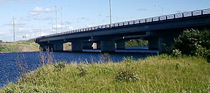
- Pont de l'Autoroute 70
- Pont du Boulevard du Royaume Ouest
- Pont du Père-Honorat
- Portage-Des-Roches bridge
 | Kyle Baker |
 | Joseph Yoakum |
 | Laura Wheeler Waring |
 | Henry Ossawa Tanner |


