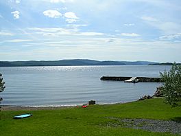
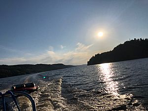
Kénogami Lake facts for kids
Quick facts for kids Kenogami lake |
|
|---|---|
 |
|
| Location | Saguenay / Lac-Ministuk / Larouche / Hébertville, Saguenay–Lac-Saint-Jean, Quebec |
| Coordinates | 48°19′36″N 71°22′34″W / 48.32667°N 71.37611°W |
| Type | Dam lake |
| Primary inflows | South shore: rivière Simoncouche rivière Cyriac décharge du lac Gilles ruisseau McDonald ruisseau Patrie rivière Pikauba décharge des Lac de la Petite Pêche North Shore (Cascouia Bay): décharge du lac Charnois décharge du lac Lésigny décharge du lac Leclerc décharge du lac Culotte décharge du lac Décène ruisseau du Pont Flottant North Shore: décharge du lac Central, du lac à Booyi et du lac Houle décharge du lac Alphonse et du lac Emma décharge du lac à Jean décharge du lac à Pierre-Guby Petite rivière aux Sables ruisseau Jean-Dechène décharge du lac Warren décharge du lac de la Ligne |
| Primary outflows | Chicoutimi River and Rivière-aux-Sables |
| Basin countries | Canada |
| Max. length | 27.24 km (16.93 mi) |
| Max. width | 6.87 km (4.27 mi) |
| Surface area | 57 km2 (22 sq mi) |
| Max. depth | 102 m (335 ft) |
| Shore length1 | catchment |
| Surface elevation | 150 m (490 ft) |
| Settlements | Lac-Kénogami, Hébertville station |
| 1 Shore length is not a well-defined measure. | |
Kenogami Lake is a long lake located in the Saguenay–Lac-Saint-Jean region of south-central Quebec, Canada. It sits at an elevation of about 150 meters (492 feet) above sea level. The lake stretches for about 27 kilometers (17 miles) and can be as deep as 102 meters (335 feet).
The name "Kénogami" comes from the Montagnais language. It means "long lake." This name was first used for a different lake in Ontario.
Kenogami Lake is found in the Laurentian Highlands. This area is about 150 kilometers (93 miles) north of the Saint Lawrence River. The lake's water flows into the Saint Lawrence River through the Saguenay River. It also connects to the Chicoutimi and Aux-Sables Rivers.
Many small rivers from the Laurentian Highlands feed into the lake. The three most important ones are the Pikauba, Cyriac, and Aux-Ecorces Rivers. Towns located on the shores of Kenogami Lake include Lac-Kénogami and Hébertville station.
The eastern side of the lake is served by Route 175. On the north side, you can find the Kénogami road and the Route des Bâtisseurs. Other smaller roads in the area help with hydroelectricity, forestry, and tourism.
Hydroelectricity is the main economic activity around the lake. Tourism comes in second, and forestry is third. The lake's surface usually freezes from early December to late March. It's generally safe to be on the ice from mid-December to mid-March.
Contents
Exploring Kenogami Lake's Geography
Kenogami Lake is a large body of water. It covers an area of about 59.1 square kilometers (22.8 square miles). It holds about 380 million cubic meters of water. The lake gets most of its water from the Laurentides Wildlife Reserve. This water comes from rivers like the Pikauba, Cyriac, and Aux Écorces.
The lake is the source of two important rivers: the Chicoutimi and the Aux Sables.
Several towns are located along the lake's shores. These include Hébertville, Larouche, and parts of the city of Saguenay.
How Kenogami Lake's Water is Controlled
The water in Kenogami Lake is held back by several dams and dikes. These structures help manage the water levels. The main dams are Portage-des-Roches, Pibrac-Est, and Pibrac-Ouest. There are also many dikes, such as Ouiqui, Baie-Cascouia, and Moncouche.
The lake has two main exits for its water:
- The Chicoutimi River on the east side. Its flow is controlled by the barrage de Portage-des-Roches dam.
- The rivière aux Sables on the north side. Its flow is controlled by the Pibrac West dam.
Key Features of Kenogami Lake
Around the lake, you can find many interesting bays, points, and islands. Here are some of them, listed clockwise from the Chicoutimi River outlet:
South Shore Features
- Villa Marie bay
- Moncouche bay (where the Simoncouche River flows in)
- Pier-à-Chabot
- Pointe aux Bouleaux
- McDonald tip
- McDonald Bay
- Cabland du Chaland bay
- Finnigan point
- Pointe du Caribou
North Shore Features
- Point Raphaël
- Points to Harvey
- Epiphanes bay
- Dufour bay
- Bay at Cadie
- Pointe aux Sables
- Bay Gélinas
- Chouinard Bay
- Théophile bay
Épiphane and Cascouia Bay Features
- Bay at Simon's
- Pointe de Sable
- Camp lake
- Clover Bay
- Bay to Richard
- Lac à Jean bay
- Saint-Édouard Island
- Dufour bay
- Gagné bay
- Notch of the Curé
Around Jean-Guy Island
- Green Island
- Neighbor Bay
- Voisine Island
Important Buildings Near the Lake
- Saint-Cyriac Chapel
- Price retirees center
From the Portage-des-Roches dam, the water flows into the Chicoutimi River for about 26.2 kilometers (16.3 miles). Then it joins the Saguenay River, which flows for about 114.6 kilometers (71.2 miles) eastward. Finally, the Saguenay River merges with the Saint Lawrence estuary at Tadoussac.
Understanding the Name "Lac Kénogami"
The official name "Lac Kénogami" was formally recognized on December 5, 1968. This happened at the Bank of Place Names of the Commission de toponymie du Québec.
 | John T. Biggers |
 | Thomas Blackshear |
 | Mark Bradford |
 | Beverly Buchanan |


