Laurentian Upland facts for kids
The Laurentian Upland (also called the Laurentian Highlands) is a large natural area. It's like a big, raised land area. In Canada, it's known as the "Laurentian Region" and is part of the huge Canadian Shield. The United States Geological Survey also sees it as a major upland area of the Canadian Shield.
Contents
Geography of the Laurentian Upland
The Laurentian Region in Canada is mostly found in Quebec. It's a high, flat area with some parts that have been cut into by rivers and glaciers. It's like the southern edge of the Canadian Shield. This region is an extension of the Laurentian Mountains. It stretches across the Ottawa Valley into Ontario, where it's called the Opeongo Hills.
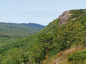
When you look at it from the Ottawa and St. Lawrence River valleys, the steep southern edges of this area look like mountains. They can be 500 to 800 meters (about 1,600 to 2,600 feet) high. But if you look across the top, the land is more gently rolling. These steep edges show where this upland region dramatically begins. Mont Raoul Blanchard is the highest point here.
This Laurentian Region in Quebec goes about 100 to 200 kilometers (60 to 120 miles) north from these steep edges. It stretches from the Gatineau River in the west to the Saguenay River in the northeast. Near Quebec City, in the Laurentides Wildlife Reserve, it reaches its highest point, over 1000 meters (3,300 feet).
Some tall peaks rise above the flat land. These include Mont Sir Wilfrid (783 m) and Mont Tremblant in the west. Near Quebec City, there's Mont Sainte-Anne (815 m). In the Laurentides Wildlife Reserve, you'll find Mont Raoul Blanchard (1166 m), Mont Bleu (1052 m), and Mont des Conscrits (1006 m). Places like Cap Tourmente (579 m) and Mont des Éboulements (770 m) show how steeply the land drops to the St. Lawrence River.
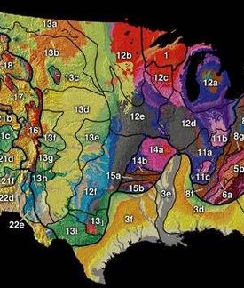
The larger Laurentian Upland area also reaches into parts of the United States. This includes northwestern Ontario and northern parts of Minnesota, Wisconsin, Michigan, and New York State. The United States Geological Survey includes the Superior Upland as part of this larger area. The Adirondack Mountains in New York State can also be seen as an extension of the Laurentian Upland.
Geology of the Laurentian Upland
The Laurentian Upland is mostly made of very old rocks. These rocks formed during the Precambrian era, which was billions of years ago. They include igneous rocks (formed from cooled lava), metamorphic rocks (changed by heat and pressure), and sedimentary rocks (formed from layers of sediment).
Most of this area is a gently rolling to mountainous peneplain. A peneplain is a land surface that has been worn down by erosion over a very long time, making it almost flat. This area is generally 800 to 1400 feet (240 to 430 meters) above sea level, except for the river valleys and lake basins.
The Superior Upland
The Superior Upland is a part of the Laurentian Upland that extends into the United States. It's located west and south of Lake Superior. This upland area, like the Adirondacks, is part of the Canadian Shield. Its rocks have been greatly changed and folded over time.
It is mainly made of igneous and metamorphic rocks. These types of rocks often create a rugged landscape. Long ago, this area had very tall mountains. But over millions of years, erosion has worn them down. Now, the land is gently rolling, and the areas between streams are quite flat, like a plateau.
The higher parts of the Superior Upland, such as the Misquah Hills and Huron Mountains, are about 1,400 to 2,300 feet (430 to 700 meters) high. This region shows how ancient mountains can be worn down into a nearly flat surface, a peneplain. Sometimes, a few moderately high hills, called monadnocks, are left behind because they were harder to erode.
In the past, this region was covered by ancient seas. This shows that the land sank below the sea after being dry for a very long time. Later, the land rose again, and erosion removed some of the younger rock layers that had covered it. The valleys you see today were likely carved by rivers that flowed over these now-removed rock layers.
Glaciation has also had a big impact. During ice ages, huge glaciers scraped away the old soils. They left behind strong, rocky hills and bumps. The glaciers also left behind an uneven layer of sand, gravel, and clay, called "drift." This drift has changed how water drains, creating many lakes and swamps. It also makes rivers rush down rocky rapids in some places.
See also
 In Spanish: Altiplanicie laurentina para niños
 | Precious Adams |
 | Lauren Anderson |
 | Janet Collins |


