Rivière du Chêne (Leclercville) facts for kids
Quick facts for kids Rivière du Chêne |
|
|---|---|

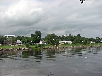
Rivière du Chêne at Leclercville
|
|
| Country | Canada |
| Province | Quebec |
| Region | Chaudière-Appalaches |
| MRC | L'Érable Regional County Municipality, Lotbinière Regional County Municipality |
| Physical characteristics | |
| Main source | Agricultural and forest streams Sainte-Agathe-de-Lotbinière 181 metres (594 ft) 46°23′43″N 71°23′08″W / 46.395318°N 71.385586°W |
| River mouth | St. Lawrence River Leclercville 5 metres (16 ft) 46°34′29″N 71°59′55″W / 46.57472°N 71.99861°W |
| Length | 80.6 kilometres (50.1 mi) |
| Basin features | |
| River system | St. Lawrence River |
| Tributaries |
|
The Rivière du Chêne (which means Oak River in English) is a river in Quebec, Canada. It flows into the southern side of the St. Lawrence River. This river passes through several towns and villages. These include Sainte-Agathe-de-Lotbinière, Saint-Gilles, Dosquet, Lyster, Saint-Janvier-de-Joly, Val-Alain, Saint-Édouard-de-Lotbinière, Lotbinière, and Leclercville. It is located in the Chaudière-Appalaches region.
River's Path and Surroundings
The Chêne River starts in a farming area. This area is west of the village of Sainte-Agathe-de-Lotbinière. The river's journey ends when it flows into the St. Lawrence River at Leclercville.
Along its path, the Chêne River is surrounded by other rivers and streams. To the north, it is close to the St. Lawrence River. To the east, you can find rivers like the rivière du Bois Clair and the Henri River. To the south, it is near the Bécancour River. To the west, there is the Petite rivière du Chêne.
The Chêne River is about 80.6 kilometres (50.1 mi) long. It drops about 176 metres (577 ft) from its source to its mouth. Near where it meets the Saint Lawrence River, it flows past the Moulin du Portage. This is a historic flour mill that used water power.
How the River Flows
The river's journey can be thought of in three main parts:
- Upper Part: The river begins in an agricultural area. It flows east, then northwest, and then west. It passes near Saint-Gilles and Lyster. This part ends when it reaches Route 116 in Dosquet.
- Middle Part: From Route 116, the river continues to flow northwest and west. It goes through Dosquet, Lyster, and Saint-Janvier-de-Joly. It also flows through the village of Val-Alain. In this section, it crosses under Highway 20.
- Lower Part: The final part of the river's journey starts in Leclercville. Here, it meets the Henri River. It then flows northwest and west. It zigzags through Leclercville and passes under Route 132. Finally, it reaches the St. Lawrence River.
The Chêne River empties into the Saint Lawrence River at a place called the Chêne Flats. This is in the village of Leclercville.
River's Name
The name "Rivière du Chêne" was officially recognized on December 5, 1968. This was done by the Commission de toponymie du Québec.
 | Kyle Baker |
 | Joseph Yoakum |
 | Laura Wheeler Waring |
 | Henry Ossawa Tanner |


