
Rivière du Moulin (rivière Saguenay) facts for kids
Quick facts for kids Rivière du Moulin |
|
|---|---|
 |
|
| Native name | Rivière Langevin |
| Other name(s) | River of the Mill |
| Country | Canada |
| Province | Quebec |
| Region | Saguenay-Lac-Saint-Jean |
| Regional County Municipality | Le Fjord-du-Saguenay Regional County Municipality |
| Unorganized territory and a city | Lac-Pikauba, Saguenay |
| Physical characteristics | |
| Main source | lac du Moulin Lac-Pikauba (Laurentides Wildlife Reserve) 907 m (2,976 ft) 47°55′55″N 71°05′02″W / 47.93194°N 71.08389°W |
| River mouth | Saguenay River Saguenay 4 m (13 ft) 48°25′50″N 71°02′00″E / 48.430662°N 71.033458°E |
| Length | 82.2 km (51.1 mi) |
| Basin features | |
| Tributaries |
|
The Rivière du Moulin (which means "River of the Mill" in English) is also known as Rivière Langevin. This river flows into the Saguenay River in Quebec, Canada. Its end point is in the Rivière-du-Moulin area, which is part of the Chicoutimi borough in the city of Saguenay.
The river is famous for its beautiful urban park, called the Rivière-du-Moulin park. This park is located right next to the river, close to where it joins the Saguenay River. The area around the river is used for logging and fun outdoor activities.
The river usually freezes over from early December to late March. It's generally safe to walk on the ice from mid-December to mid-March, but be careful near any fast-flowing parts!
Contents
What's in a Name?
The "Rivière du Moulin" got its name from a Sawmill built around 1810. A man named Peter McLeod built this mill on the river. He worked for the Company North West at the time. The name "Rivière du Moulin" was first written down in 1827.
The river also has another name, "Langevin." This name comes from the Langevin family. They used to own a flour mill near the river's mouth.
The Innu people, who are Indigenous to the area, called the river "Papawitish." This name was used by explorers from 1725 until 1825. "Papawitish" means "beaver about 2 to 3 years old" in their language, innu-aimun. The official name "Rivière du Moulin" was made formal on December 5, 1968.
River's Journey
The Rivière du Moulin starts high up in the Laurentian Mountains. It begins at Lac du Moulin, which is about 907 meters (2,976 feet) above sea level. This lake is part of the Laurentides Wildlife Reserve.
From Lac du Moulin, the river flows mostly north. It travels for about 82.2 kilometers (51.1 miles) all the way to the city of Saguenay. Finally, it empties into the big Saguenay River.
Along its journey, the river passes through different areas. It flows through forests and then enters urban parts of Saguenay. It also goes through the village of Laterrière. Near its end, it flows through the Parc de la Rivière-du-Moulin. The river has some rapids and waterfalls along its path, like the Langevin Falls.
The Rivière du Moulin joins the Saguenay River on its southeast side. This meeting point is in the "Rivière-du-Moulin" district of Saguenay. From here, the water flows east with the Saguenay River for 126.1 kilometers (78.4 miles). It eventually reaches Tadoussac, where it mixes with the Saint Lawrence Estuary.
Water and Land
The area of land that drains water into the Rivière du Moulin is called its watershed. This watershed covers about 373 square kilometers (144 square miles). It includes many permanent rivers, smaller streams, lakes, and wetlands.
Some of the main streams and rivers that flow into the Rivière du Moulin are the Croft, Fortin-Gobeil, Pedneault-Maltais, and Romuald-Simard rivers. The two most important lakes in the basin are Lac du Moulin and Grand Lac.
The Rivière du Moulin flows through two main types of land. First, it crosses the Laurentian Mountains. Then, it enters the lower lands of the Saguenay valley from Laterrière onwards.
People Living Near the River
In 2001, it was estimated that between 10,000 and 15,000 people lived in the Rivière du Moulin watershed. All these people live in the city of Saguenay. The number of people per square kilometer changes along the river. In the Laterrière area, there are about 22 people per square kilometer. In Chicoutimi, it's much more crowded, with about 384.4 people per square kilometer.
Images for kids
-
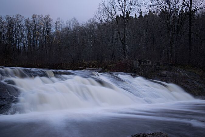
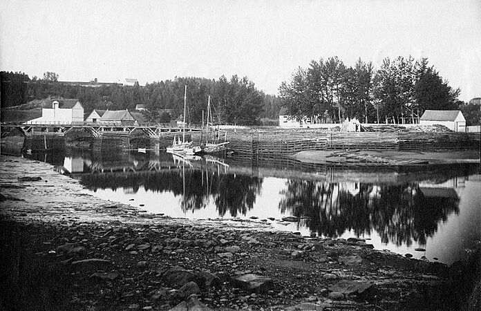
Rivière-du-Moulin, near Chicoutimi
-
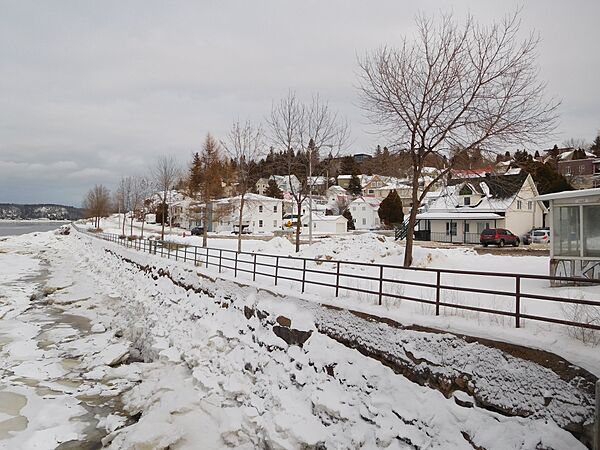
View from Saguenay boulevard, in Chicoutimi
-
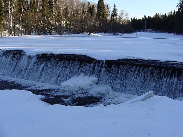
View from Parc de la rivière-du-Moulin, in Chicoutimi
-
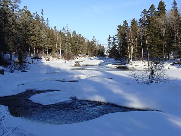
View from Parc de la rivière-du-Moulin, in Chicoutimi
-
Residence Price, between 1895 and 1921


